Close

Honeymoon Pool to Balingup

Completed over 5 days, 4 nights hiking a connected 3 trails. Total distance: 93kms Date hiked: 24.9.21 to 28.9.21

Day One: 

Starting at Honeymoon Pool in the Ferguson Valley near Wellington Dam Friday 24.9.21 after being dropped off by Simone from Traaverse. An excellent service provided in Collie to be picked up / dropped off to your point of interest. We had stayed at the Collie Ridge Motel in their rather excellent Spa room Thursday night after leaving our car securely parked at Simone’s place.

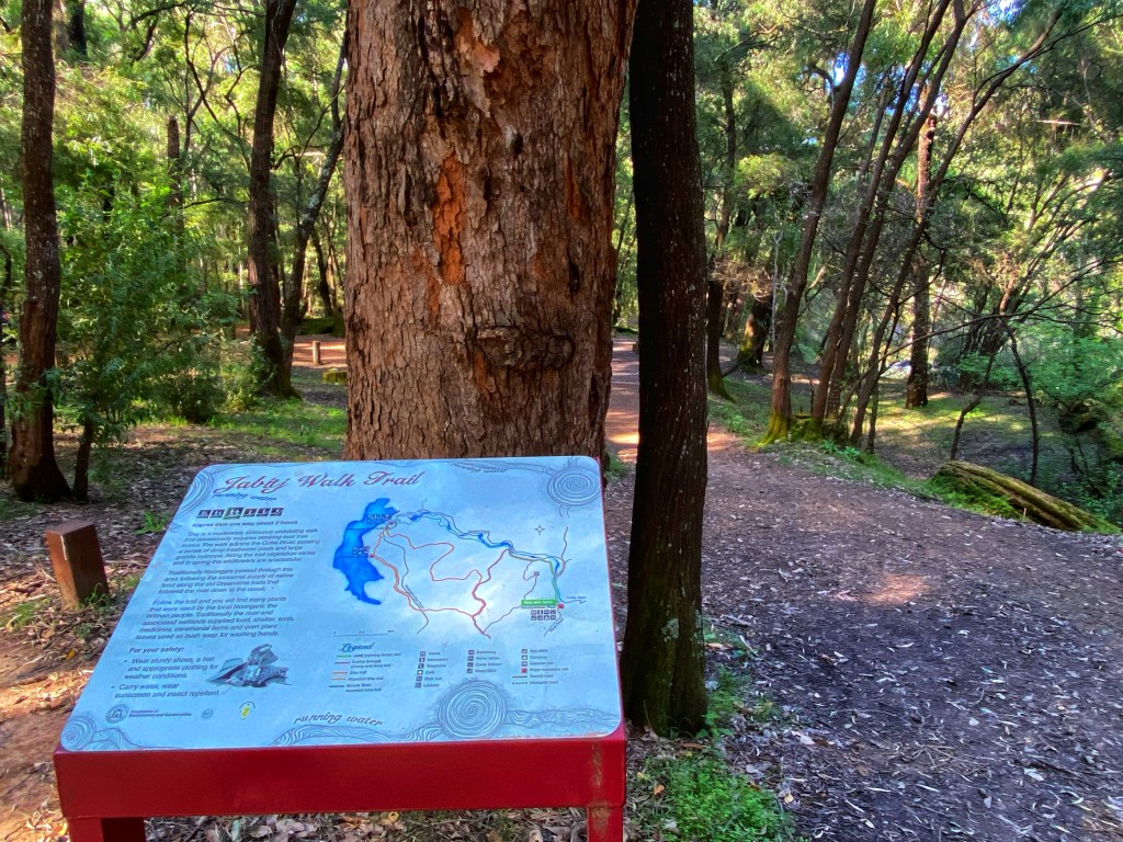
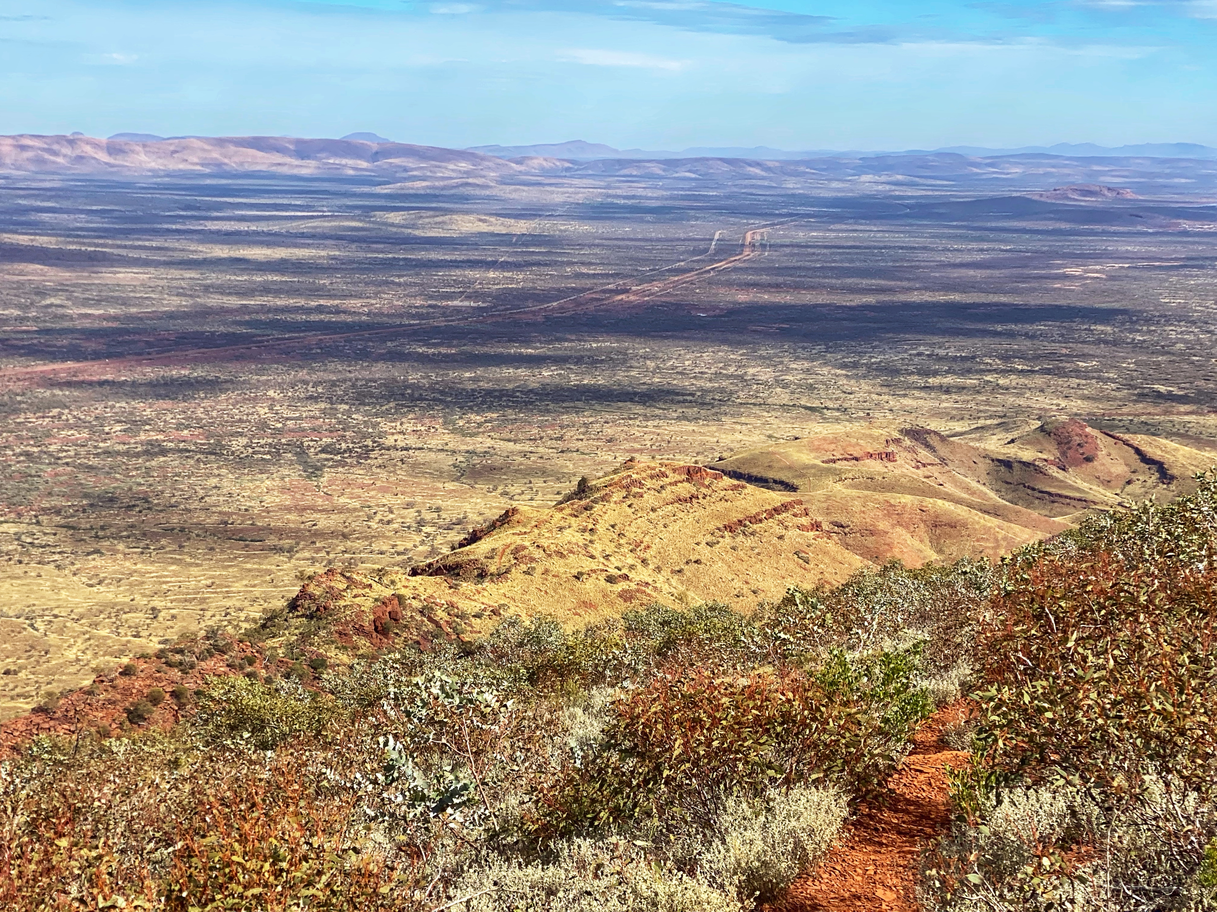
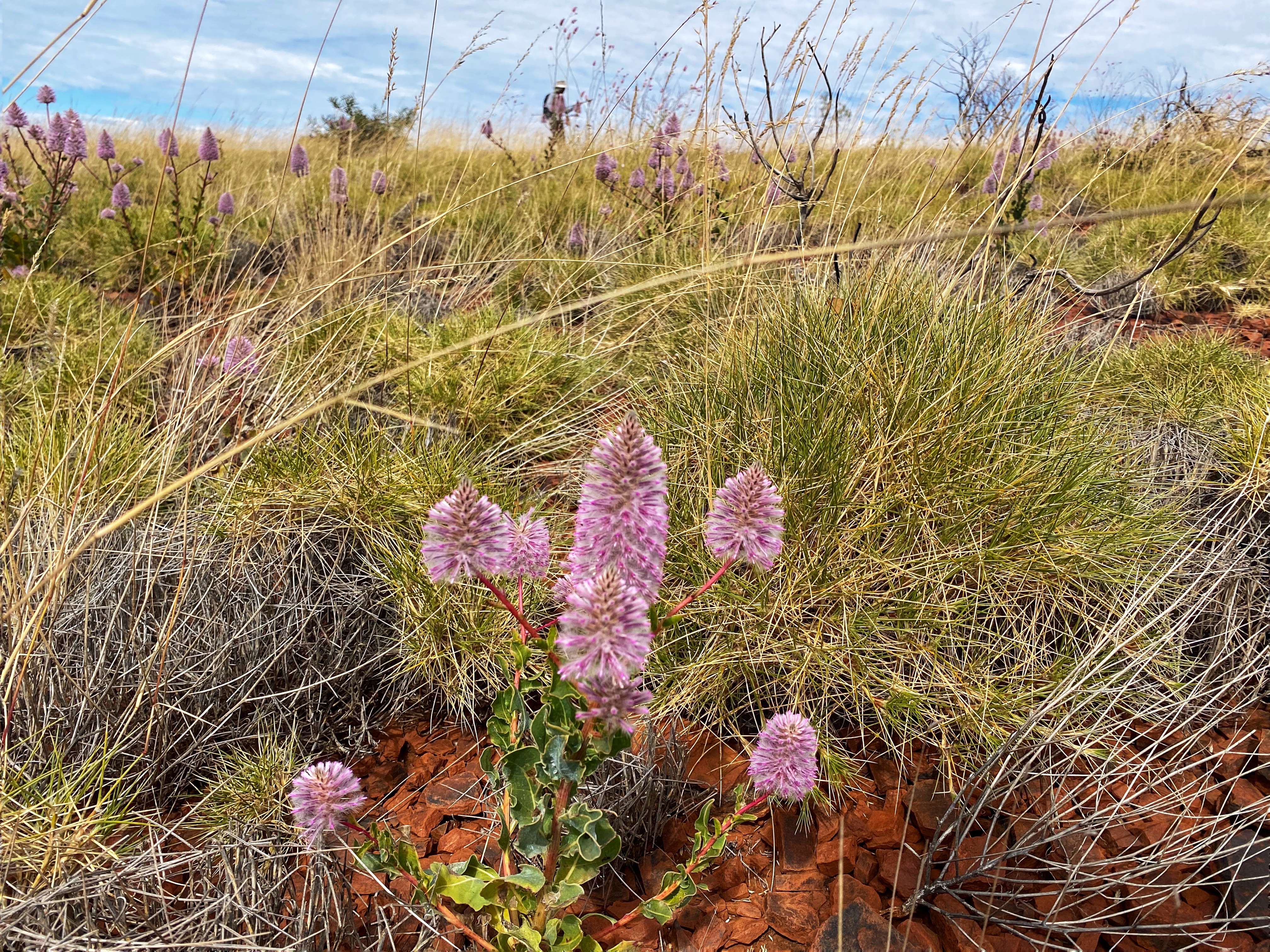
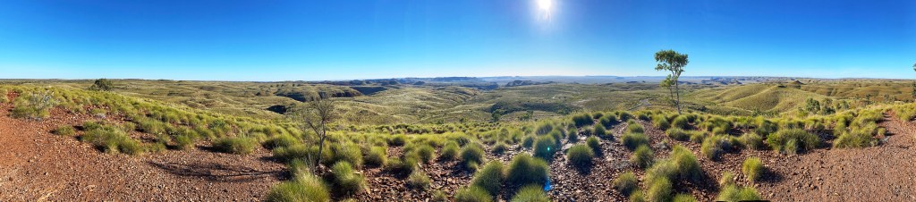
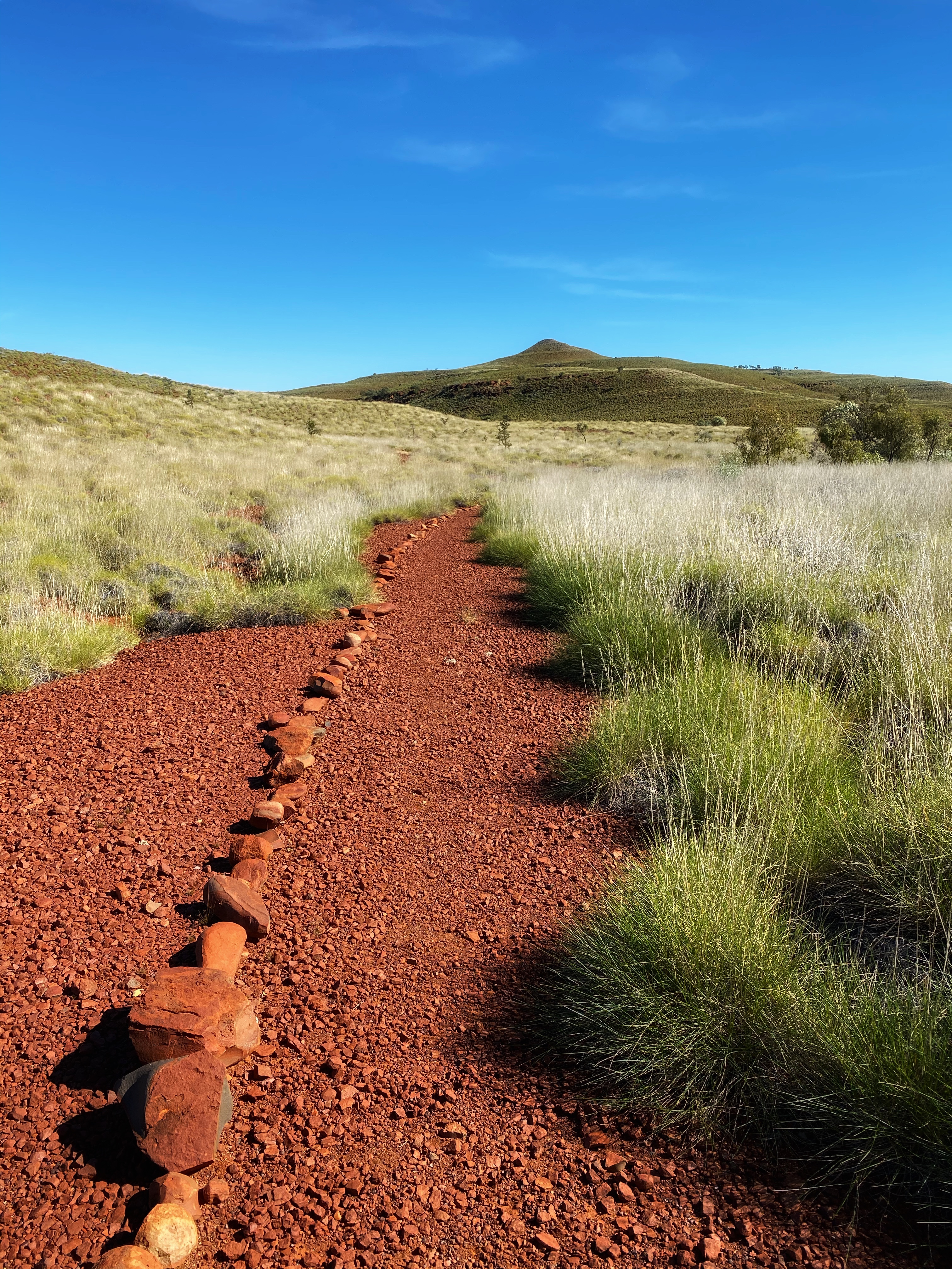
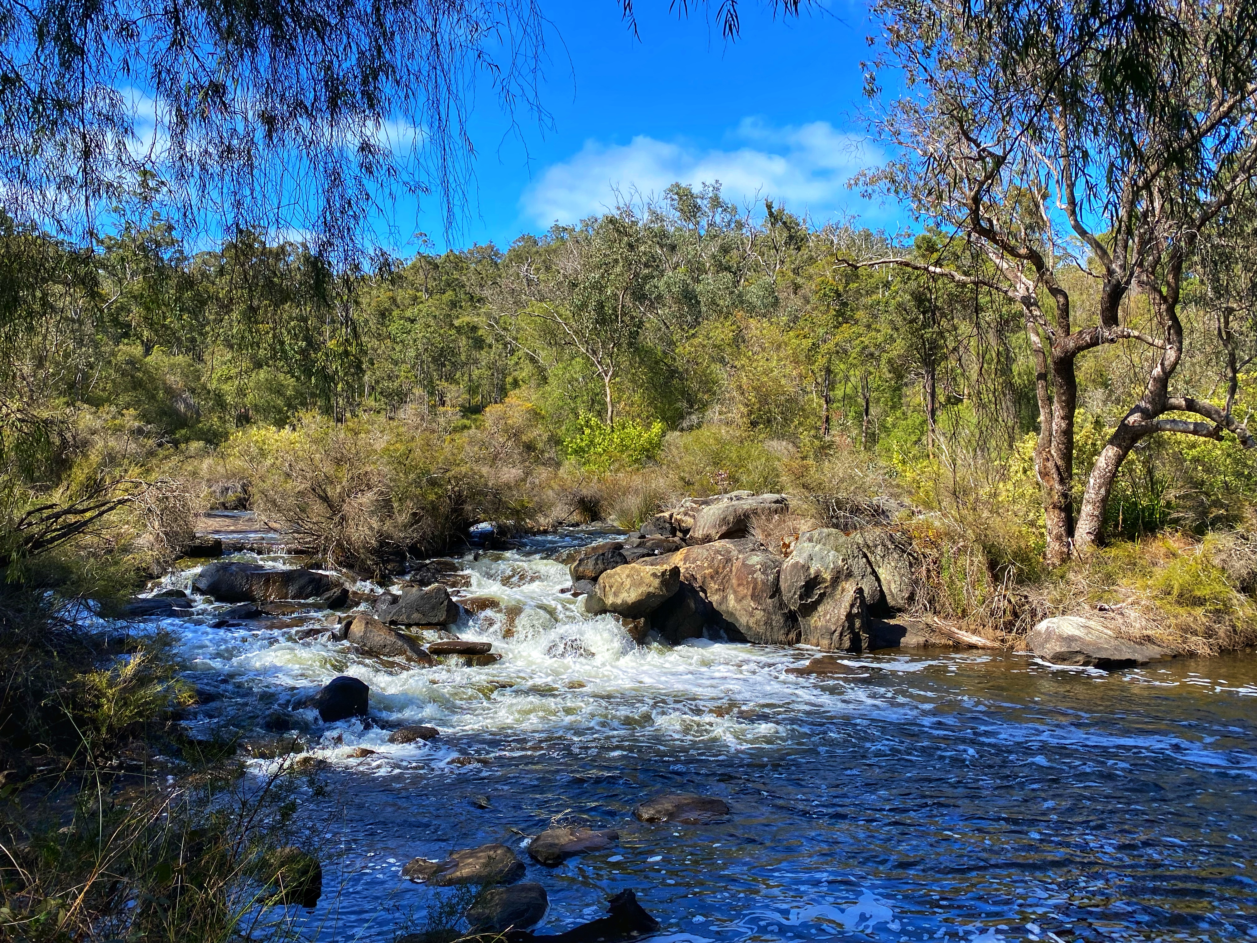
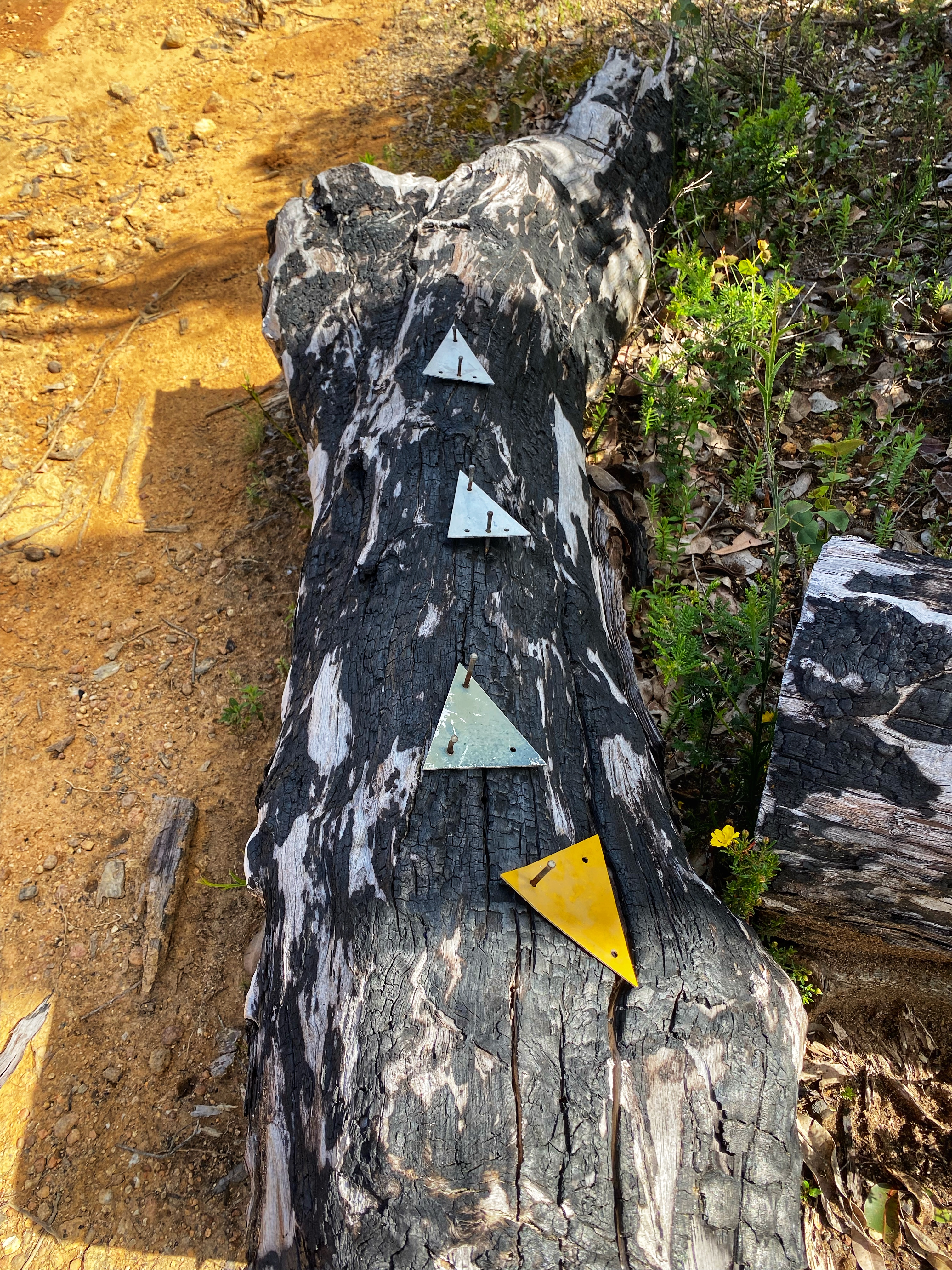
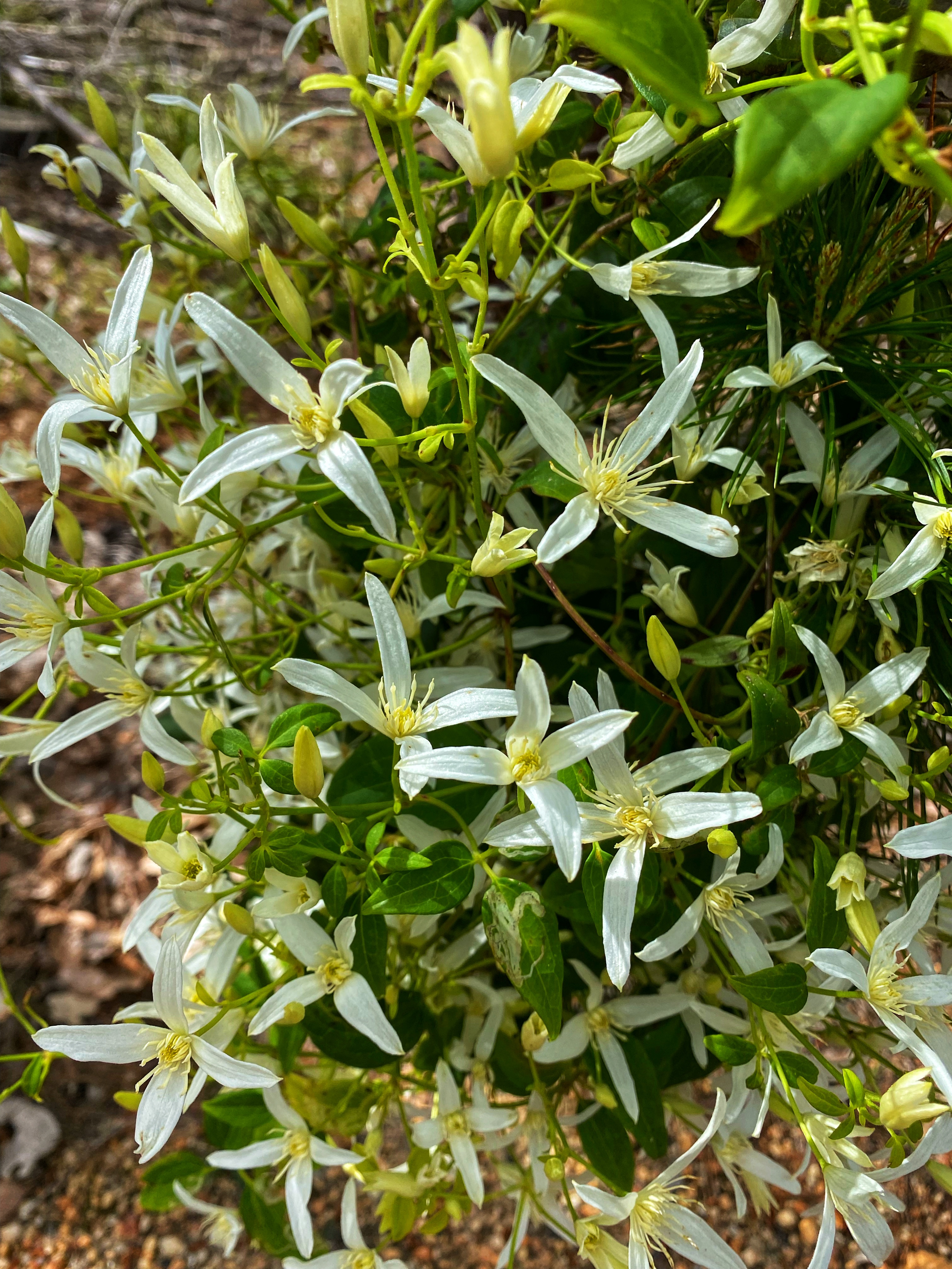
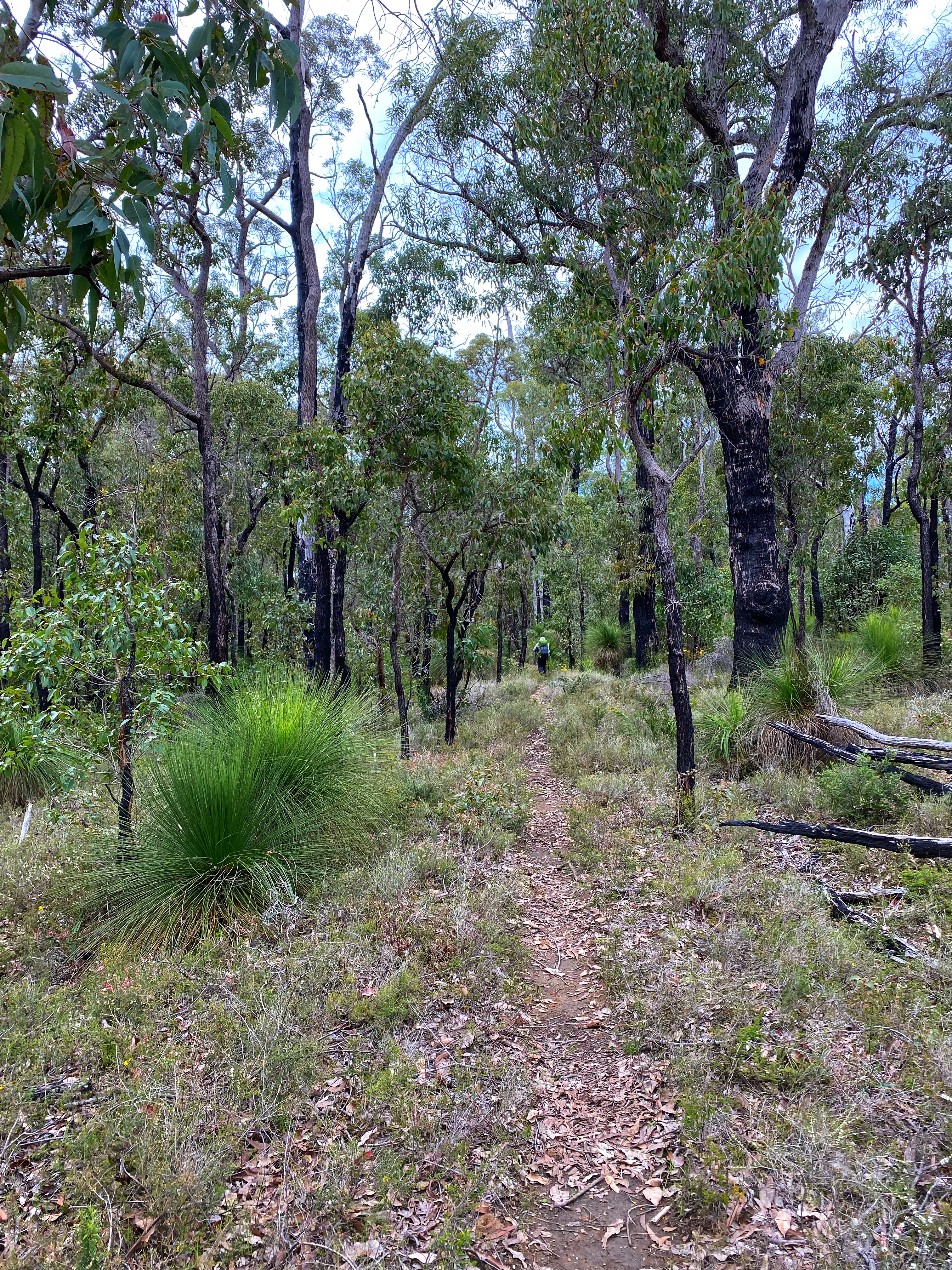
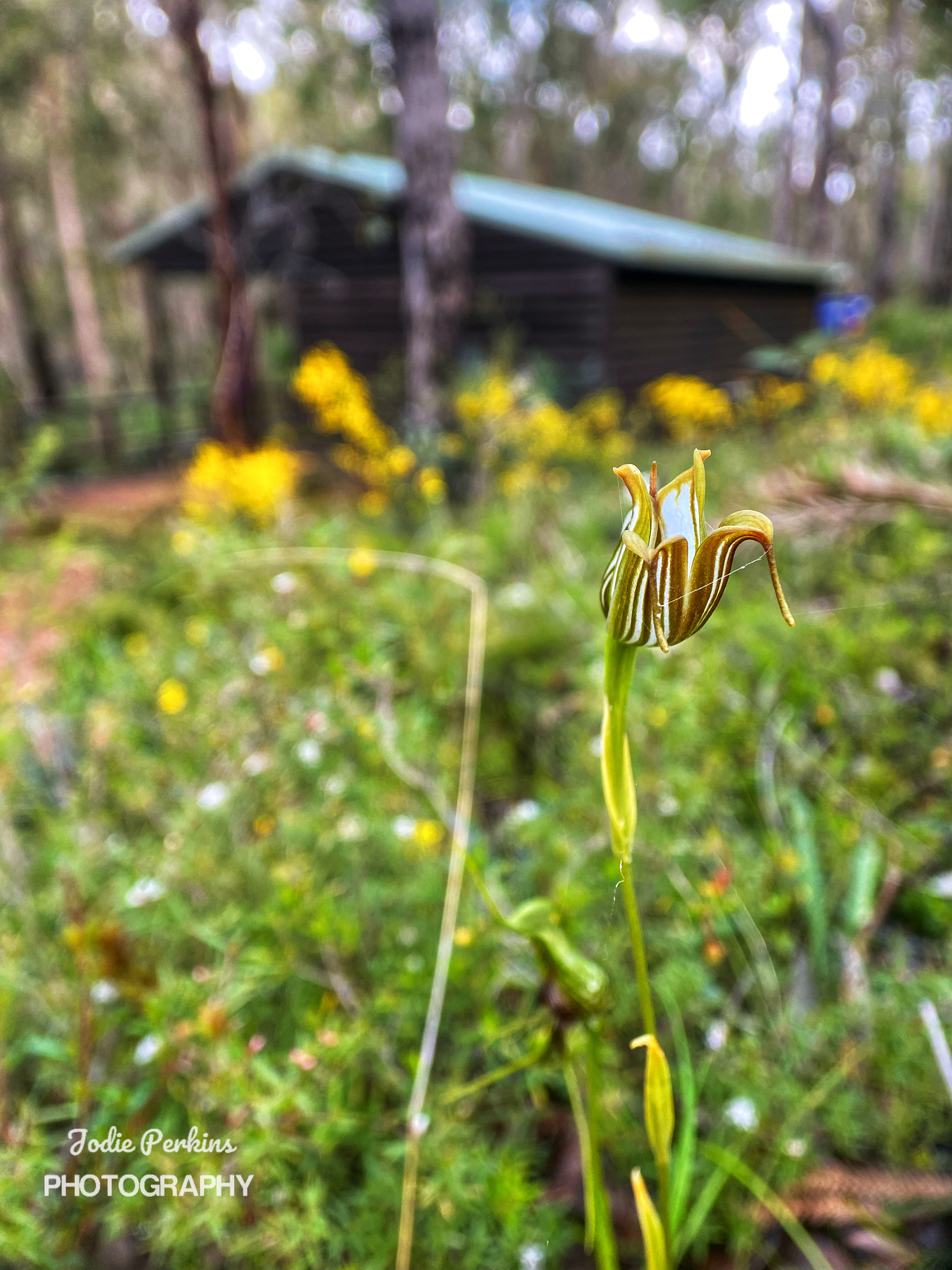
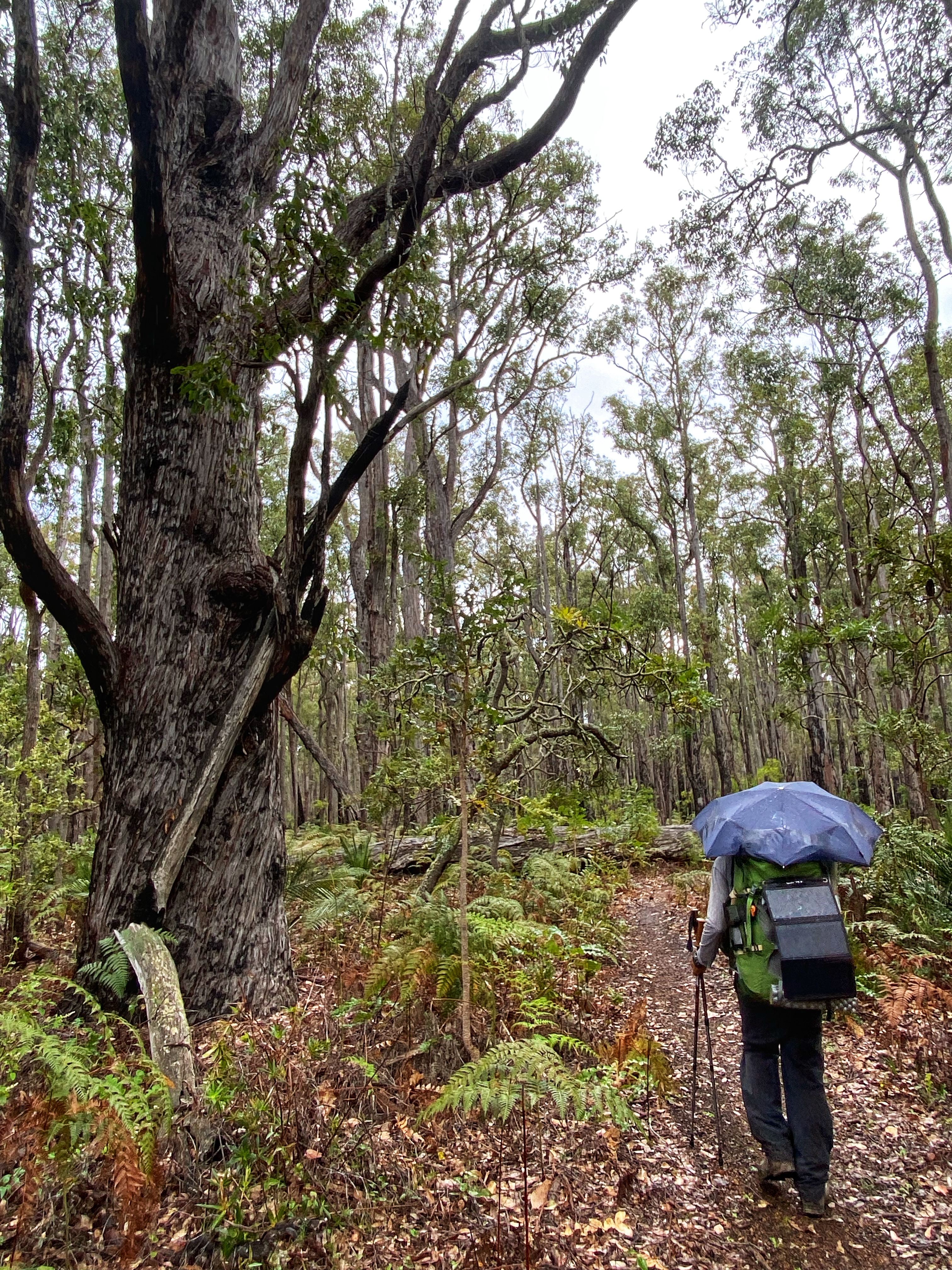
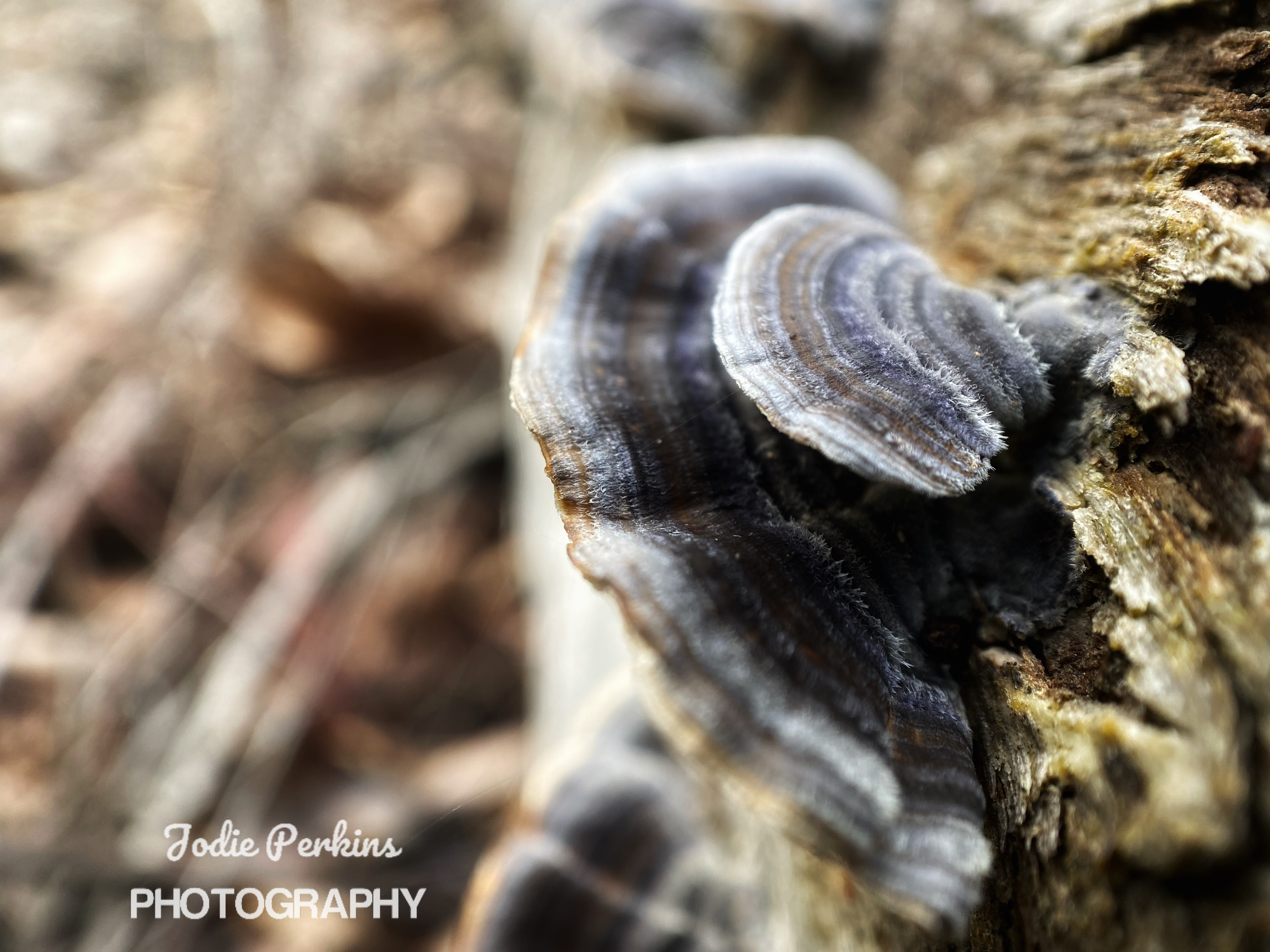
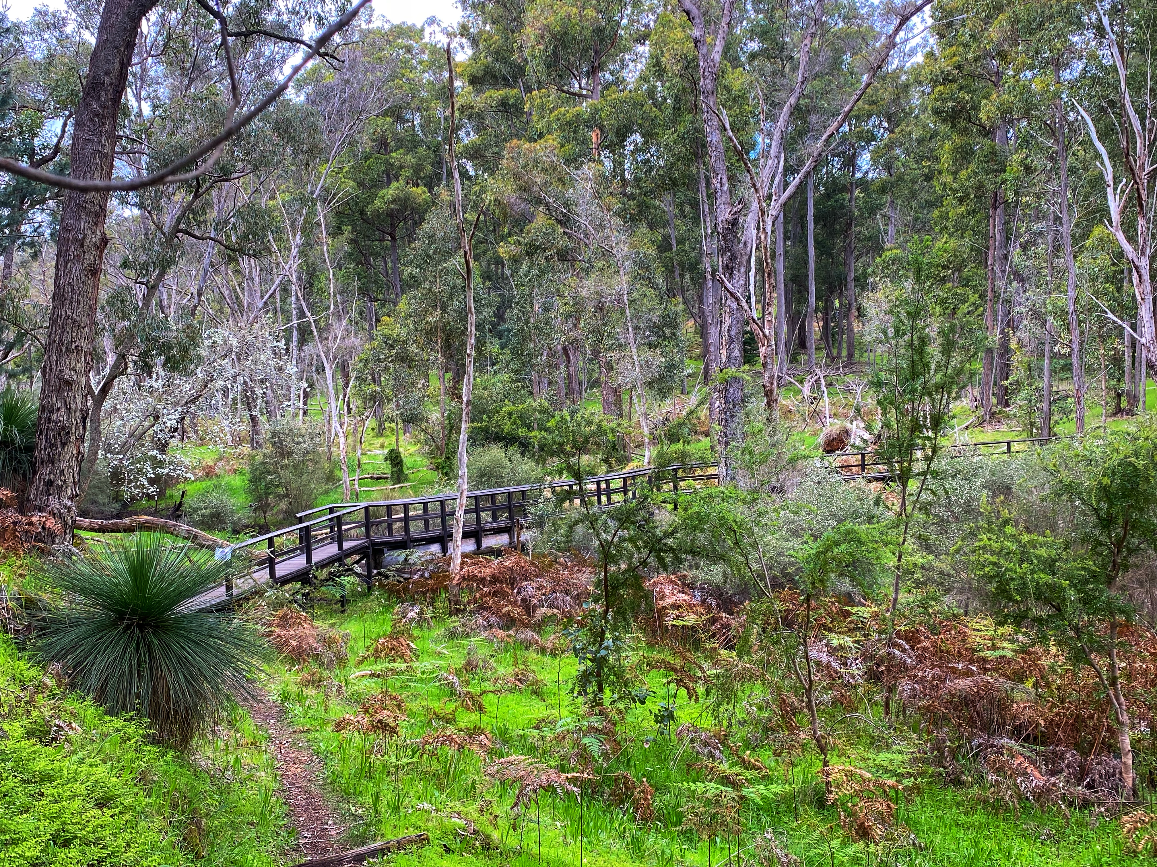
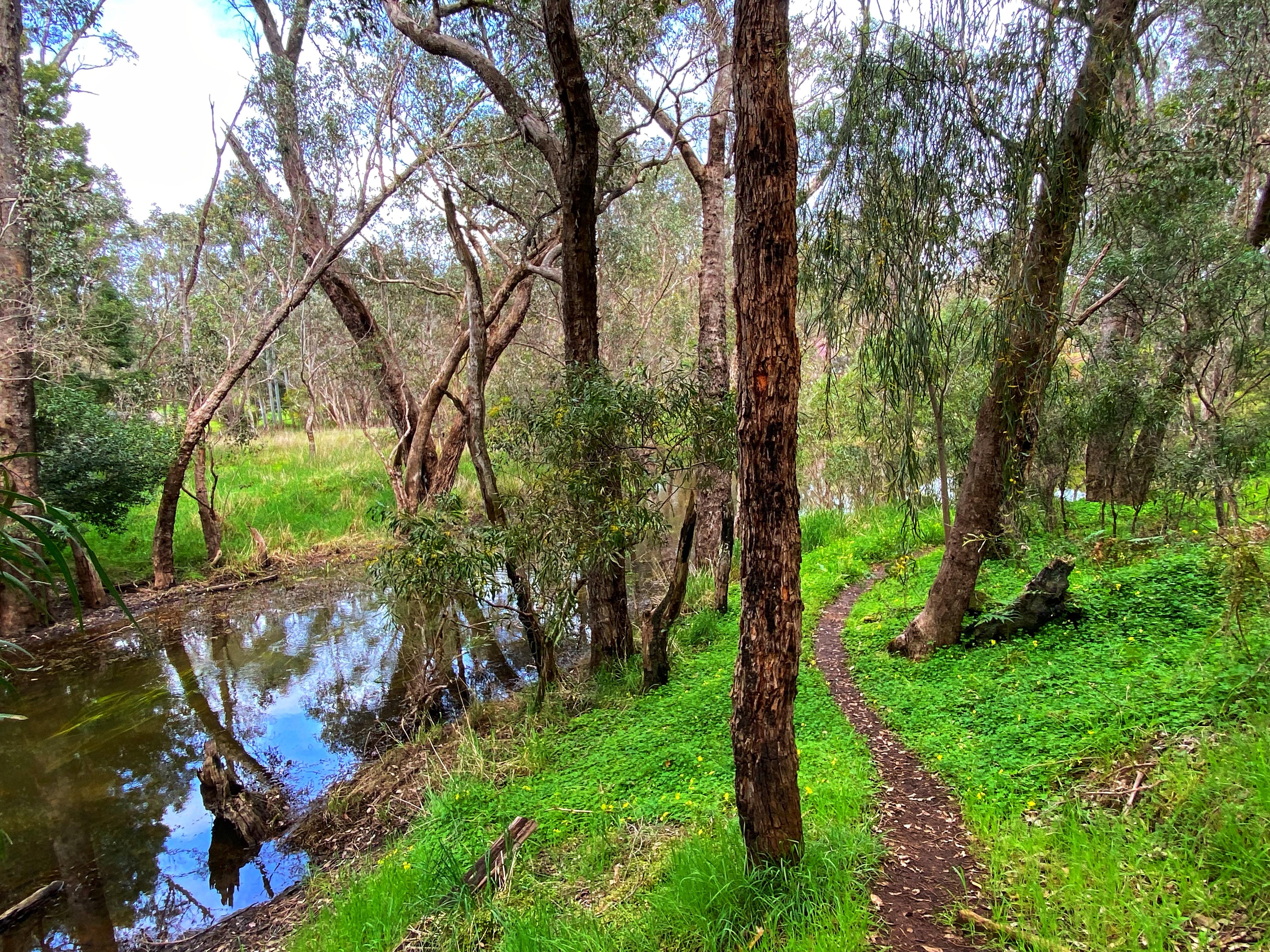
Honeymoon Pool is a very popular camping spot in summer with bush camping spots right by the lovely Collie River. On Friday morning 9am there were few campers around, the air was still crisp and cold. Simone dropped us off with a bar of chocolate each so this was it! We set off along the Jabitj Trail, 6kms one way that goes alongside the river most of the way, with some up and downs. A pleasant start to our walk, the Munda Biddi, (long distance cycle trail from Kalamunda to Albany) follows the same route halfway along before going left up a steep hill. There are lots of wildflowers and orchids to spot along the way.

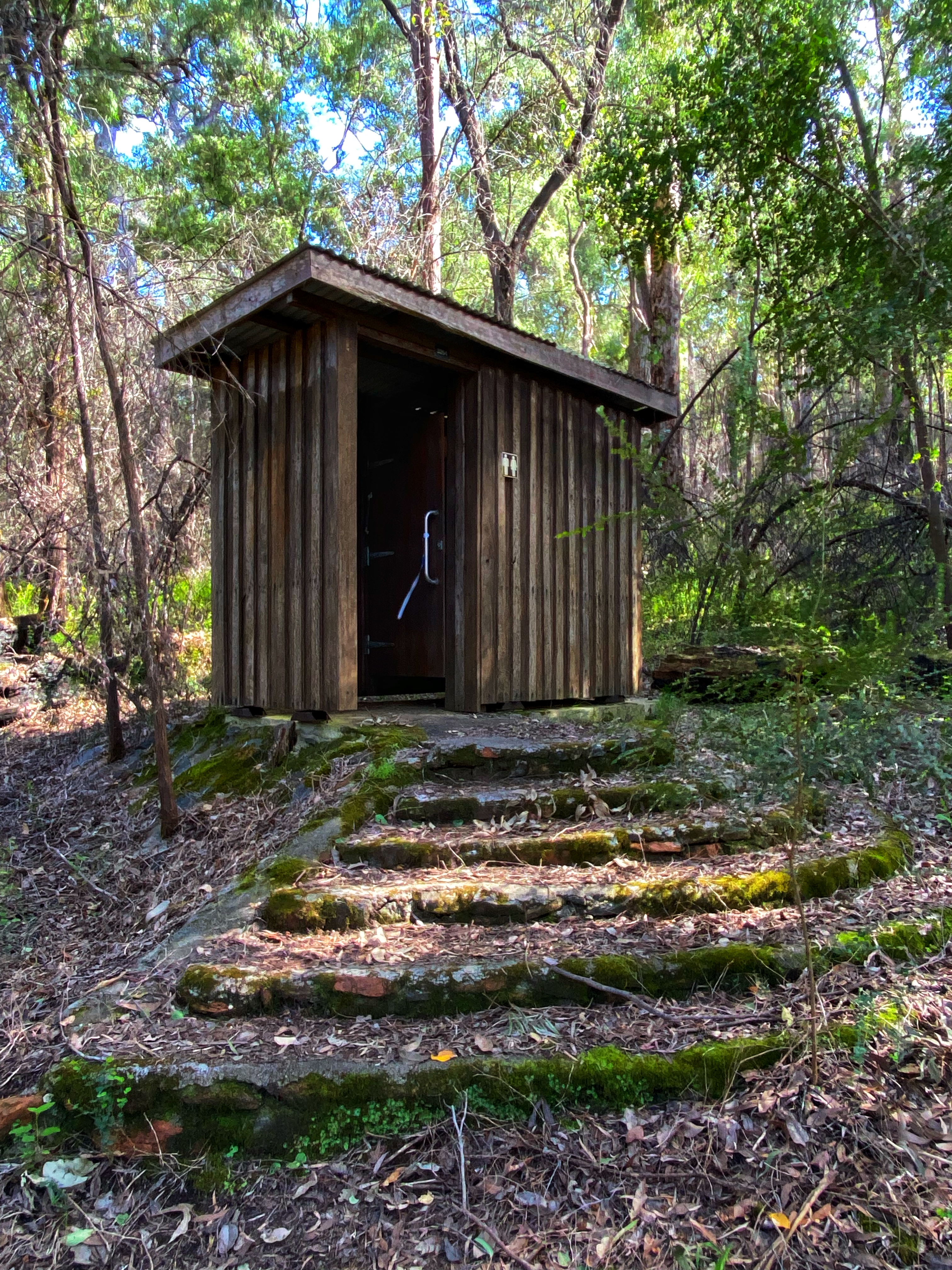
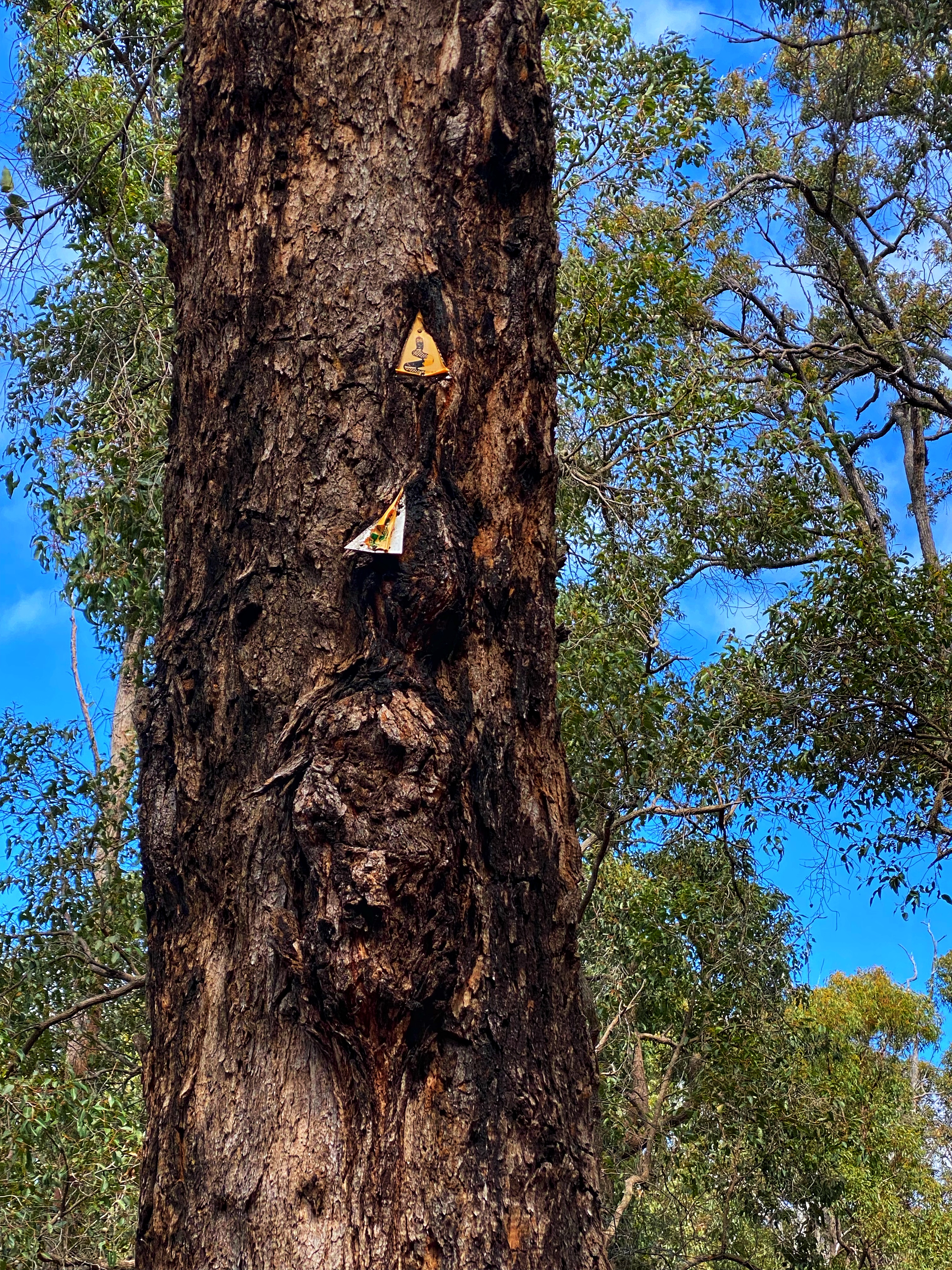
The river providing some little rapids in parts to stop and watch. A toilet block stands alone not far into the walk, seemingly out of place and must of been part of a campsite at one stage. The interesting part of this walk is that it used to be part of the Bibbulmun Track before the Bibbulmun was realigned in the late 1990’s. Right near the end there remains one recognisable Bibbulmun waugal marker still on a tree, though it now is way above eye level as been there so long and the tree has grown more since its placement. We could have turned right at the road that takes you below the Wellington Dam wall but there is no signage here to indicate the Wellington Spur Trail. We turn left and finish the last kilometre of the trail which proves the hardest, straight up a nice steep incline. At the top, the trail ends and spits you out near the cafe. Perfect opportunity to recover over a coffee and shared carrot cake. It is almost the long weekend and there are enough tourists, day walkers and bicycle riders about to fill the air with busy ness. We seem to be the only two fools walking around with houses on our backs.

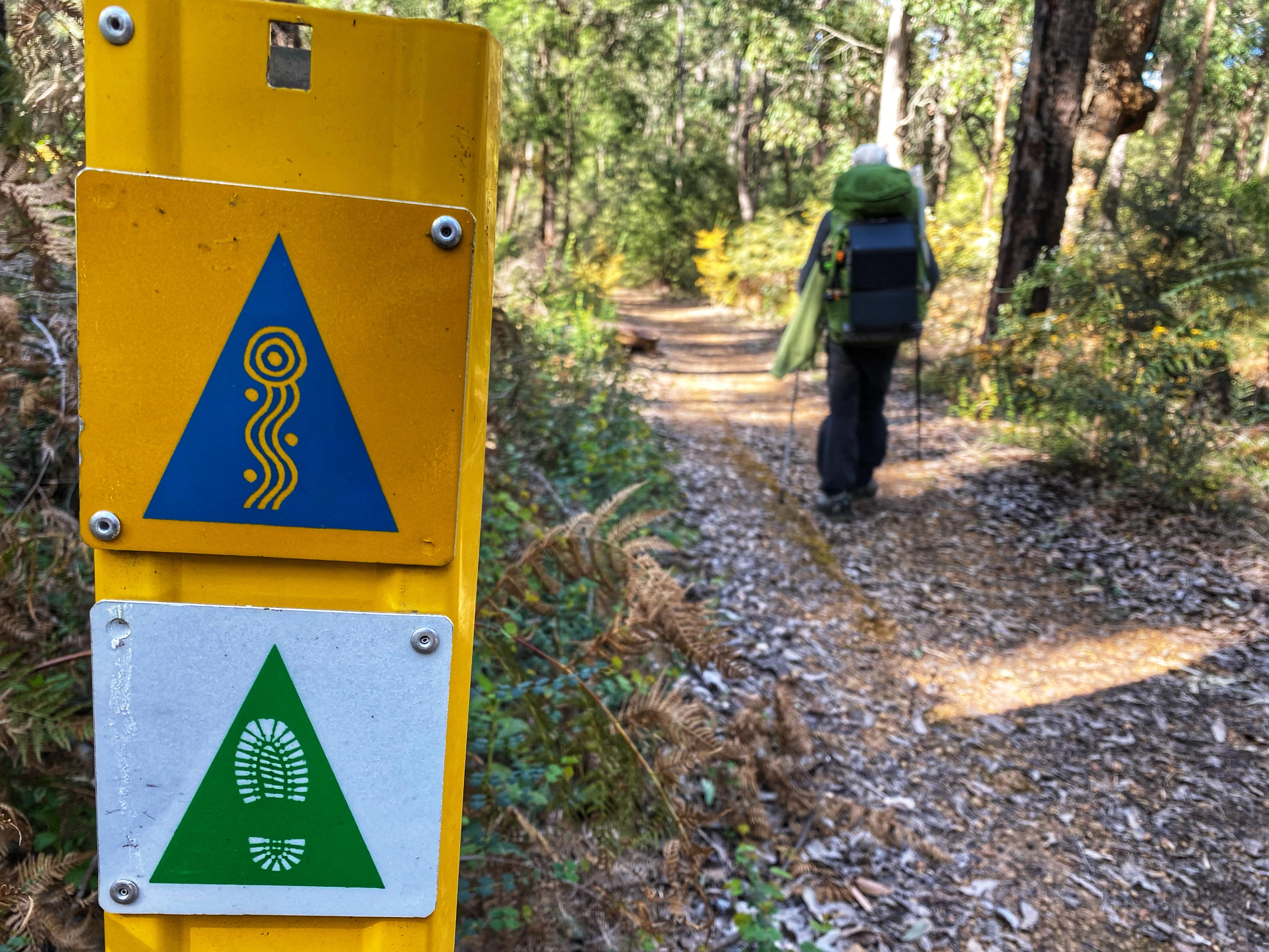
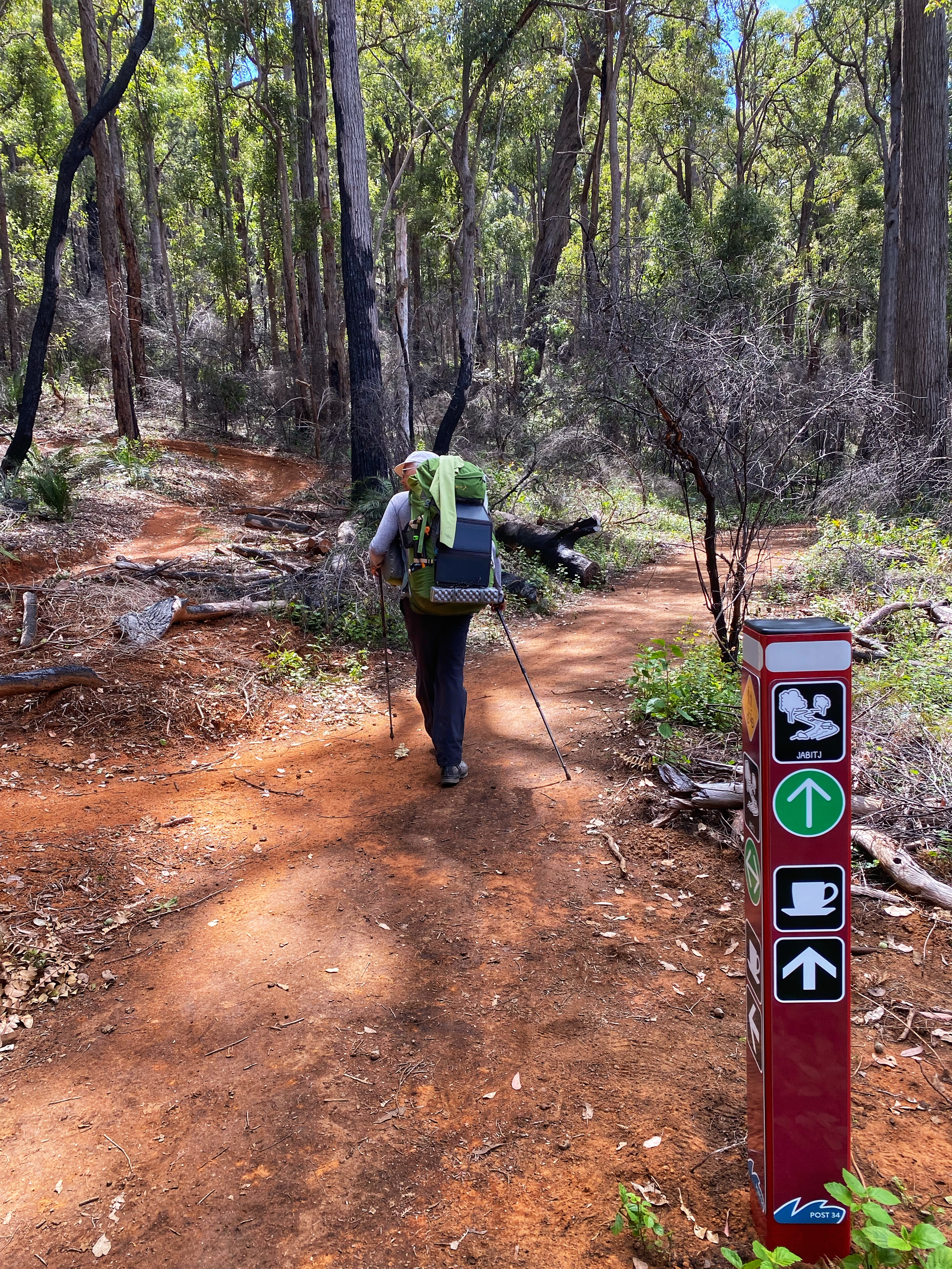
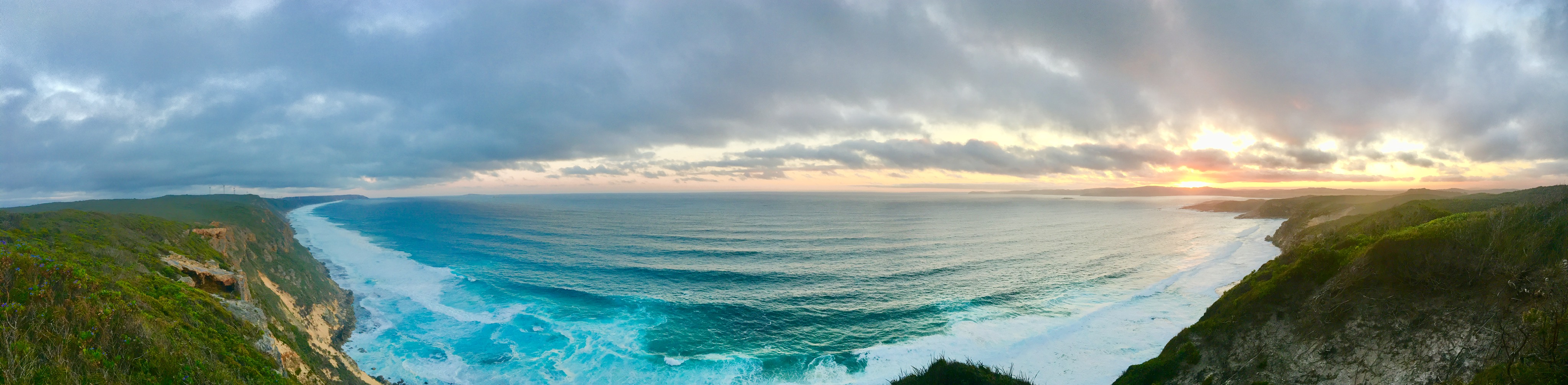
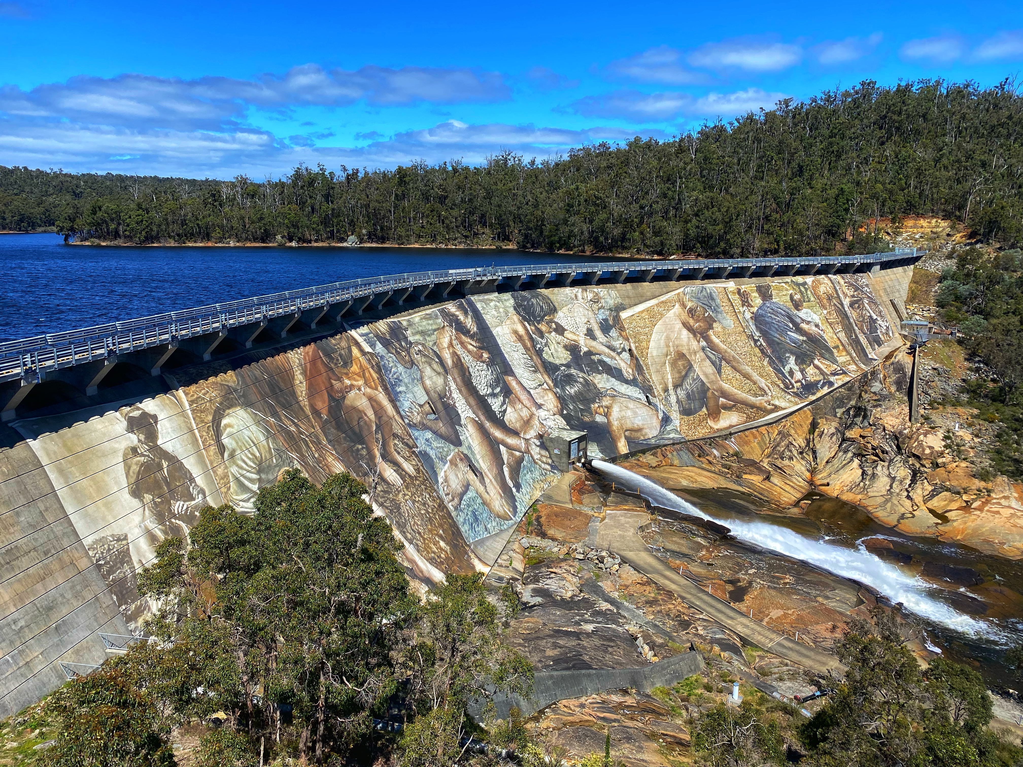
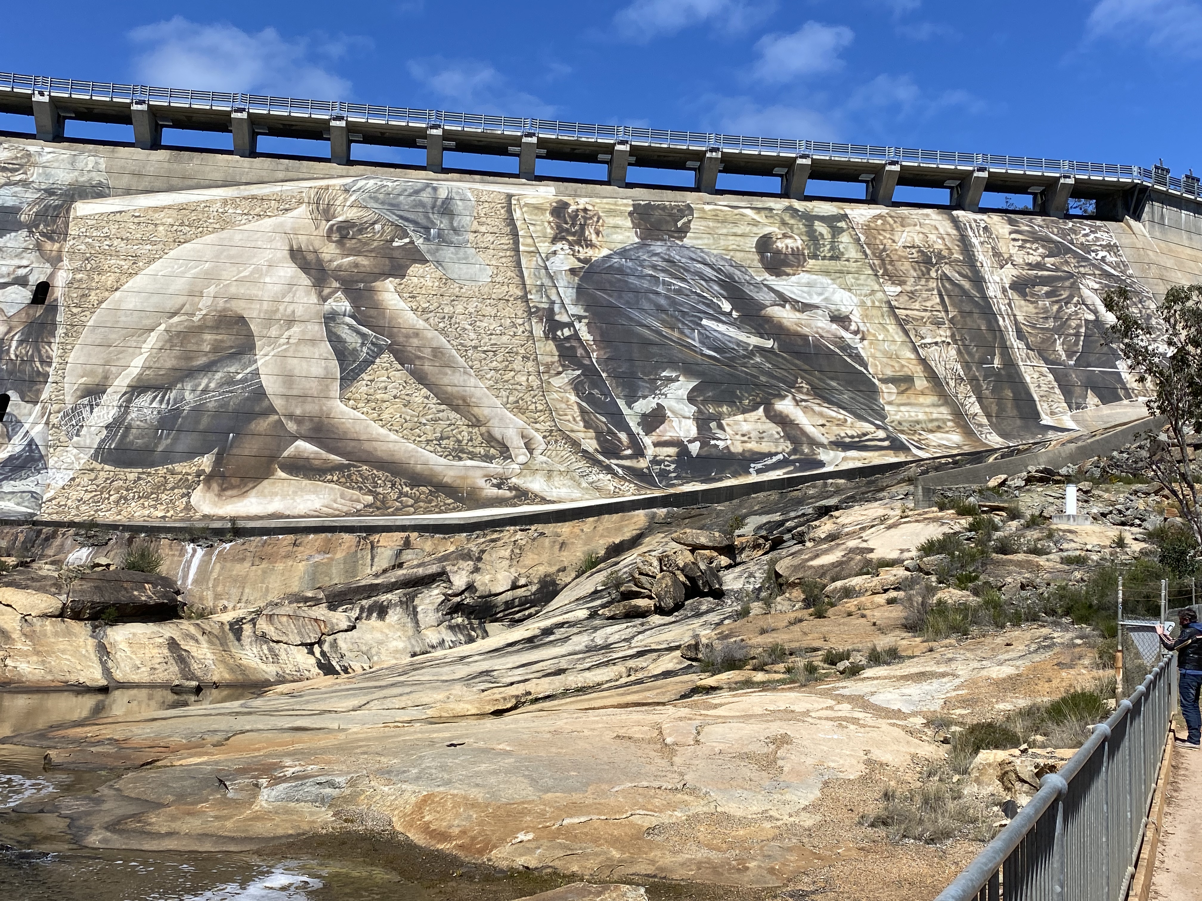
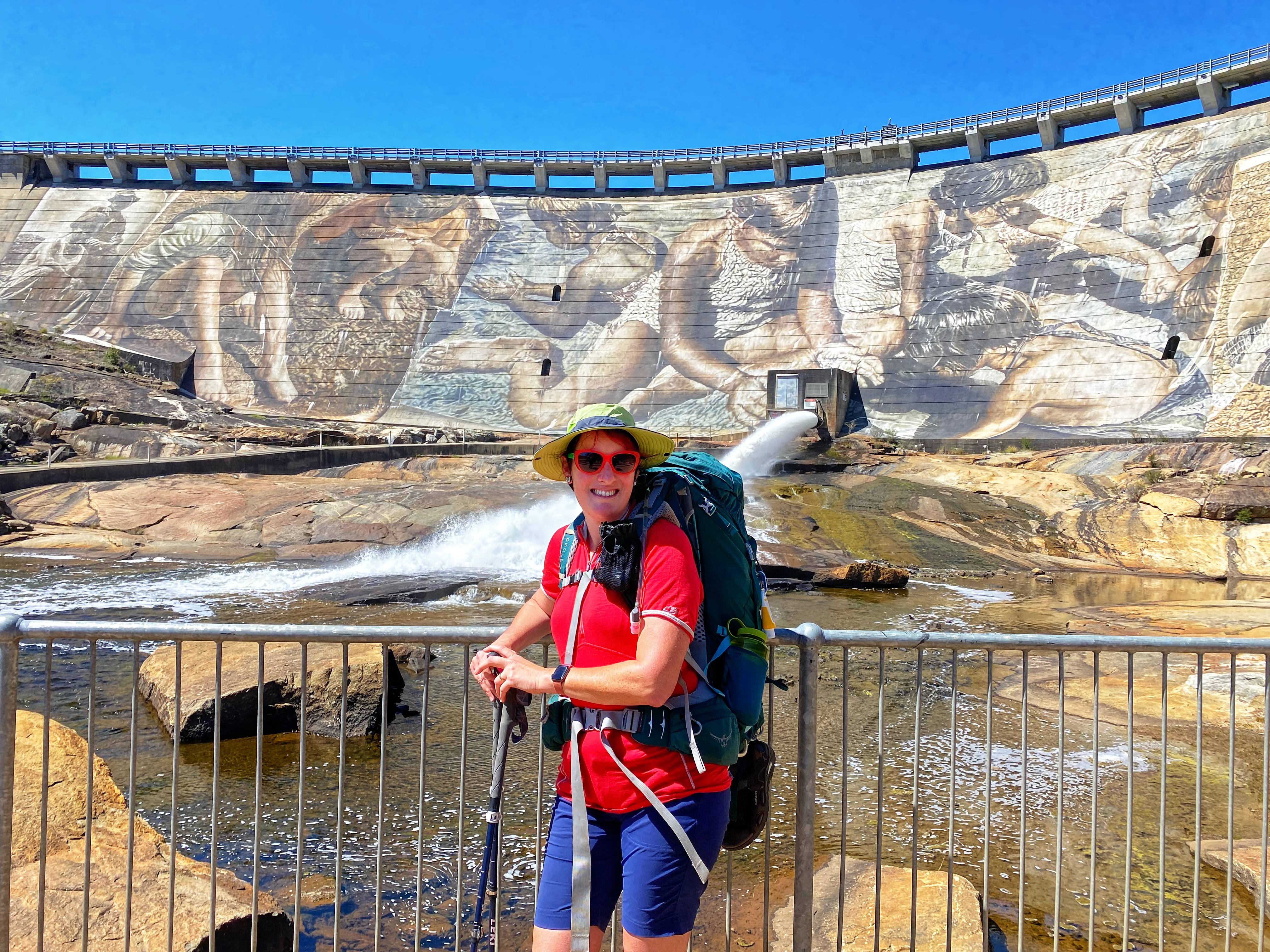
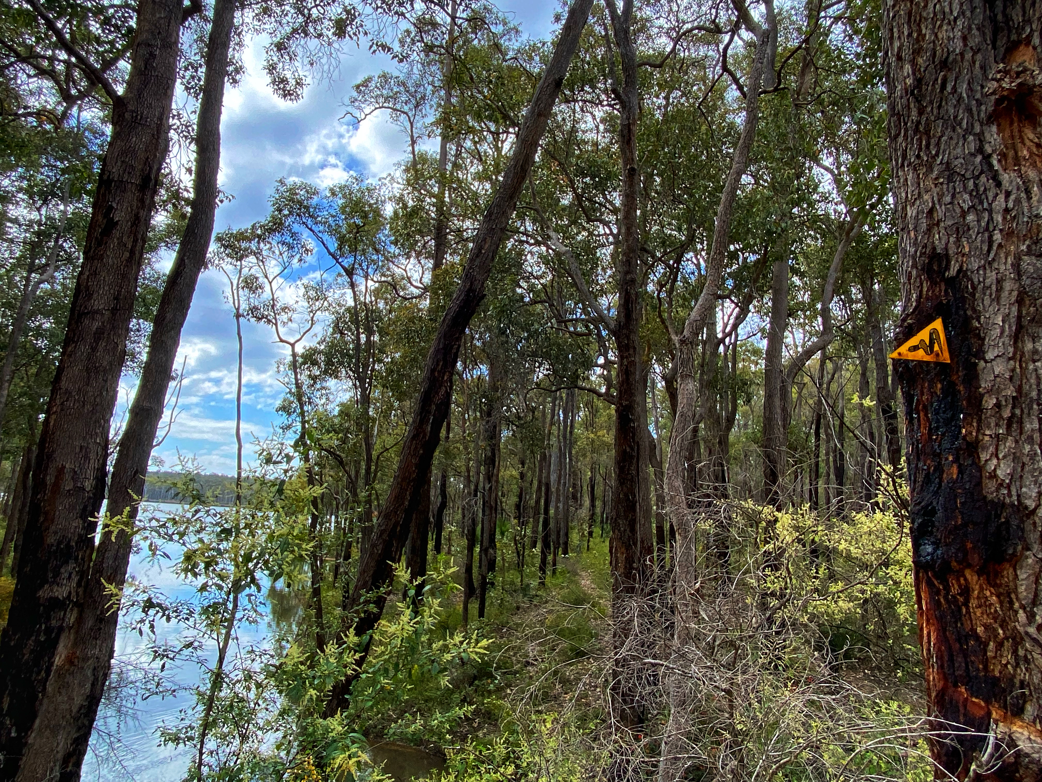
Lucky we had a pleasant sunny cool day as we backtracked back down to the road and went across below the Wellington Dam wall, thus admiring the new fantastic art mural across the whole wall. Still no indication where the Spur Trail was we continued about 200 metres up the road with Ambles threatening to catch a lift back to Collie and yahhhh! We spotted the trail head signage for the Bibbulmun Wellington Spur Trail, a 20km one way trail connecting the Wellington Dam and Bibbulmun Track. The marker signage is a green and black waugal marker just like the Bibbulmun yellow and black. We had 3.5kms to Arcadia campsite, the one of two along this trail and designed as a group campsite. We were tired from stopping at the cafe and had to get our momentum going, for Ambles and his 22kg backpack this was harder to achieve.

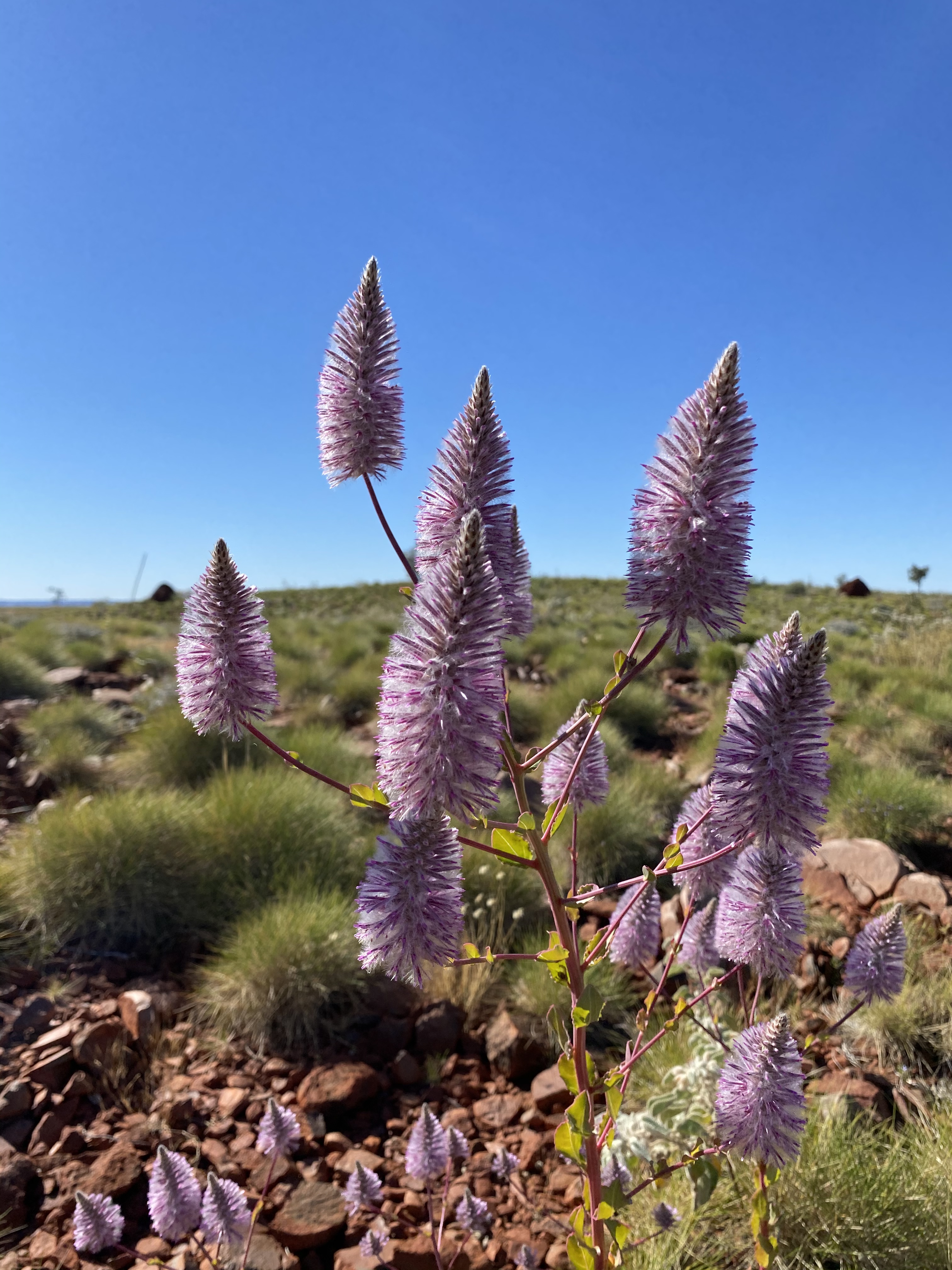
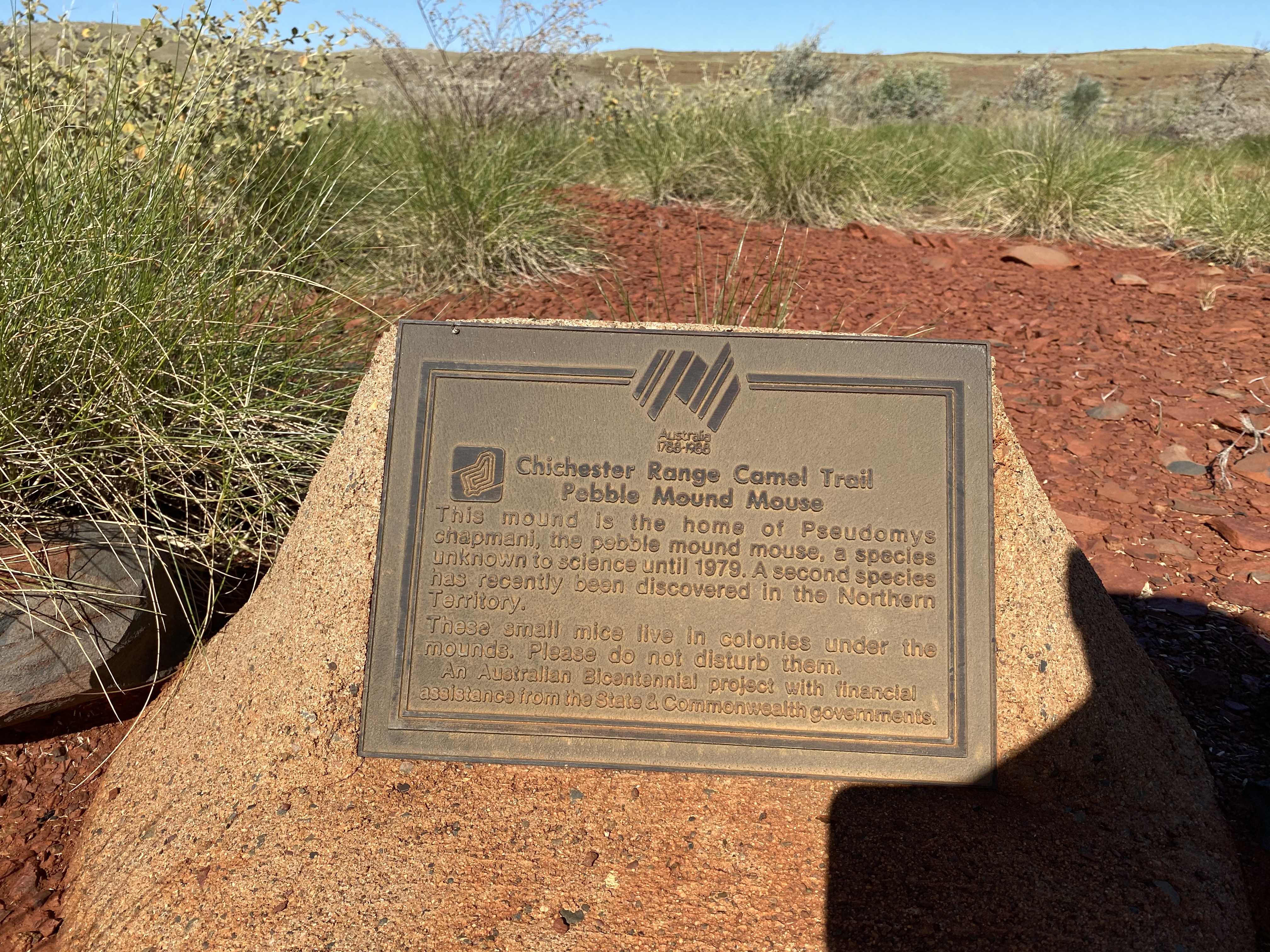
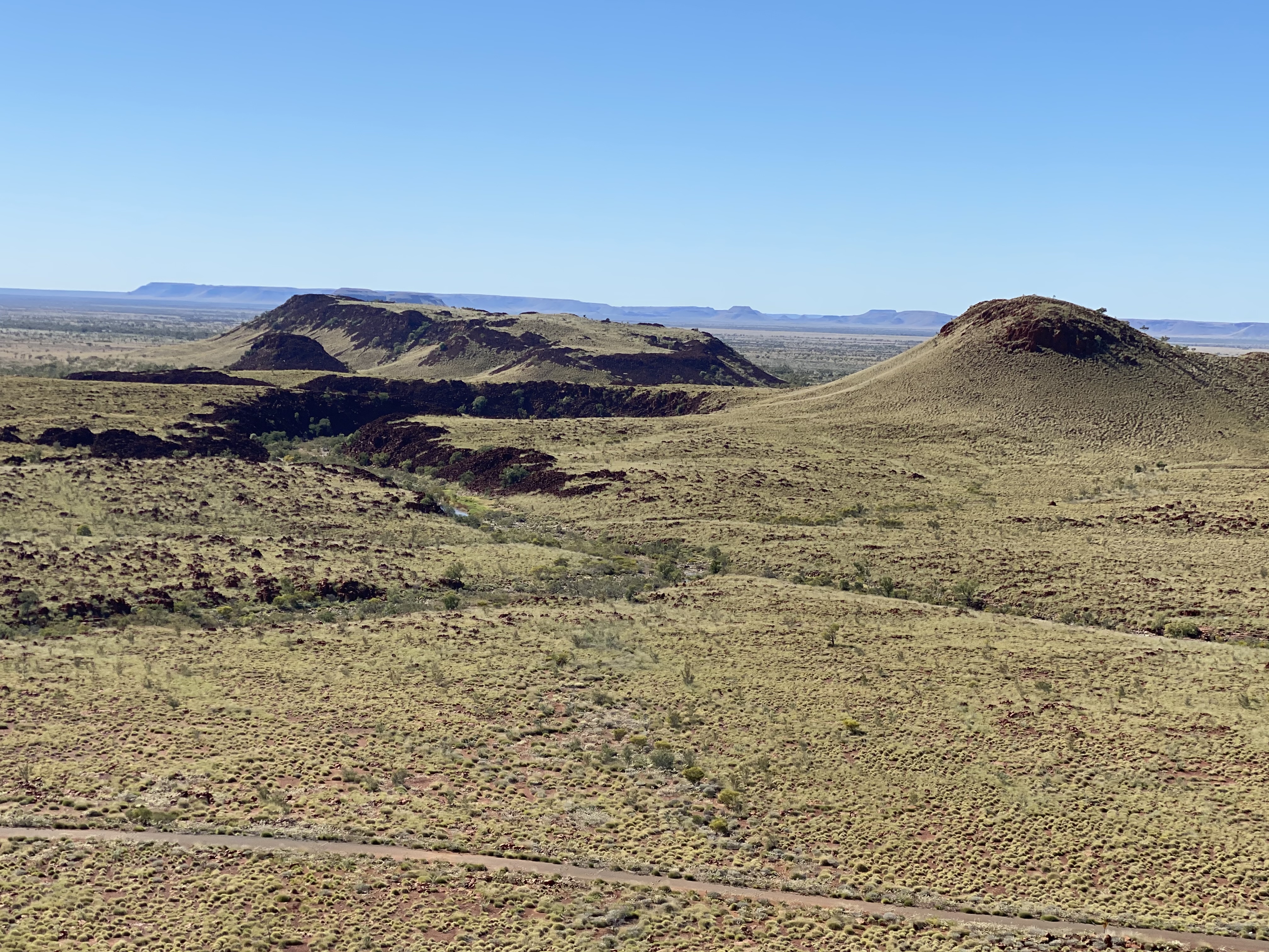
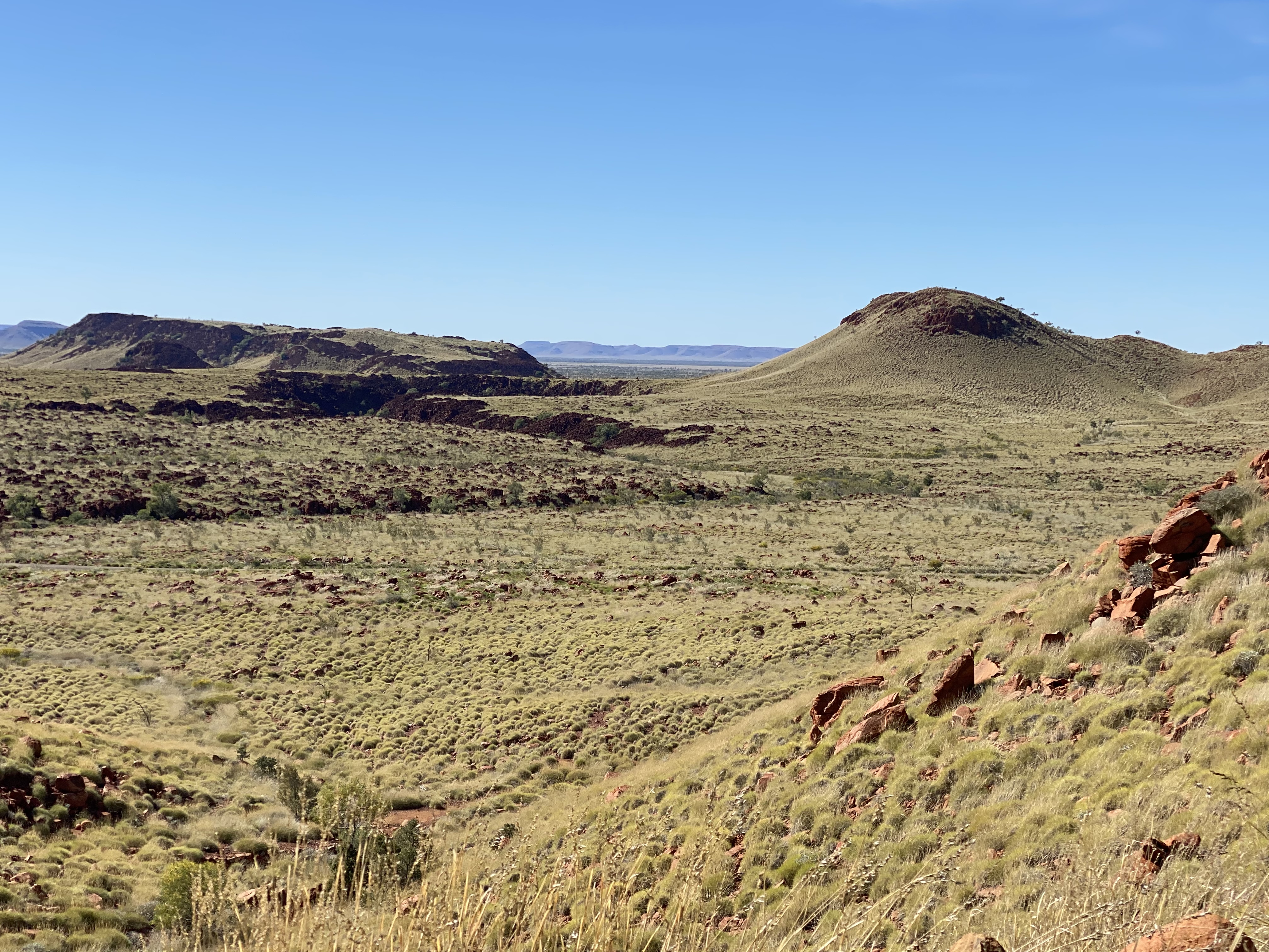
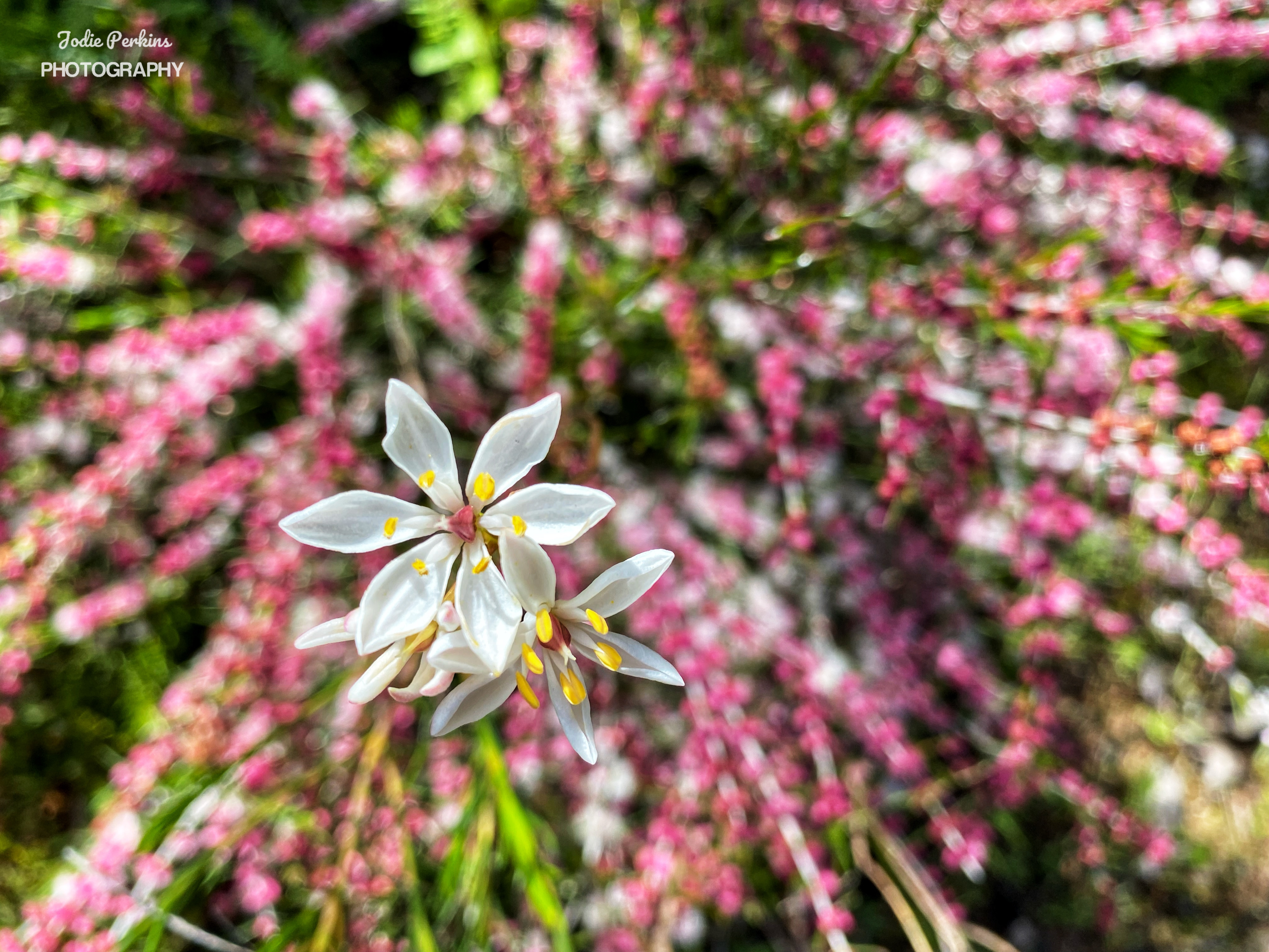
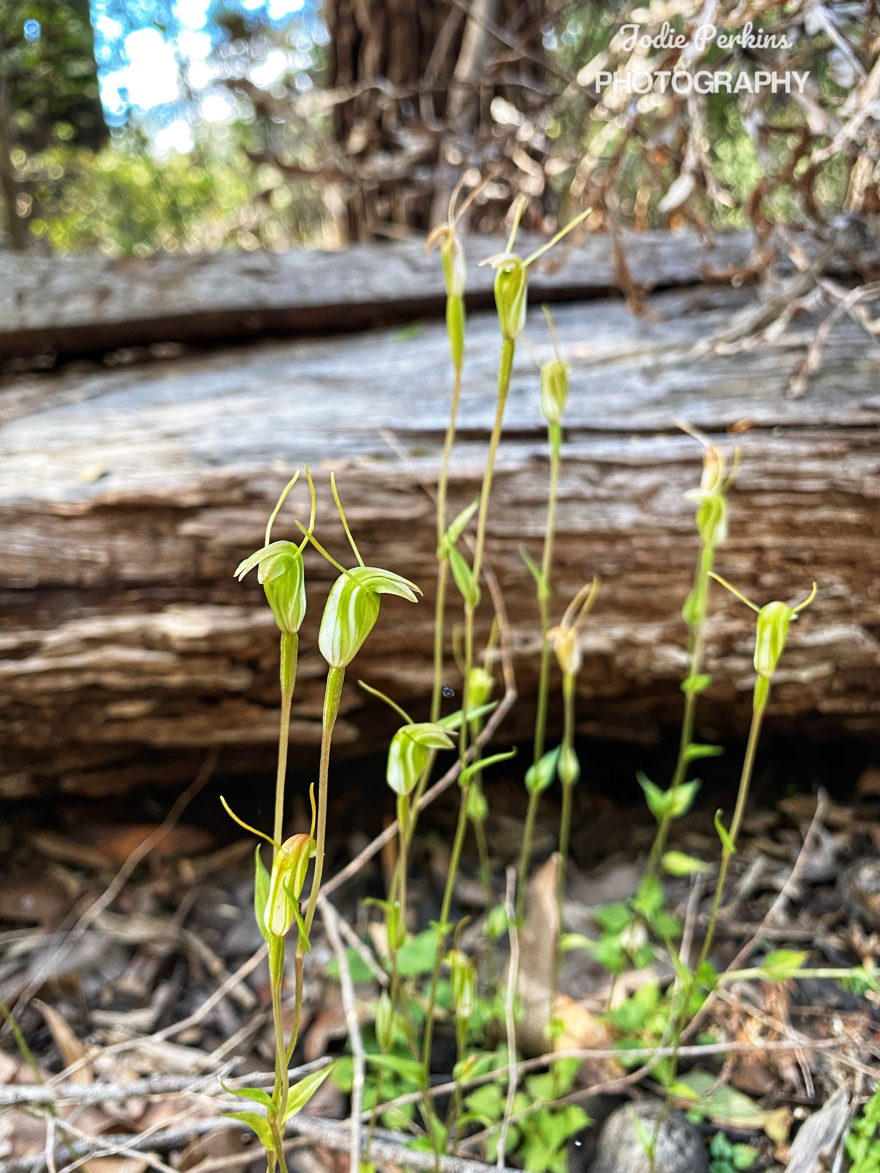
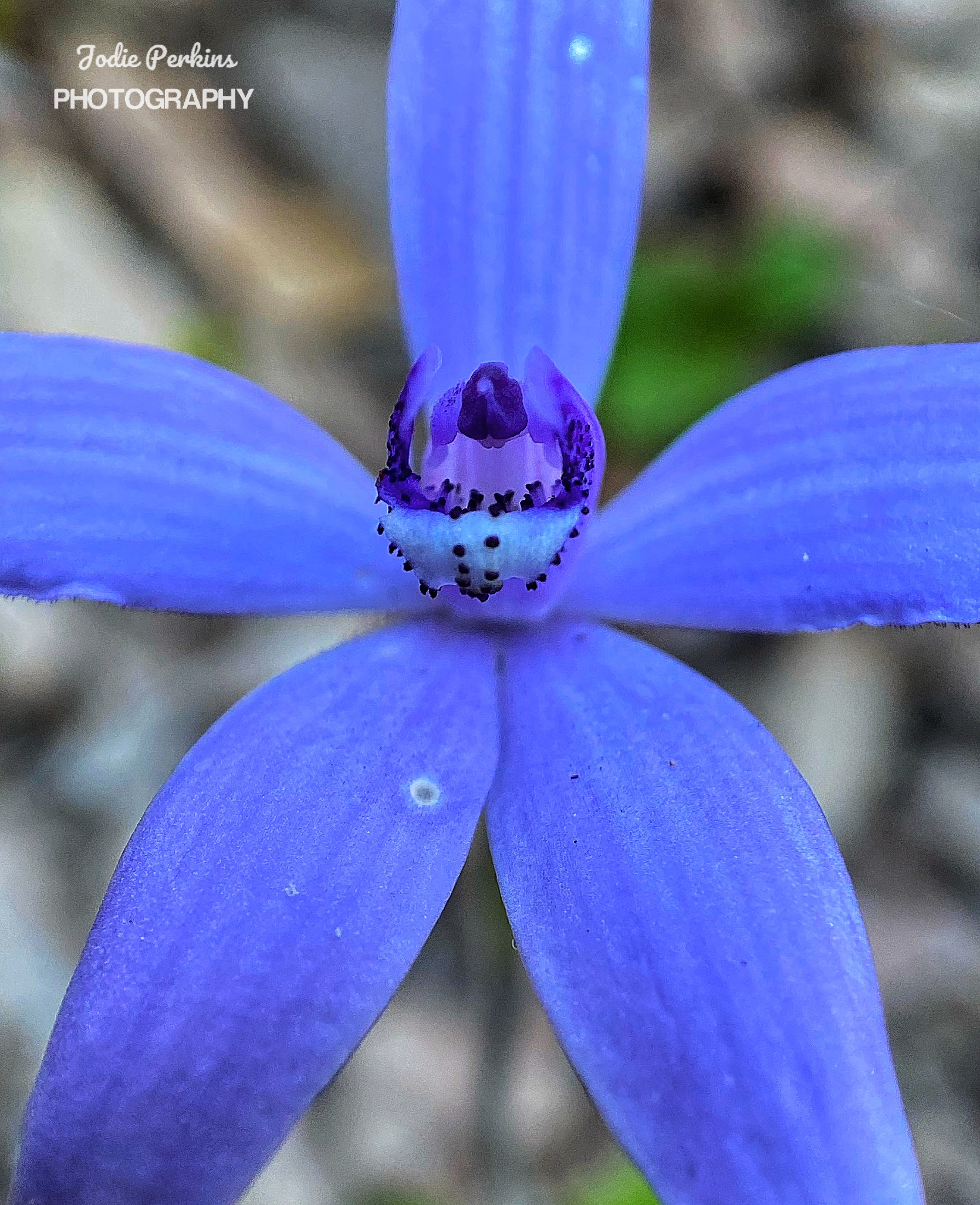
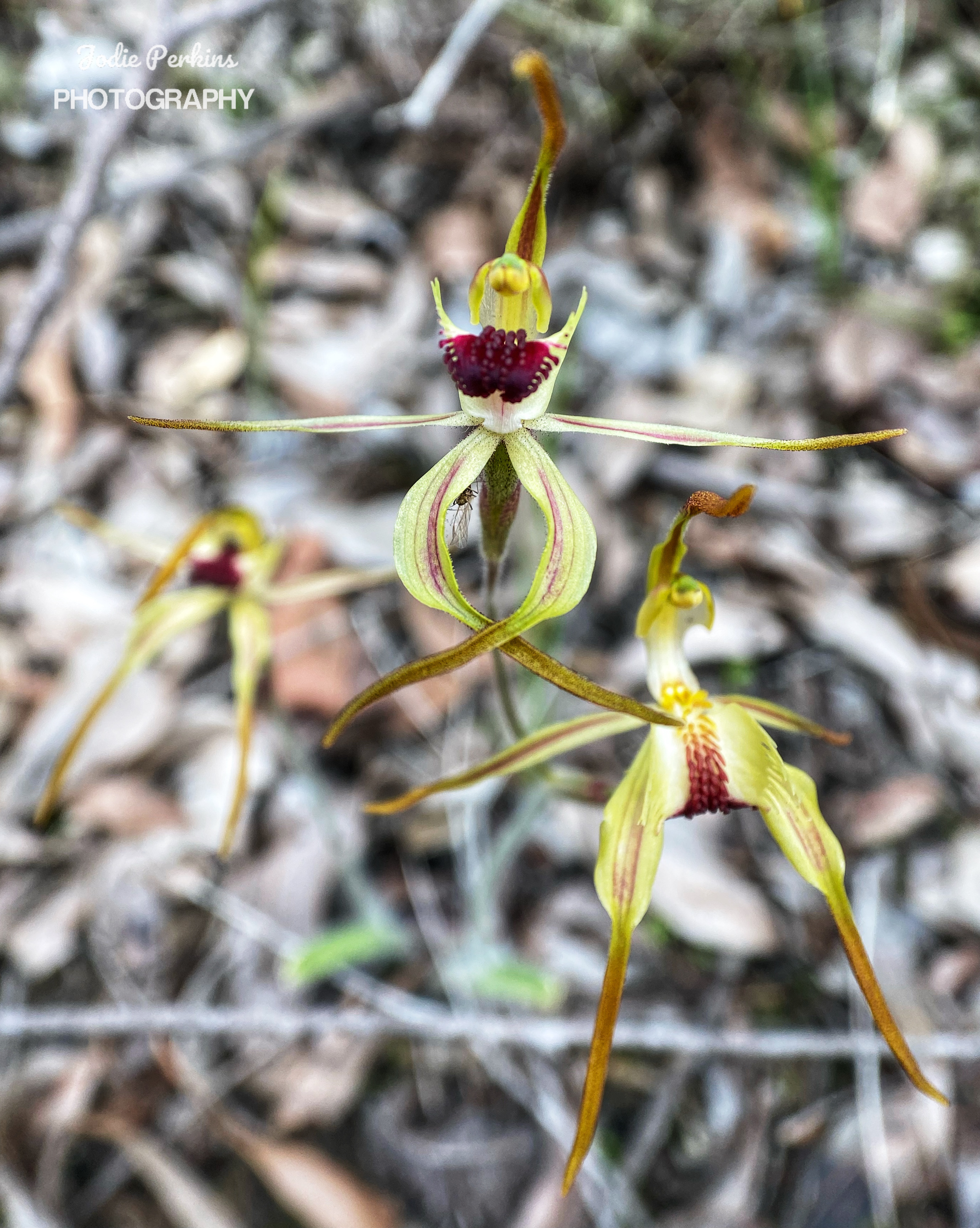
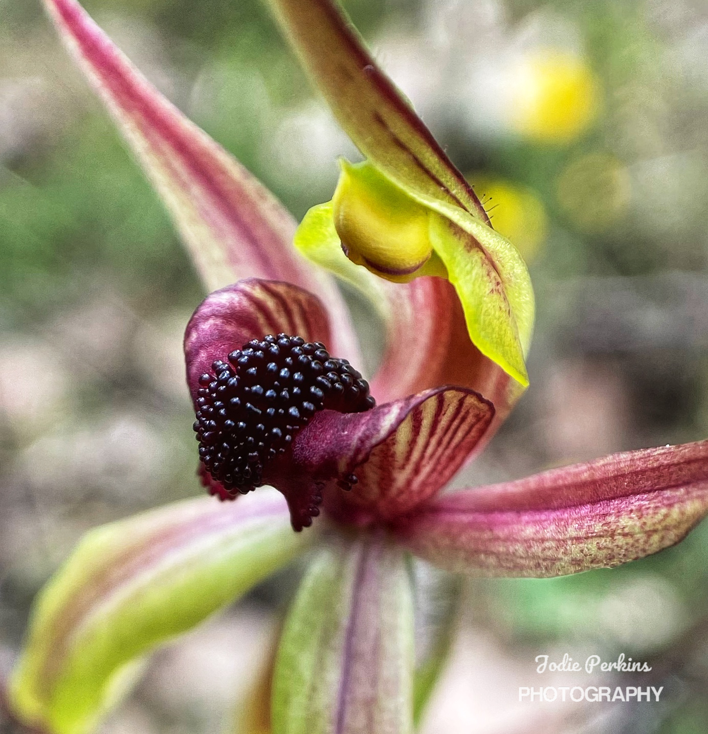
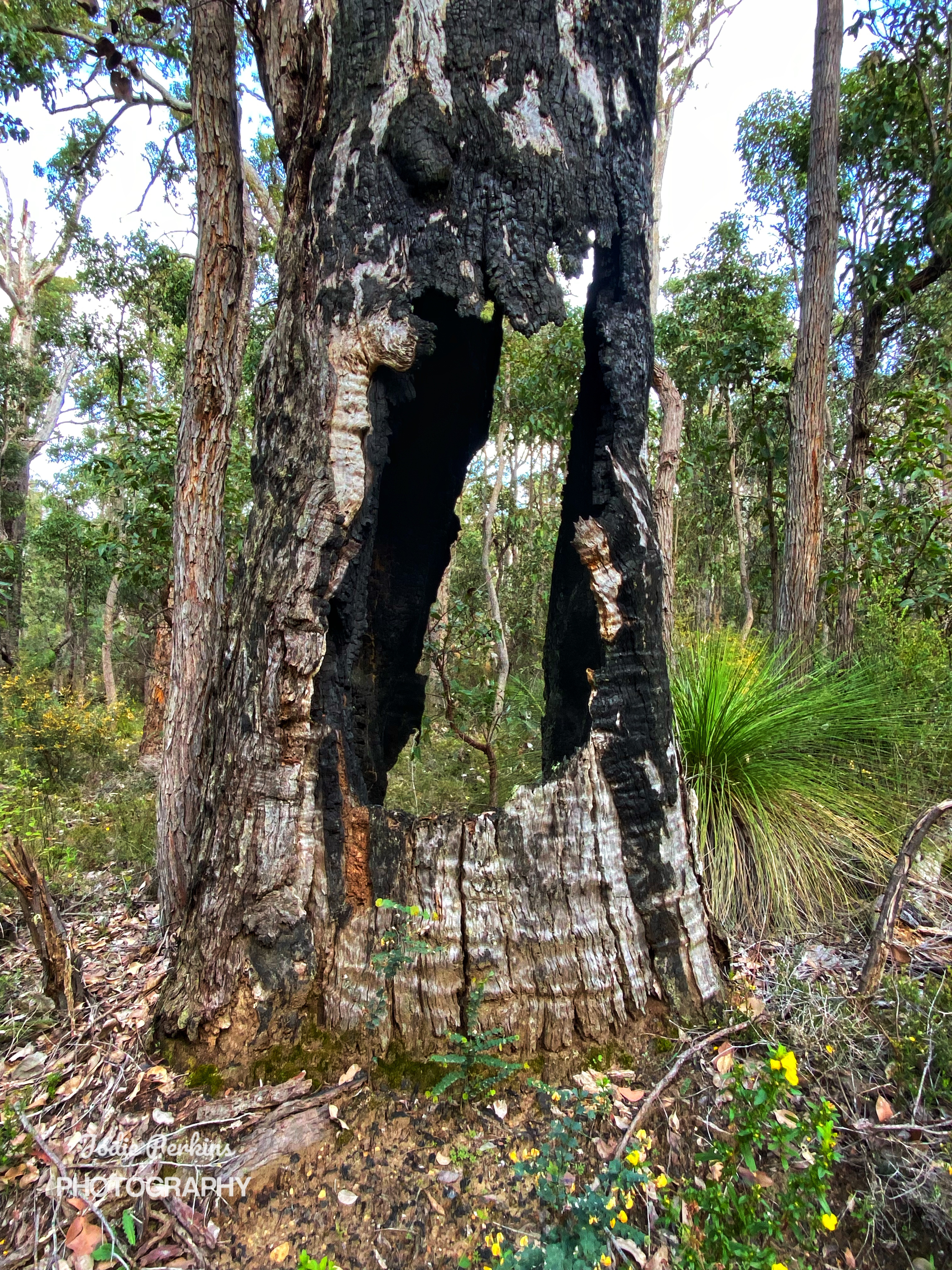
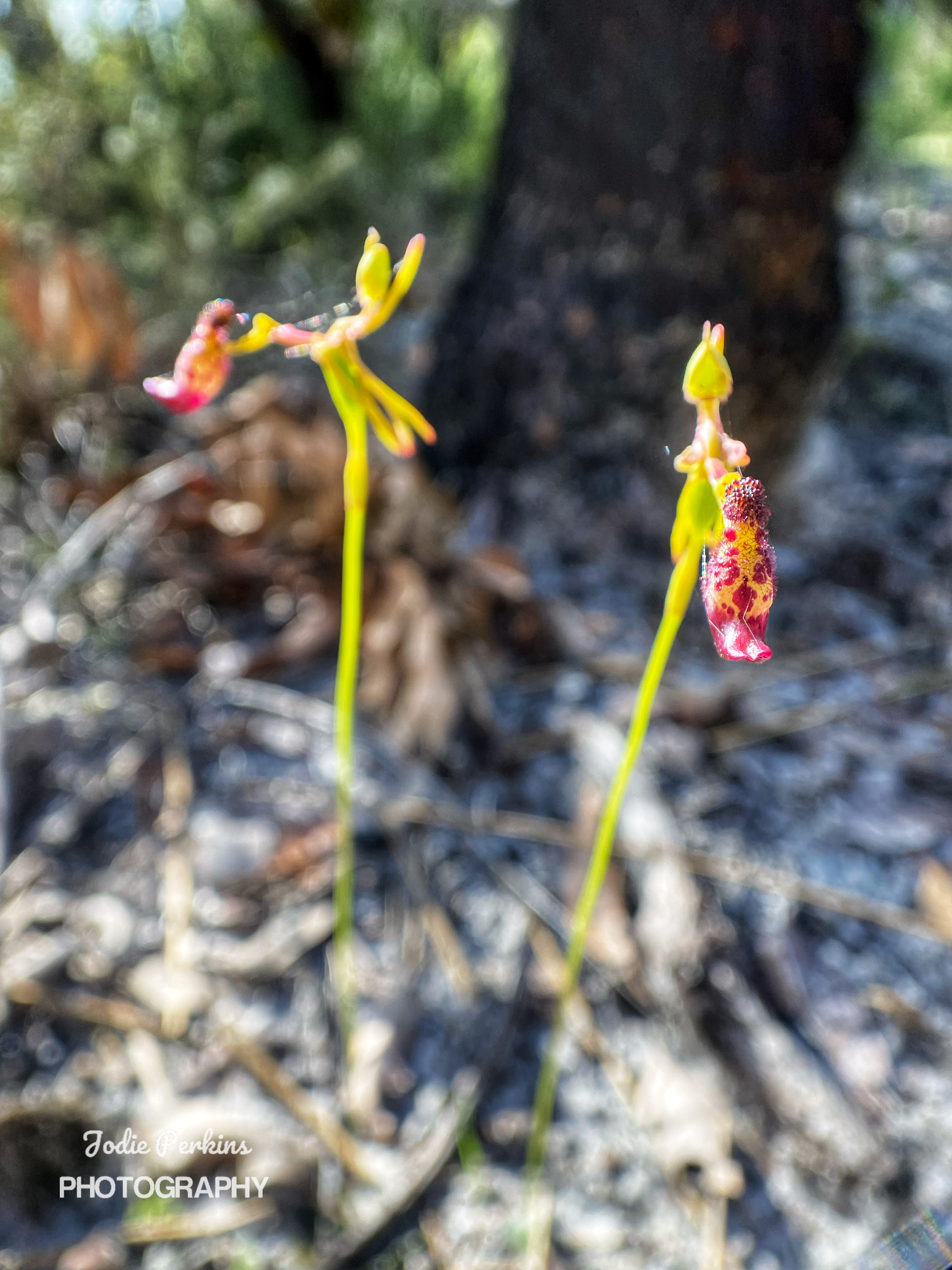
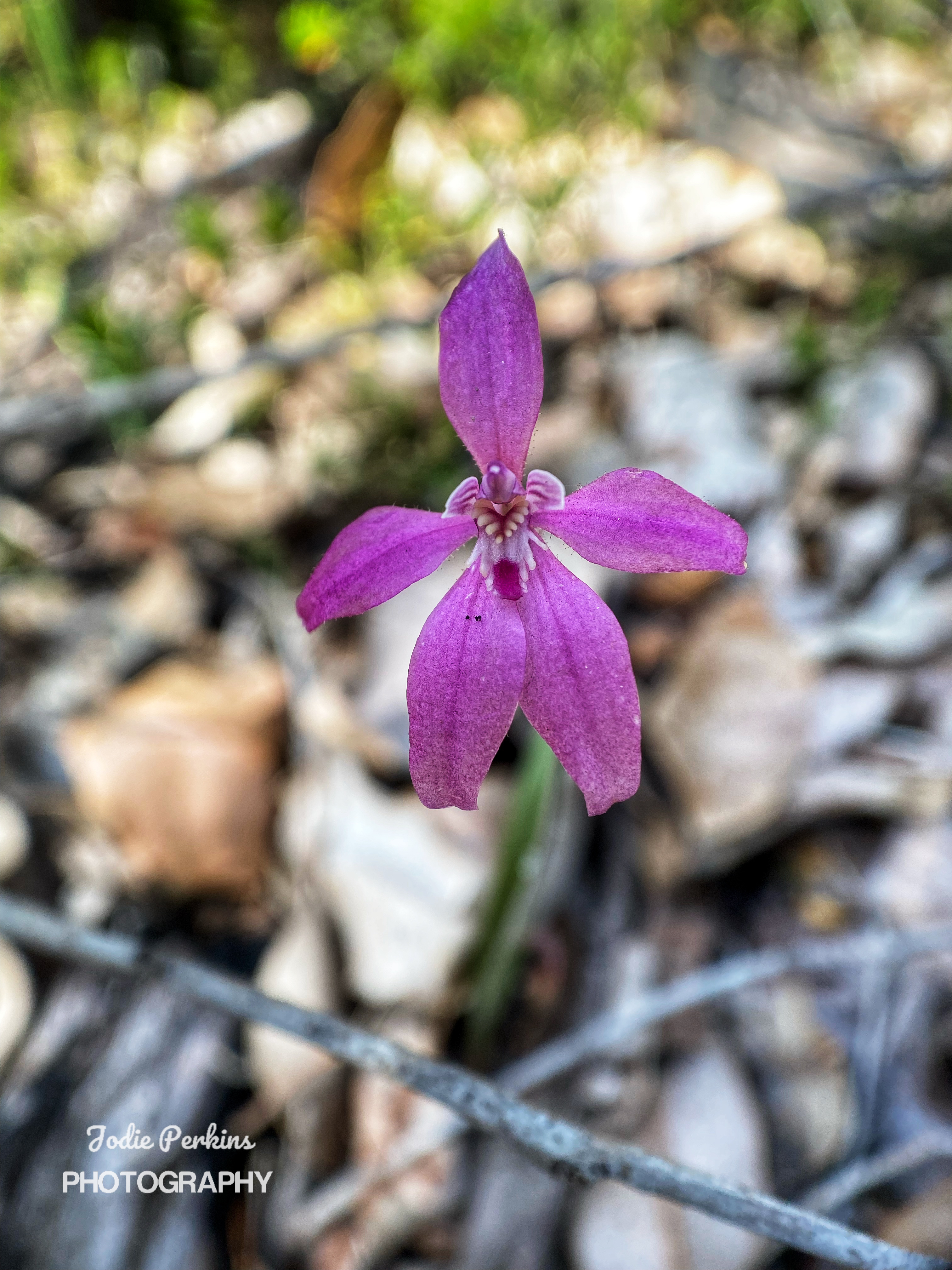
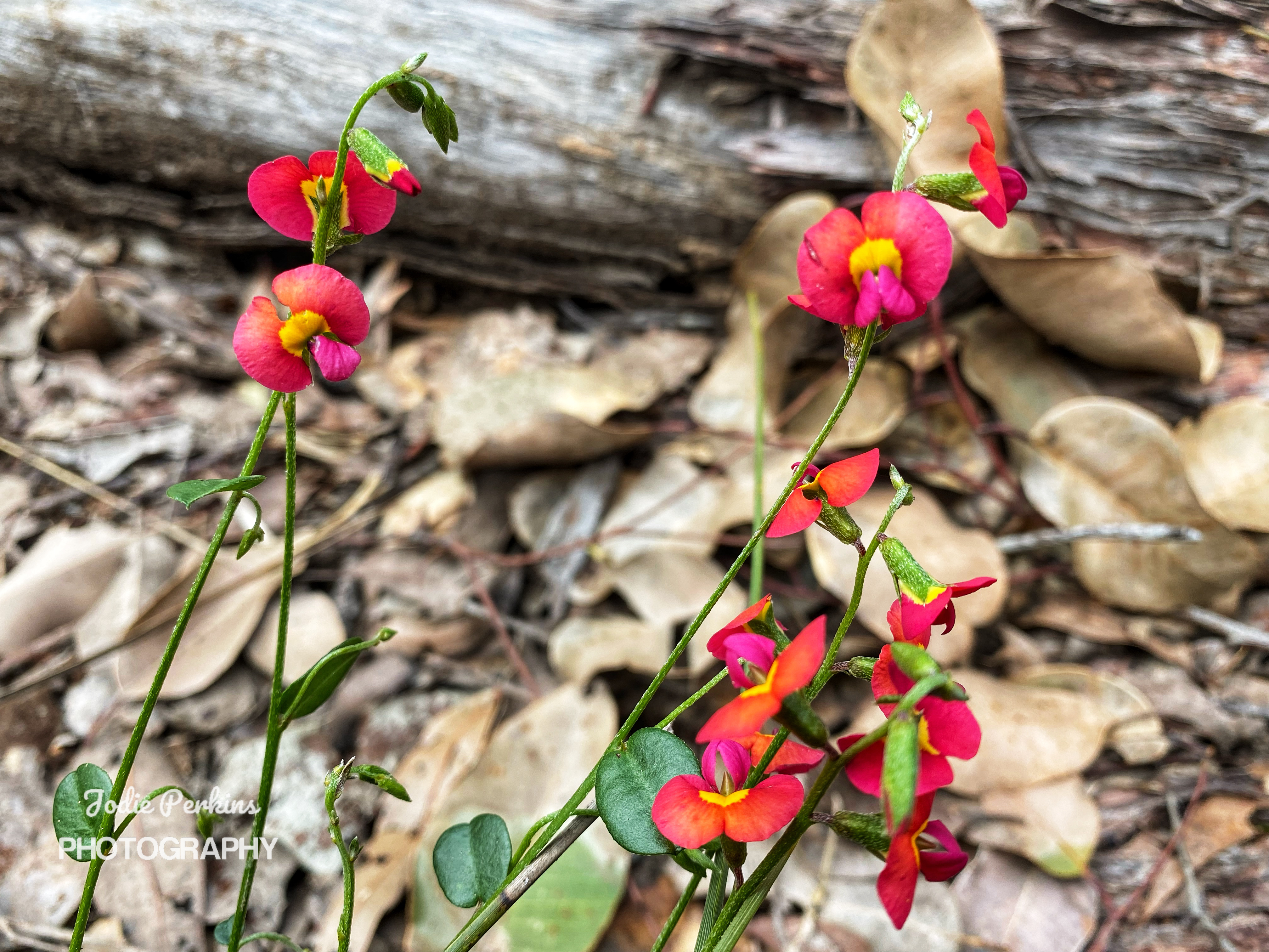
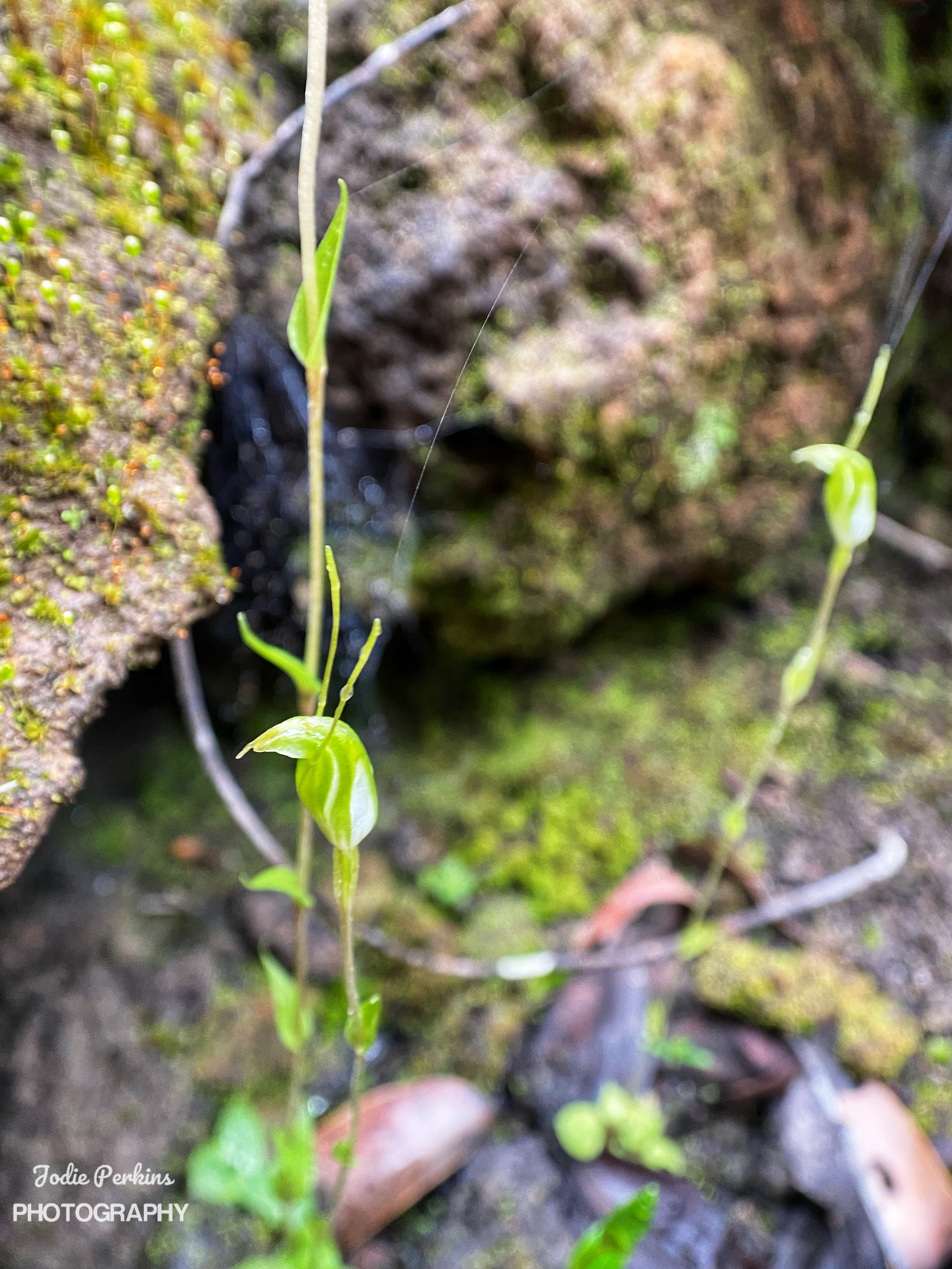
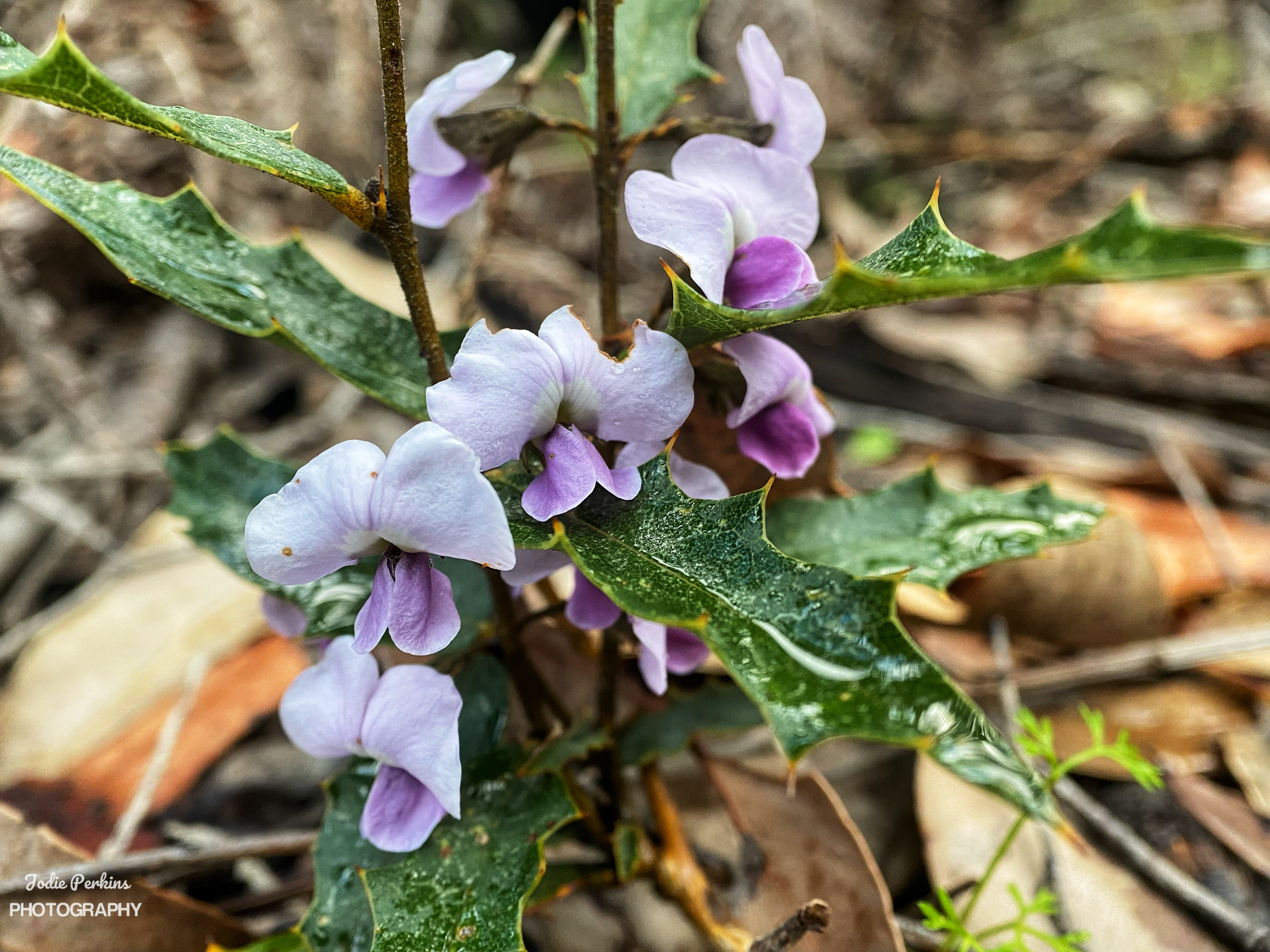
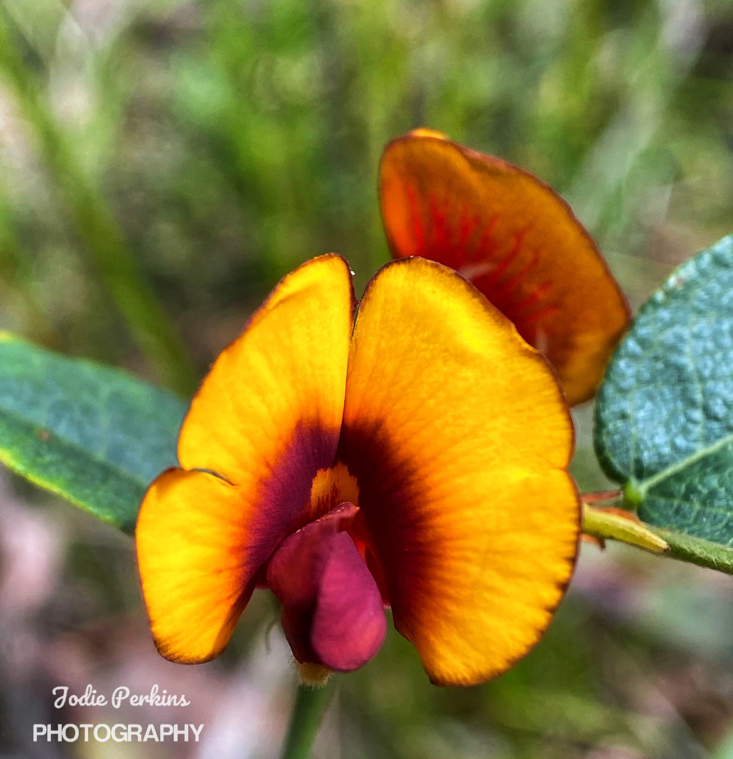
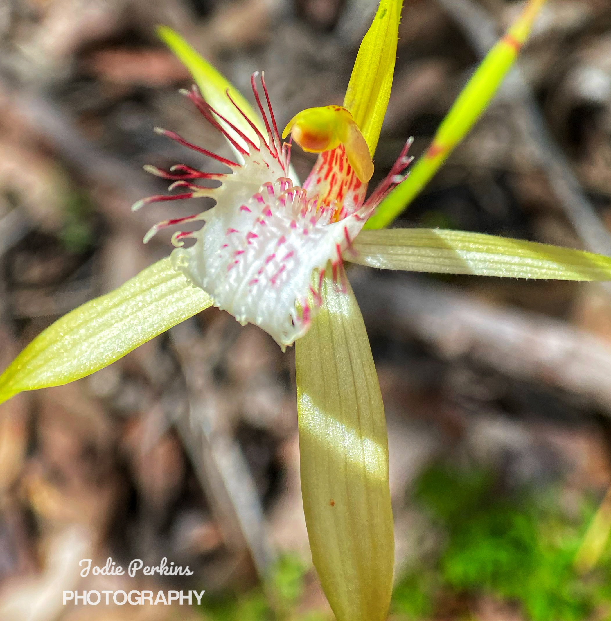
The first part is straight up a steep bitumen road for 300metres or so before heading into bush at the top of the Wellington Dam wall. The first 500 metres is lovely with the water to our left before we venture away permanently from it. Most of the way is up hills. Some go for longer than others and it is a clear effort to get to our destination. I spot a million Silky Blue Orchids, their vibrant blue colour contrasting with the Forest colours. The effects of the prescribed burn in 2019 is still obvious. With a kilometre to go, Ambles has had enough, his feet are hurting, his shoulders are hurting as he hasn’t adjusted the backpack right and all the weight is on his shoulders. He zooms pass me while I’m taking photos of some beautiful delicate Pink Fan Orchids and I don’t catch up until Arcadia Campsite. 

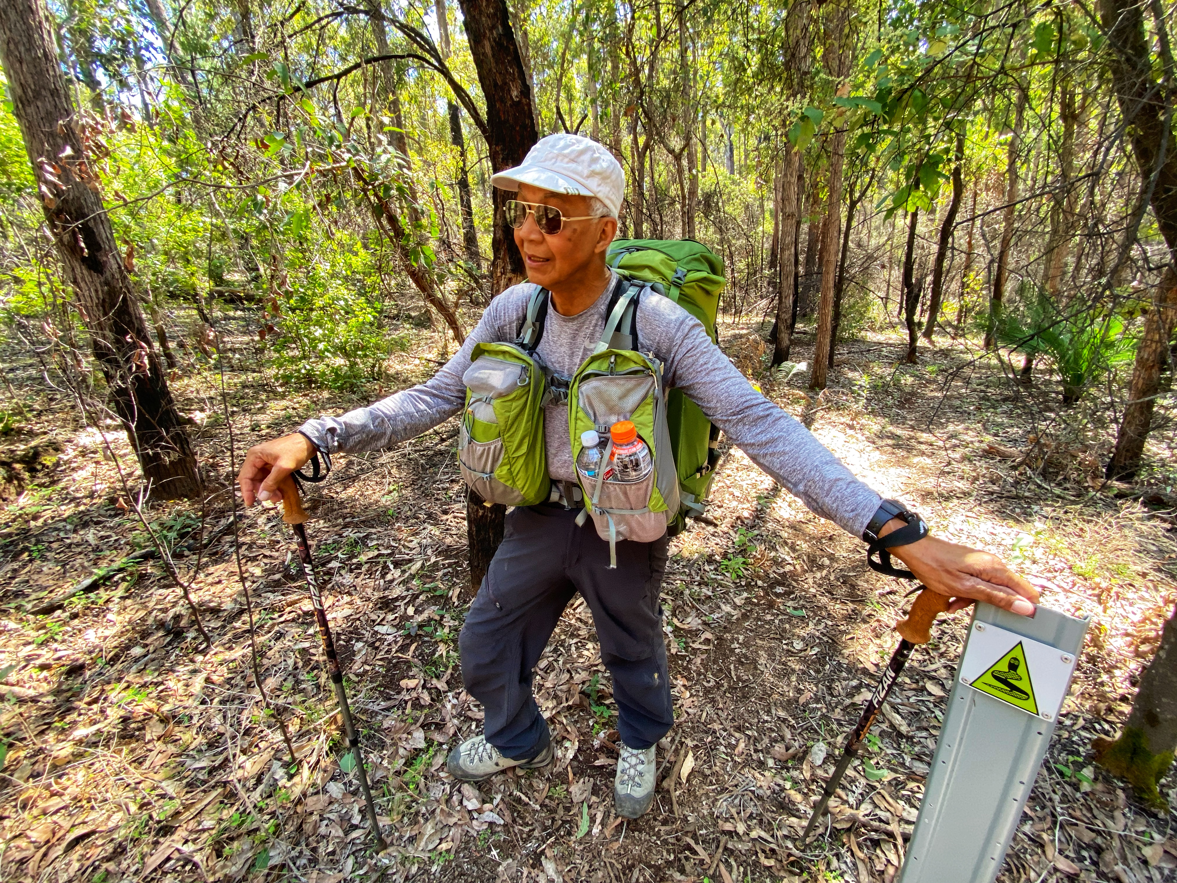
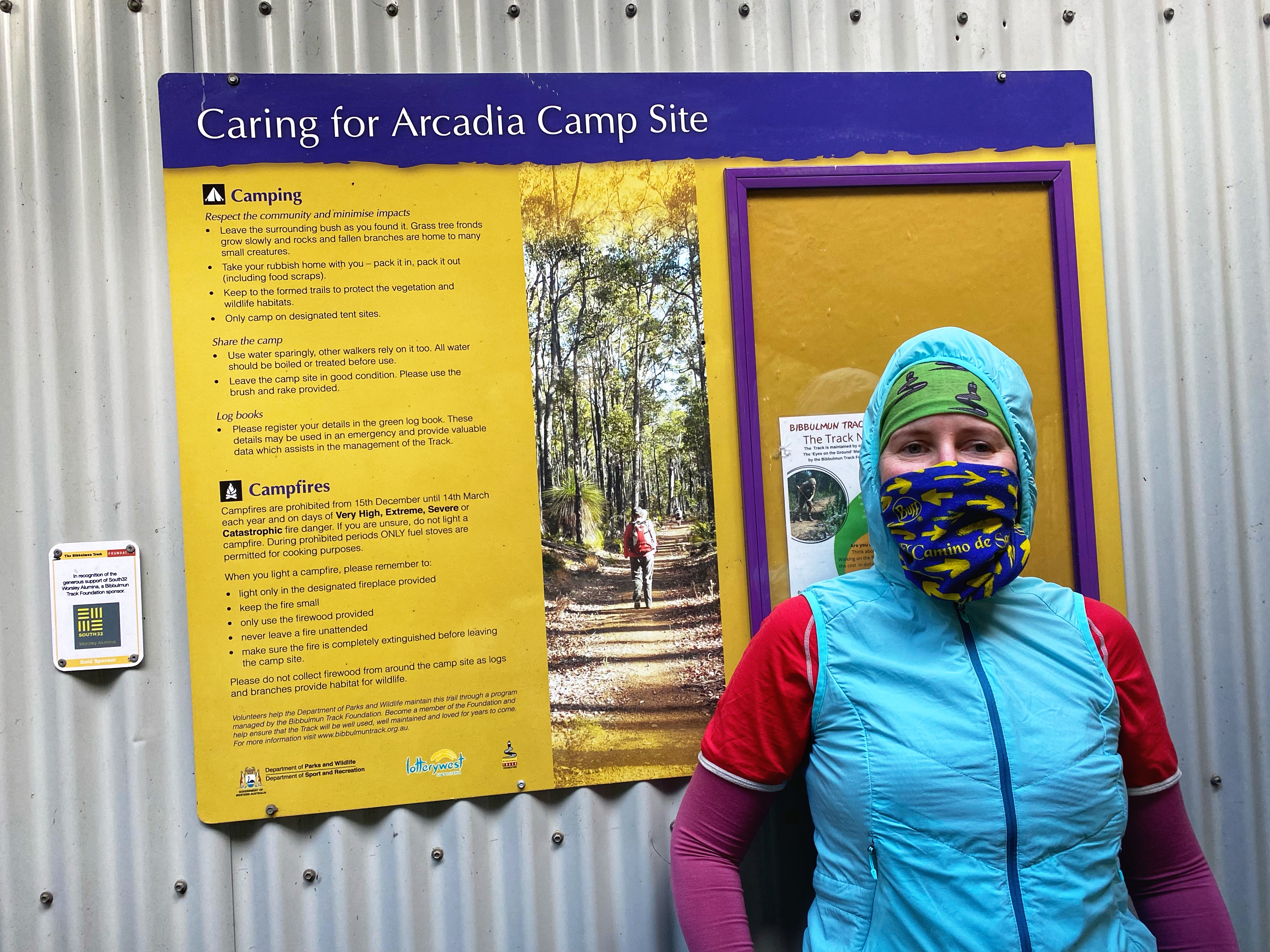
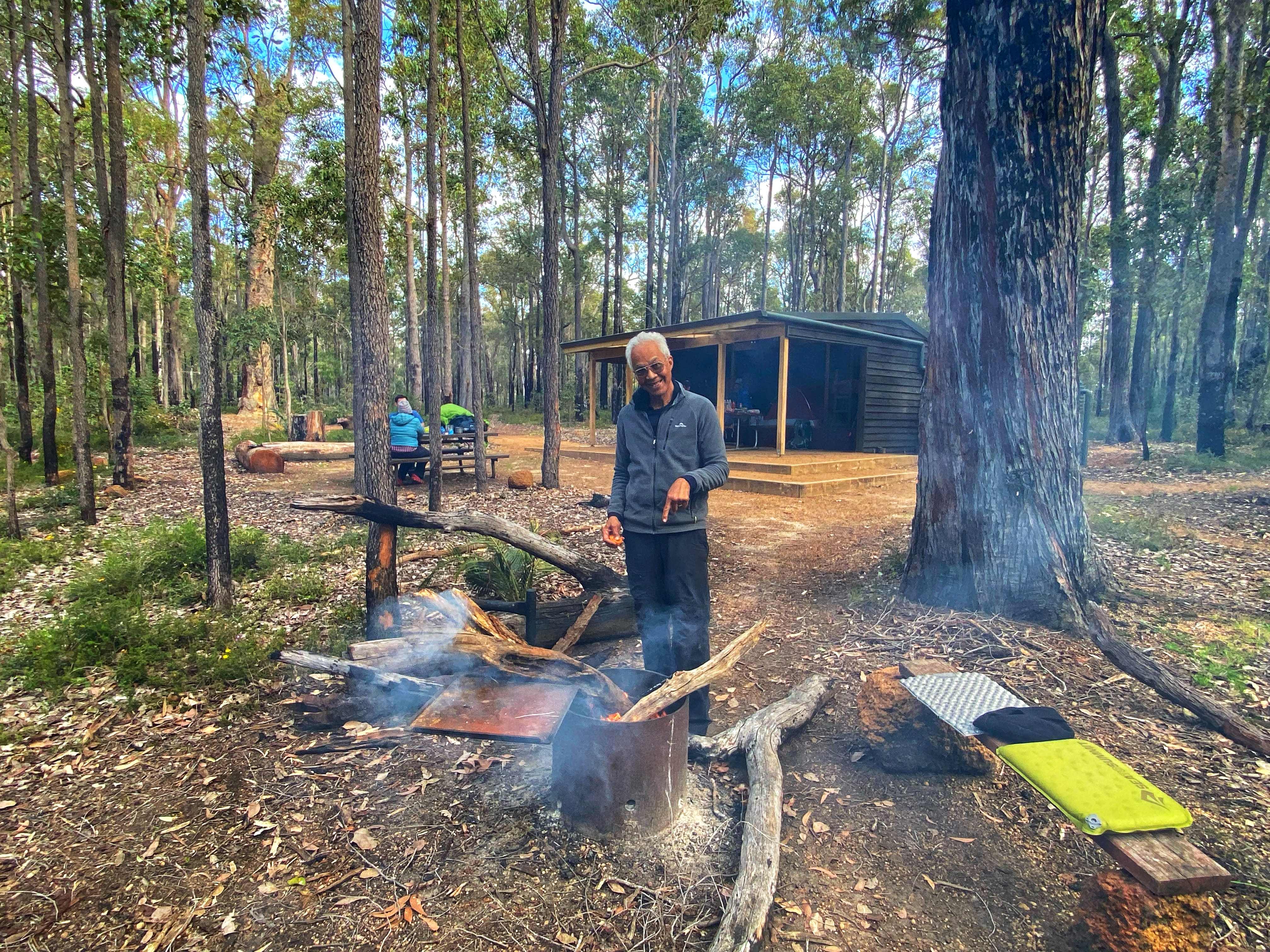
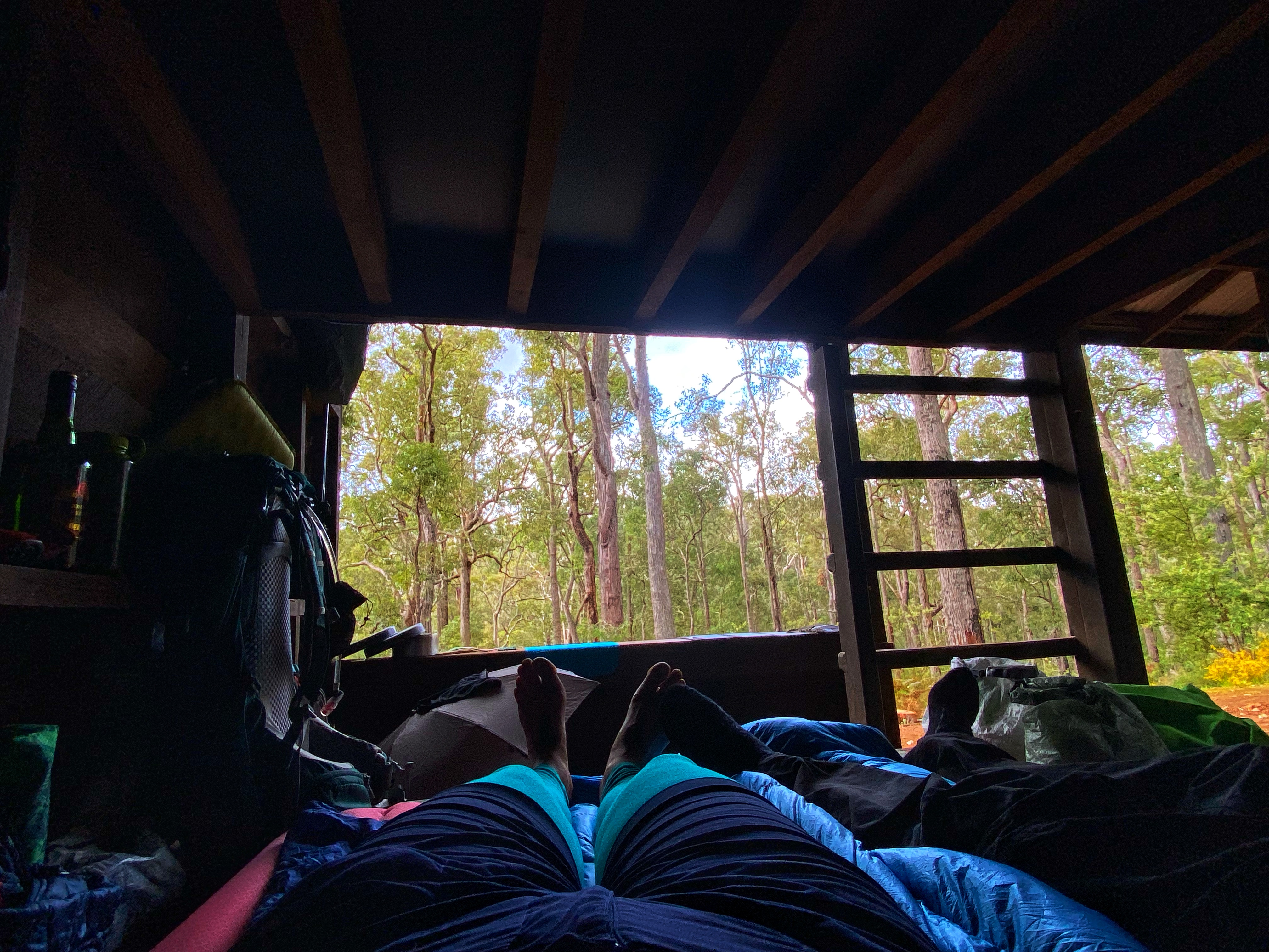
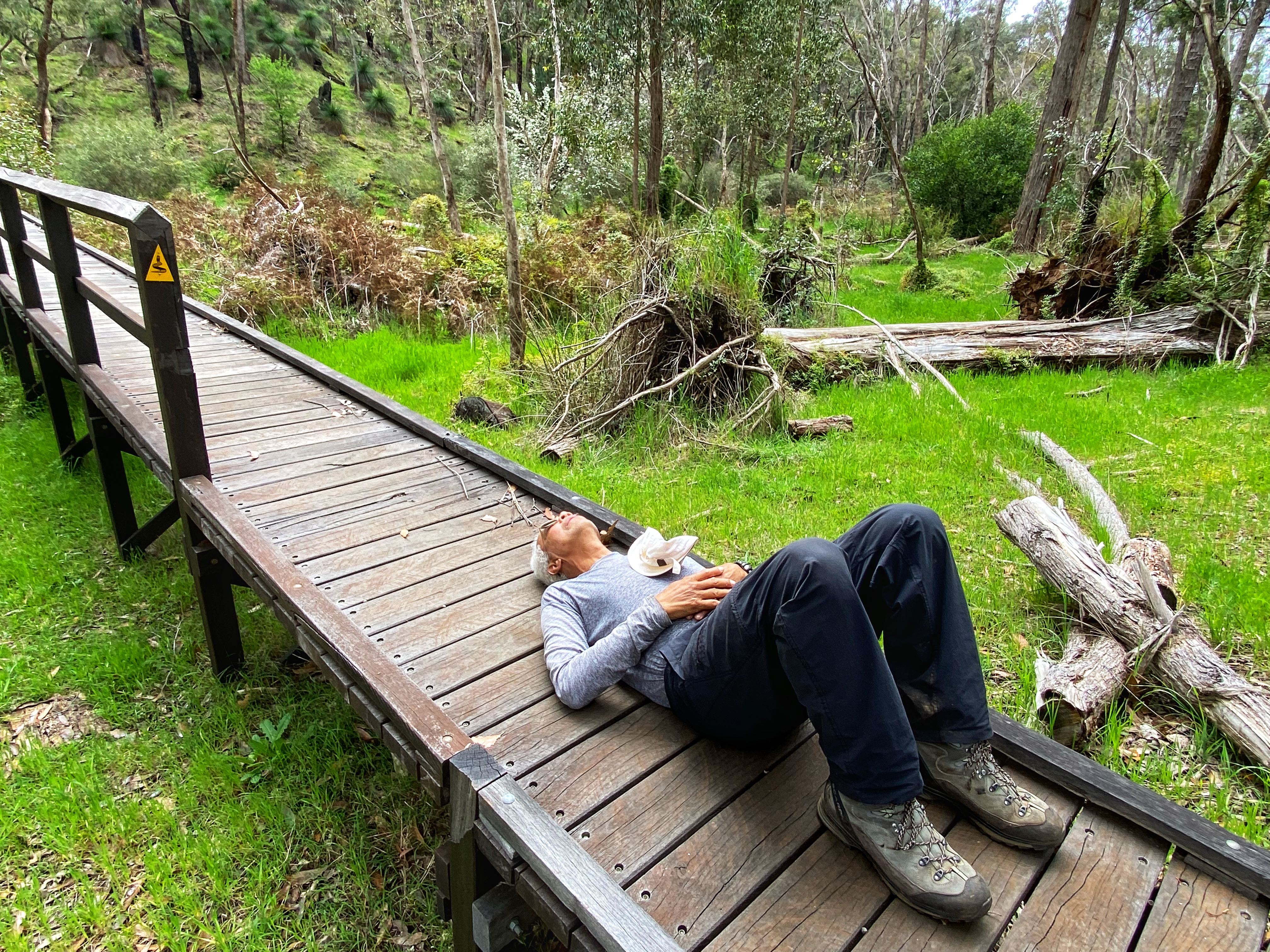
These campsites are different to the Bibbulmun in that they are even better. Equipped for large groups there is a large communal shelter roof over two picnic tables. Ample tent sites. Two large toilet blocks, not the standard narrow toilet rooms you can’t comfortably get changed in on the Bibbulmun. And a large group sized campfire. Don’t forget – and water tank! There was no mention of water tanks at either campsite so I carried extra water in. Always better to be prepared just in case! Ambles thinks why not set up the tent under the shelter near the picnic table. But just in case someone turns up, we decide to set up in one of the designated tent sites.

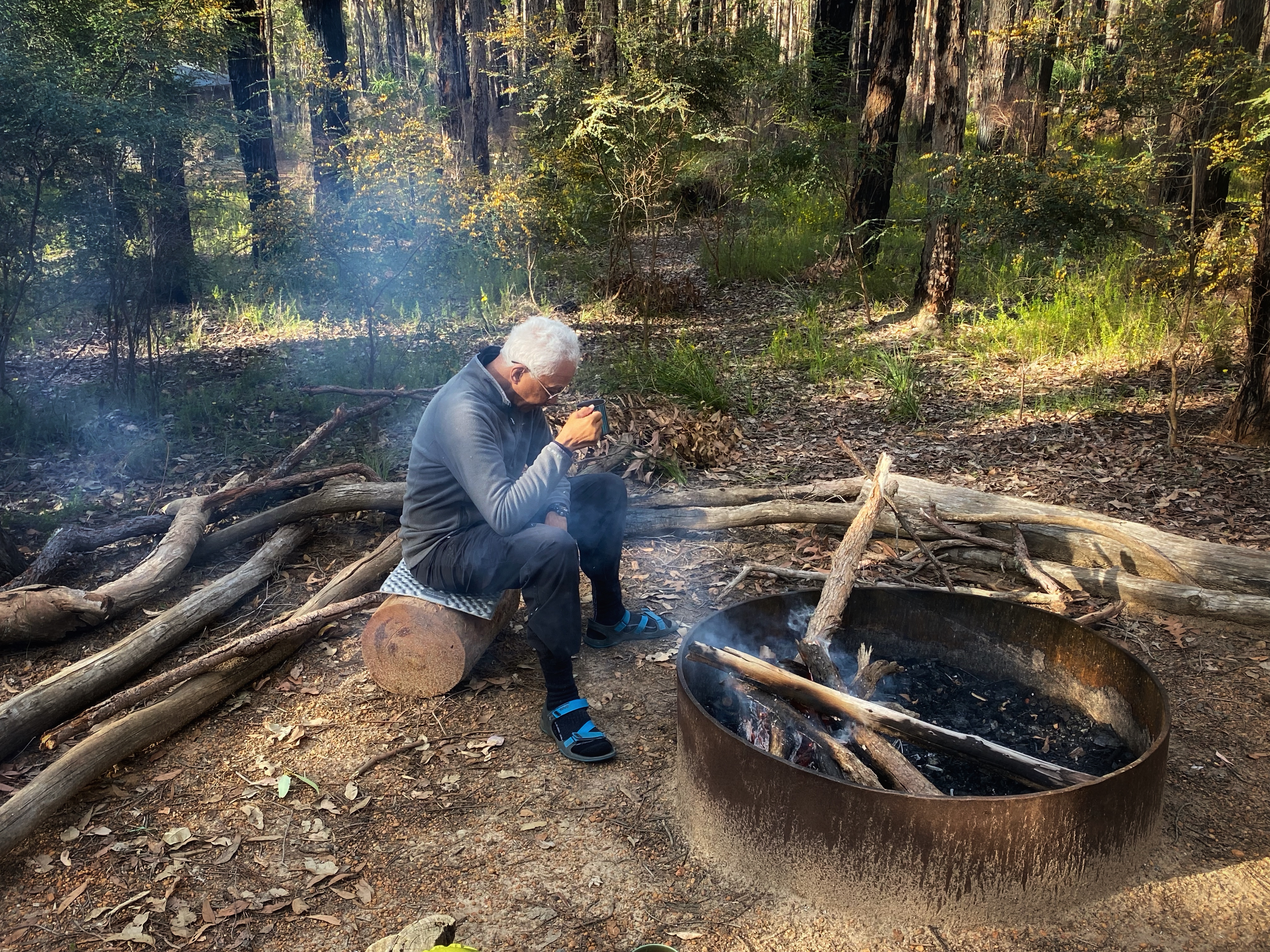
We have the afternoon to relax and unwind. Our bodies are sore, aching and unhappy with us. Ambles gets the campfire going and we end up having the place to ourselves not seeing another hiker at all. But trail mortorbike riders we do hear nearby on other dirt roads as they rip noisily along. We are very cosy in our tent & sleep very well that night. 

Day Two:

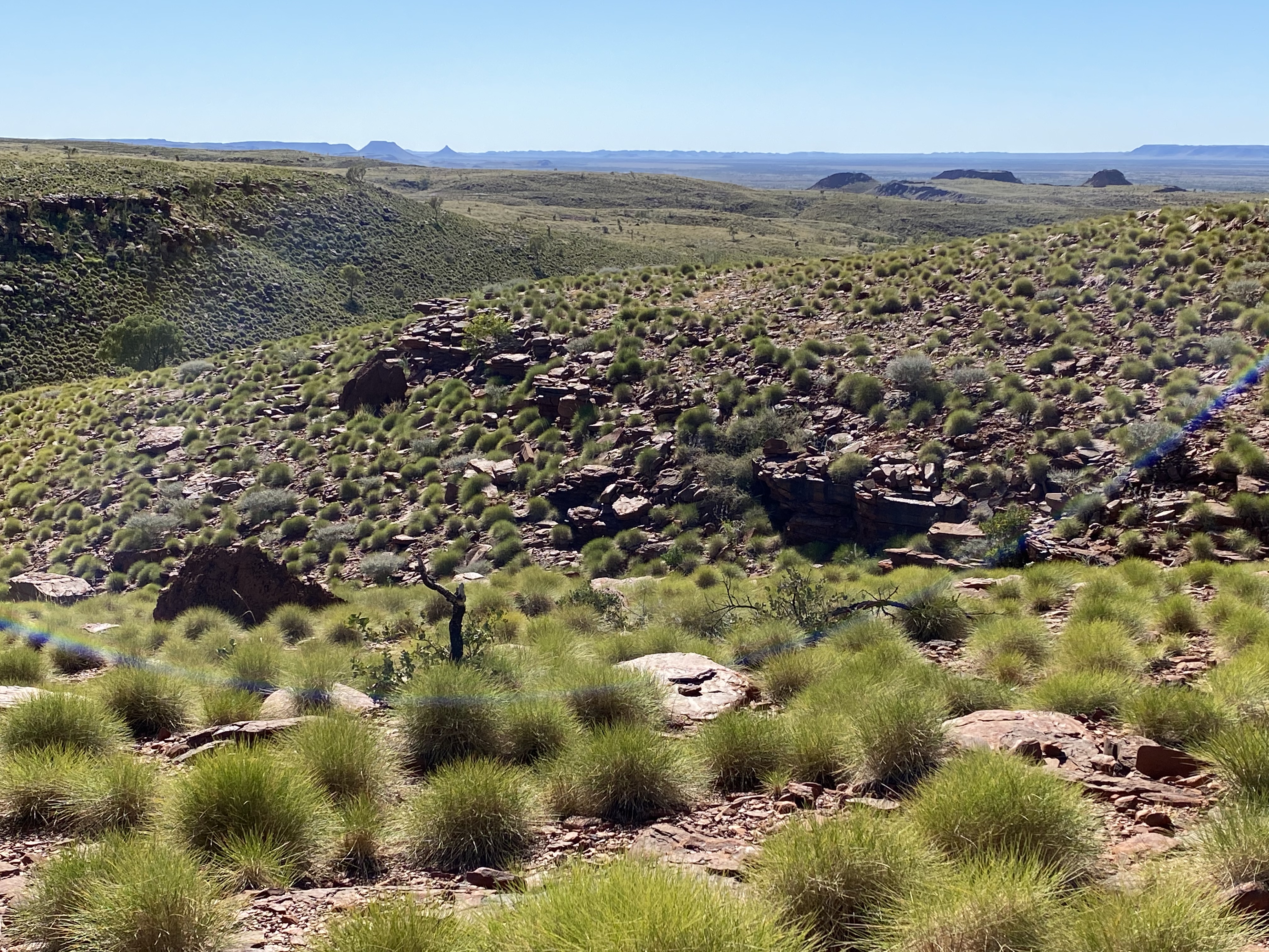
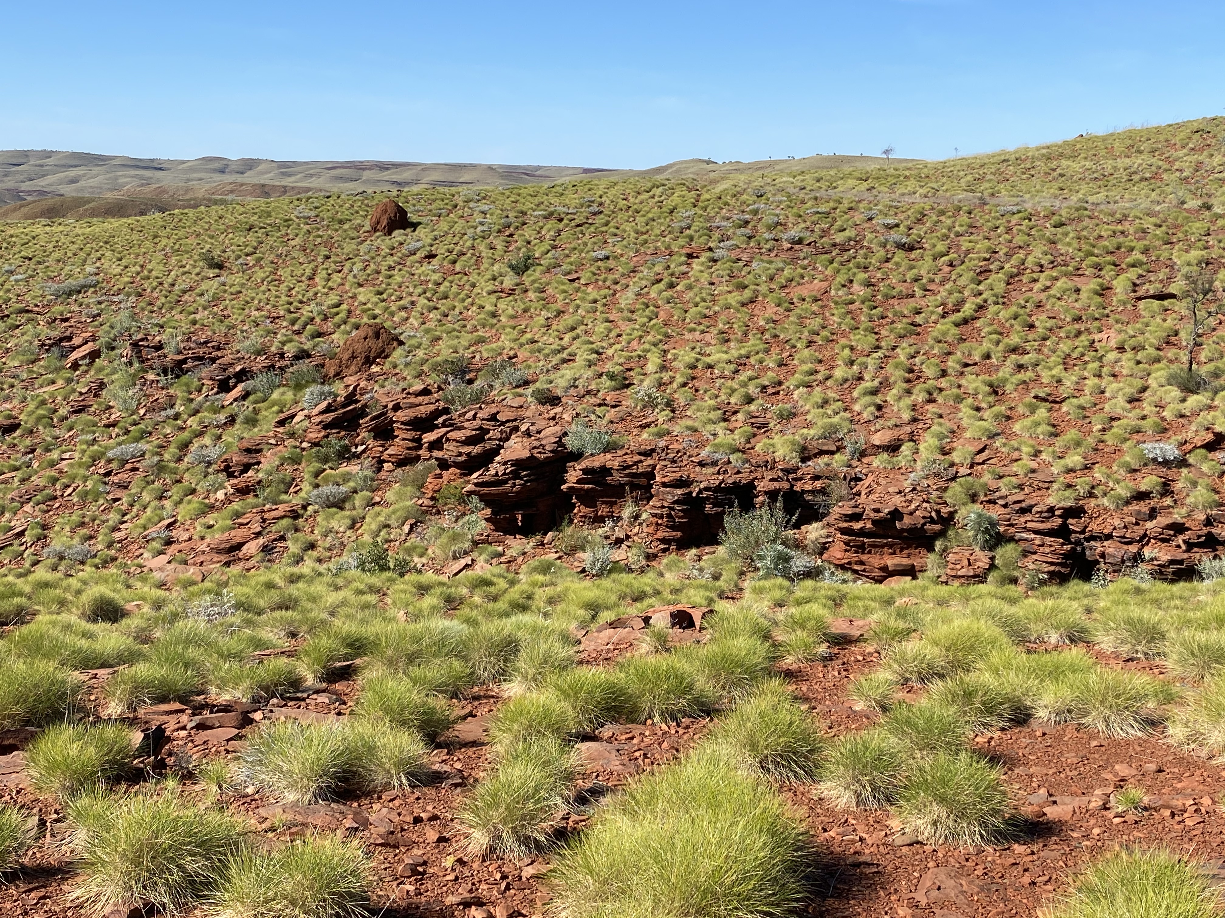
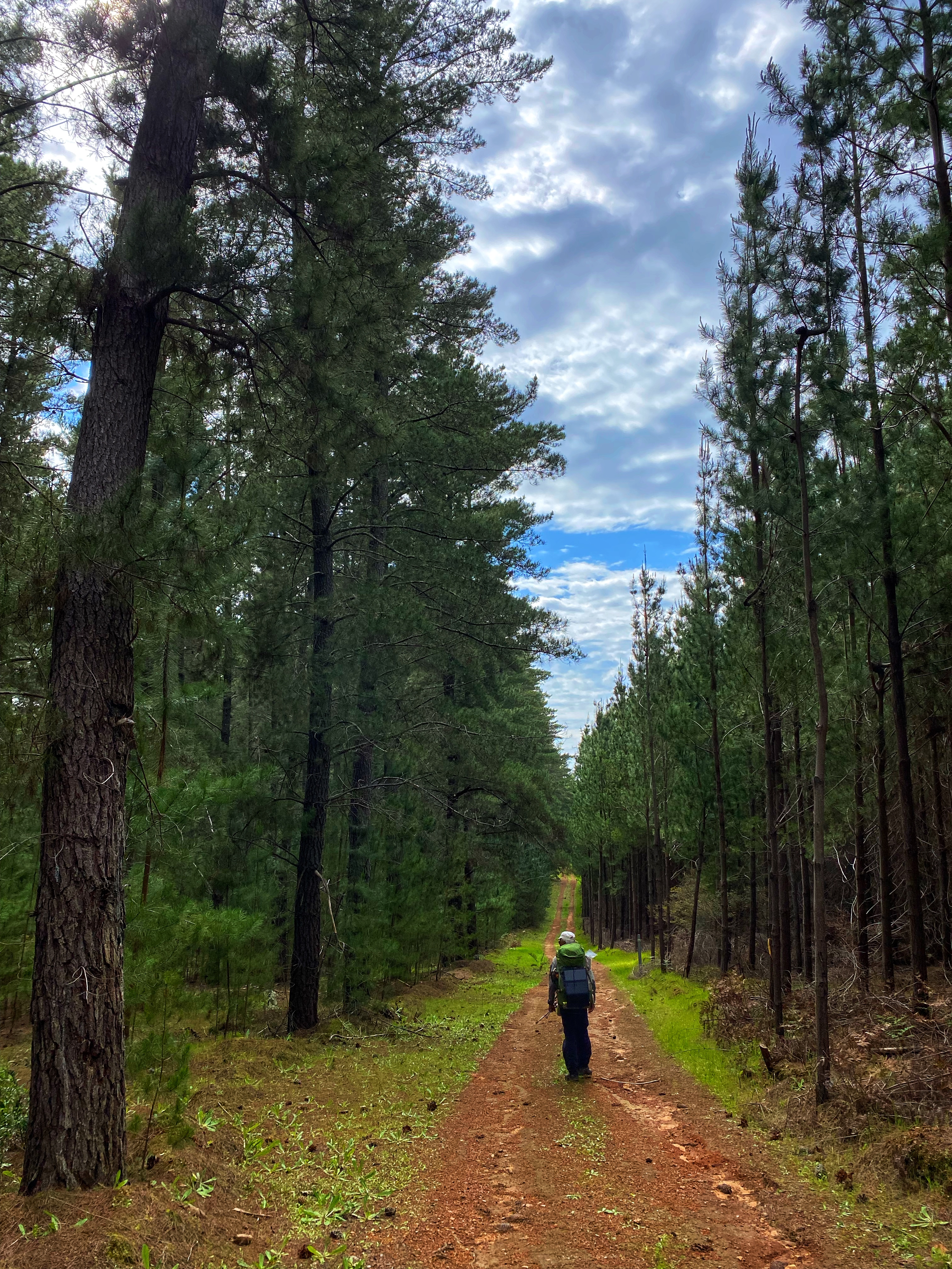
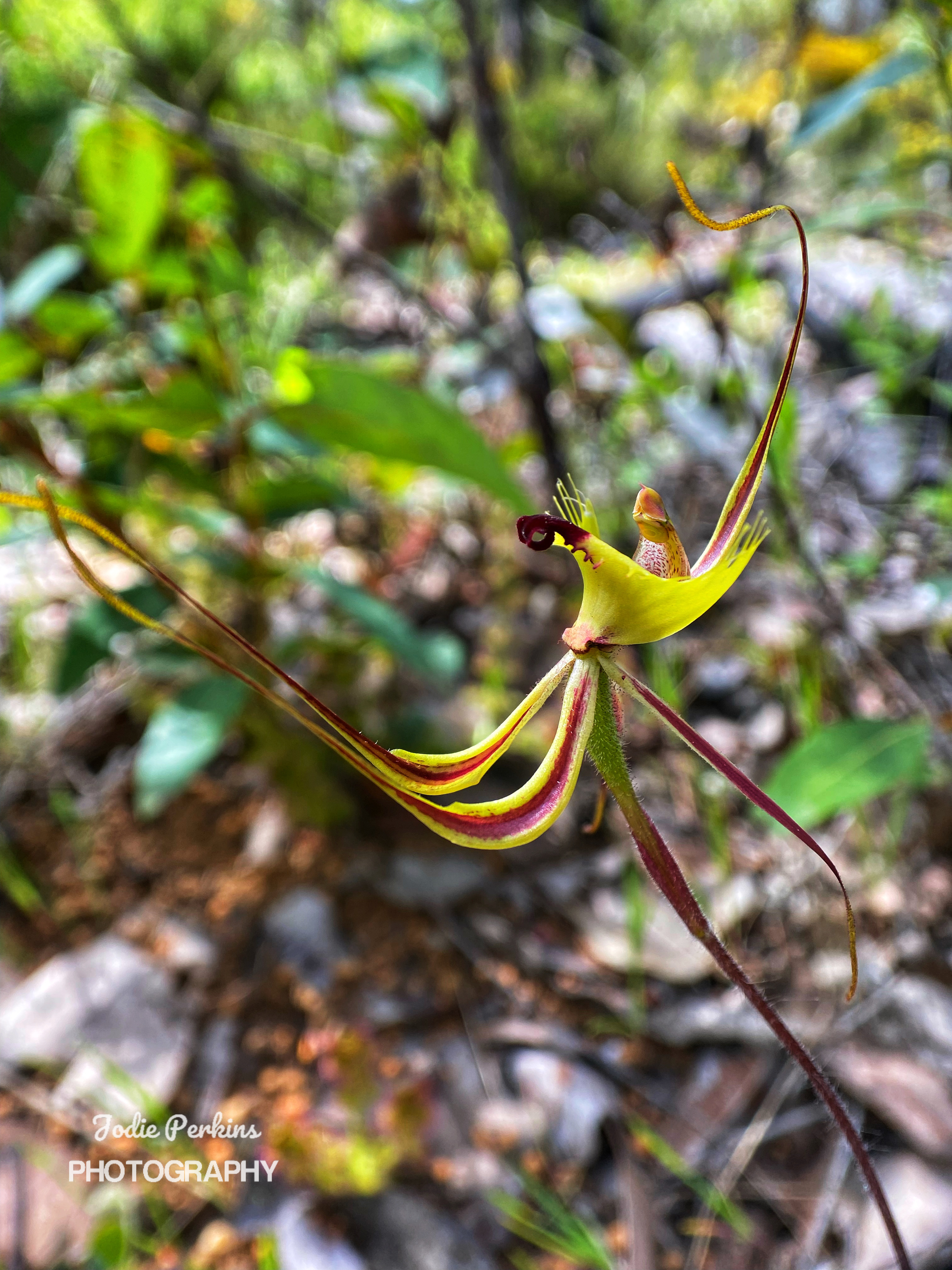
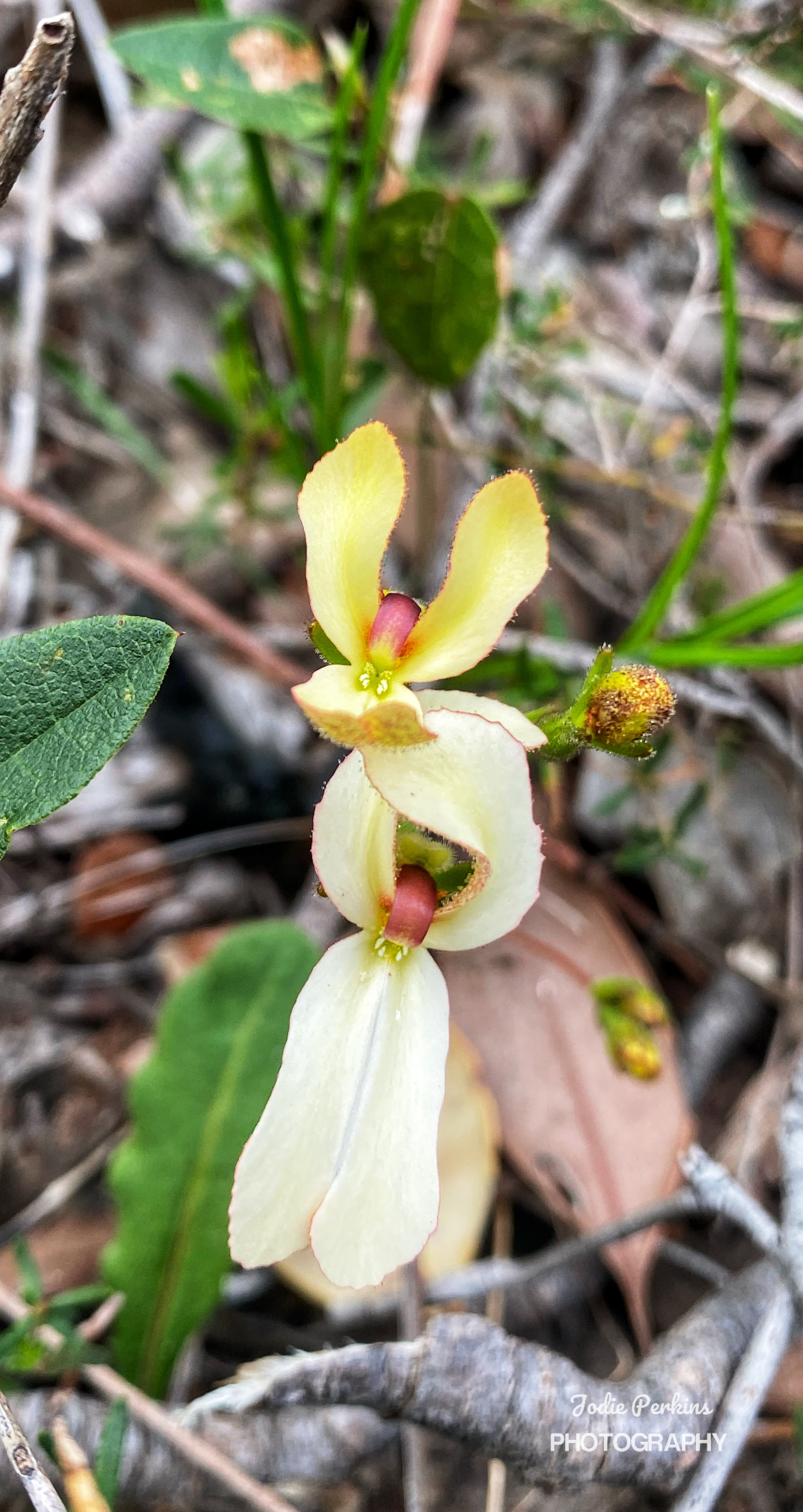
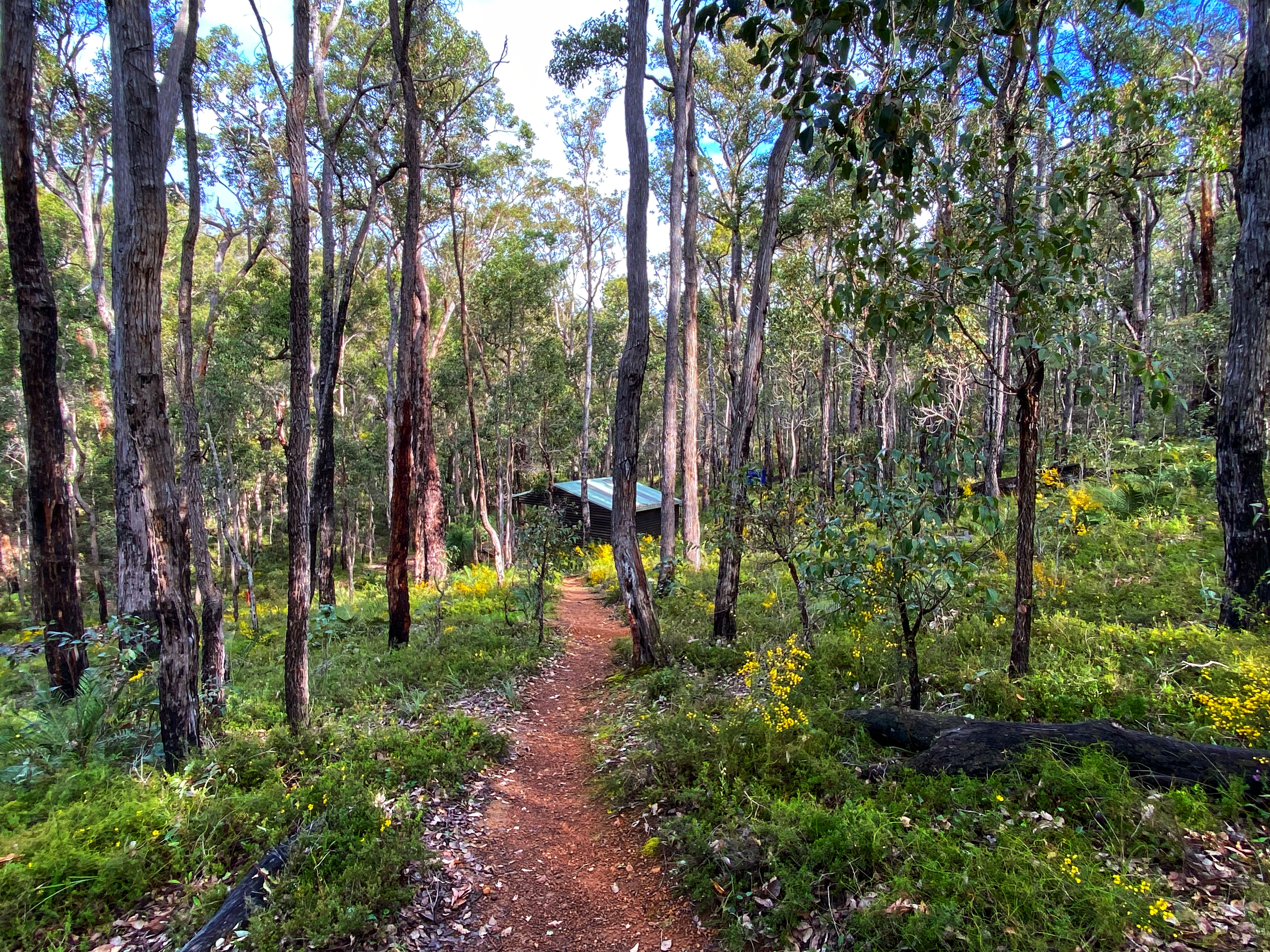
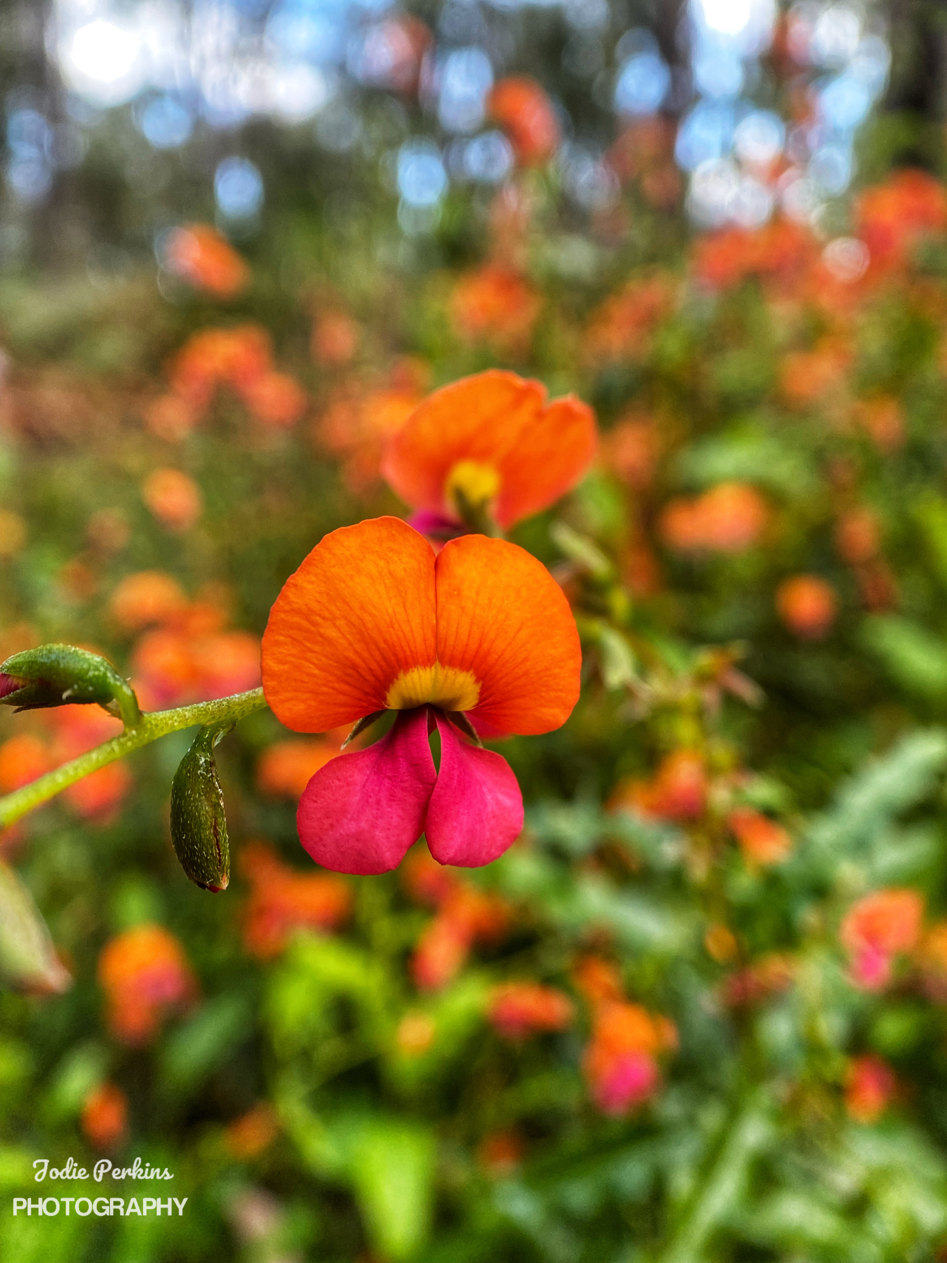
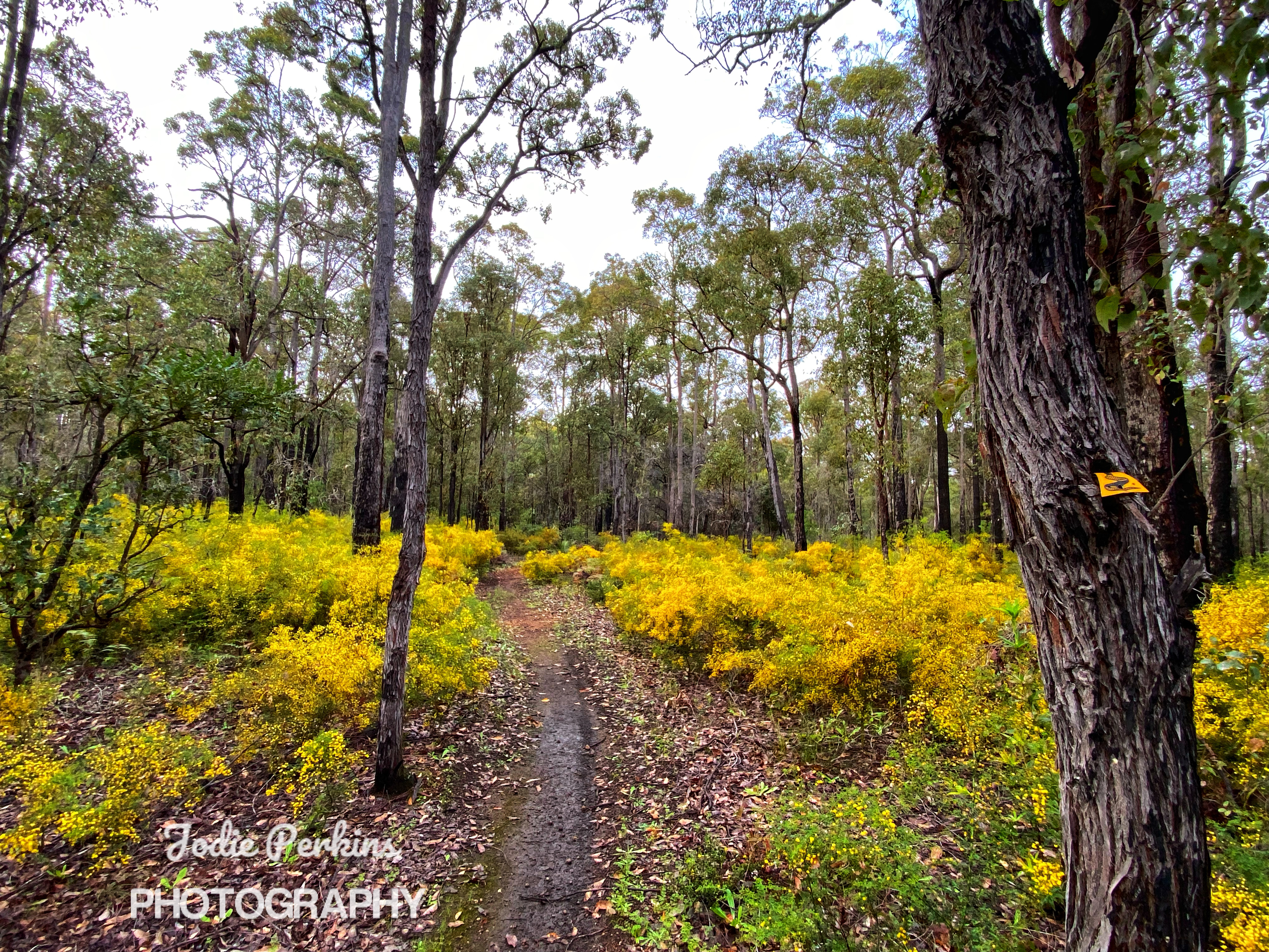
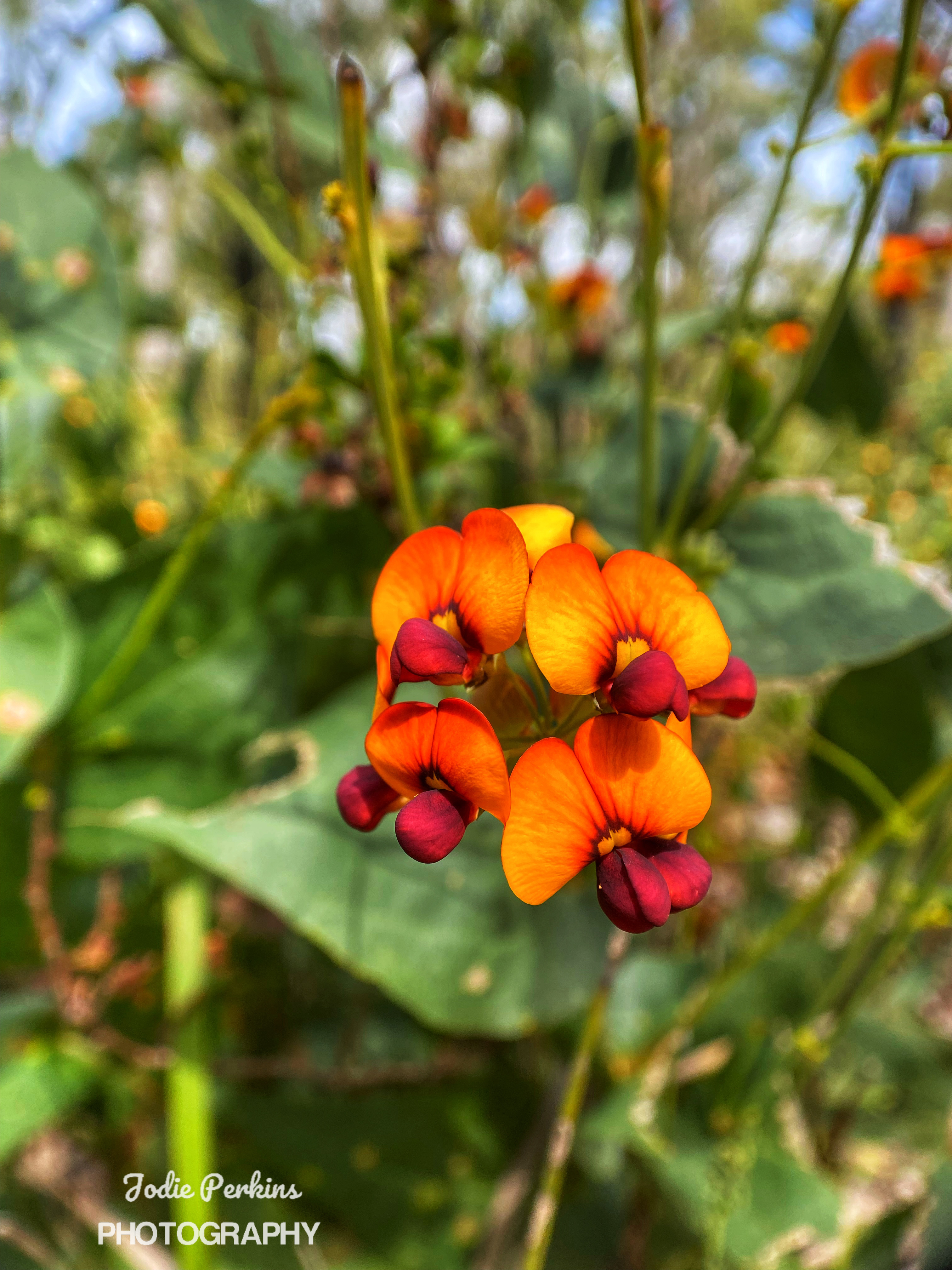
We are up nice and early, having our quick breakfast, packing up the tent and heaving our backpacks back on. I start off fresh, feeling good besides the tight soreness in my glutes and calf muscles. The distance ends up being 17kms, for some reason we were expecting it to be longer. Most of the way through Forest is flat, wide tracks with many more Silky Blue and Bird Orchids to see. The clubbed and leaping Spider Orchids are also in abundance. Ambles is struggling from the get-go. Especially a long steep hill incline that appears really takes the wind out of our sails. We pass through pine plantations and there is a ridiculous diversion that must add on an extra kilometre. Some of the waugal markers are the actual Bibbulmun yellow and black ones, some green & black. Maybe they ran out of the green and black ones. We instantly feel back at home. 

There’s more Forest through a narrow goat track and I eventually need a break as feeling zapped of energy. Ambles catches up 5 minutes later thinking he had passed me without realising. We spend too long there having a snack break. 25 minutes late I’m impatient and bark at Ambles to get going. We were thinking we still had 2.5 hours to go and I’m pleasantly surprised an hour later to reach Lyall’s Mills Campsite. The second group campsite and a mere 100 metres from the intersection of the Bibbulmun and Wellington Spur trails. It is 12.30pm when we reach Yabberup Campsite 400 metres away up a steep incline. We are the first to arrive with a couple of day walkers heading to the Mumby Pub from Collie. Yabberup Campsite is one of the smaller Bibbulmun Track campsites. The toilet is wobbly on its foundation. One of the water tank taps pathetically dribbles out water. But an upgrade has been had with fitting in clear sunlight panels at the front to maximise more sunlight into the shelter. Someone must have read my previous blog where I named Yabberup the worse campsite on the track. It is Saturday and the long weekend is in full swing so it is no surprise we end up with a full house inside the shelter plus more section walkers putting up their tents outside. Mark comes in hiking the section on his own. He carries a portable radio to listen to the grand final footy game being held that night at Perth’s Optus Stadium. We also meet four current End to Enders hiking Kalamunda to Albany and get to know them over the next few days. Simone is hiking on her own but has teamed up with Ben hiking on his own. Simone is a pocket rocket and zips along at a good pace, she carries her own little hiking foldable chair and makes an effort to socialise with everyone. Ben is a friendly  guy that has hiked all of the Bibbulmun in sections and is attempting another thur hike as the previous times he has been unsuccessful. Then the real stars are Olli and Viv, totally green at thur hiking and multi day hiking at that. They started out at Kalamunda with oversized backpacks with too much stuff. Once they reached Dwellingup 16 days later, they had ordered and had delivered to them replacement hiking stuff half the weight and amazingly are still going strong. Olli impresses Ambles with his young age of 71 years. They may be the slowest on the track, but what does that matter, we all reach the same destination at the end of the day do we not?

Ambles had decided to put our tent up inside the shelter in the middle lower section. We were told a storm was possibly coming in overnight. I was thinking we would have to move as more people came in as the afternoon wore on. There must have been 20 people there that night. Most were section walkers like us and one was End to Ending south to north. We didn’t speak much but she was in her tent right next to us and wasn’t impressed with our sleeping mattress. I hadn’t realised how noisy it actually is, especially on a wooden floor in a crowded shelter. I did not sleep well, trying not to turn too much and not go to the toilet until the morning. I felt for the others that put their tents up outside but luckily it did not rain as forecasted. Oh….. and the Melbourne Demons won the grand final  footy match.

Day Three:

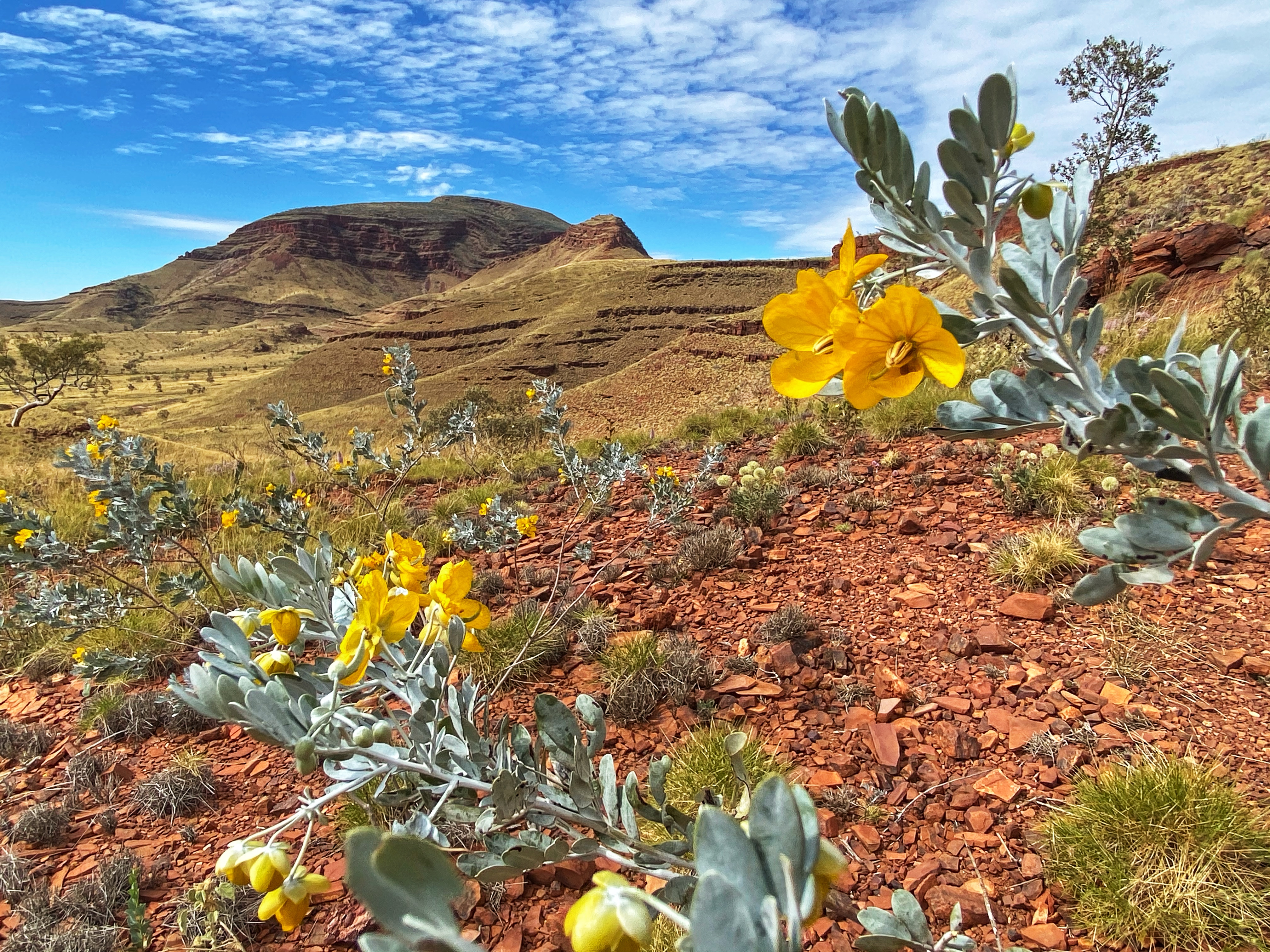
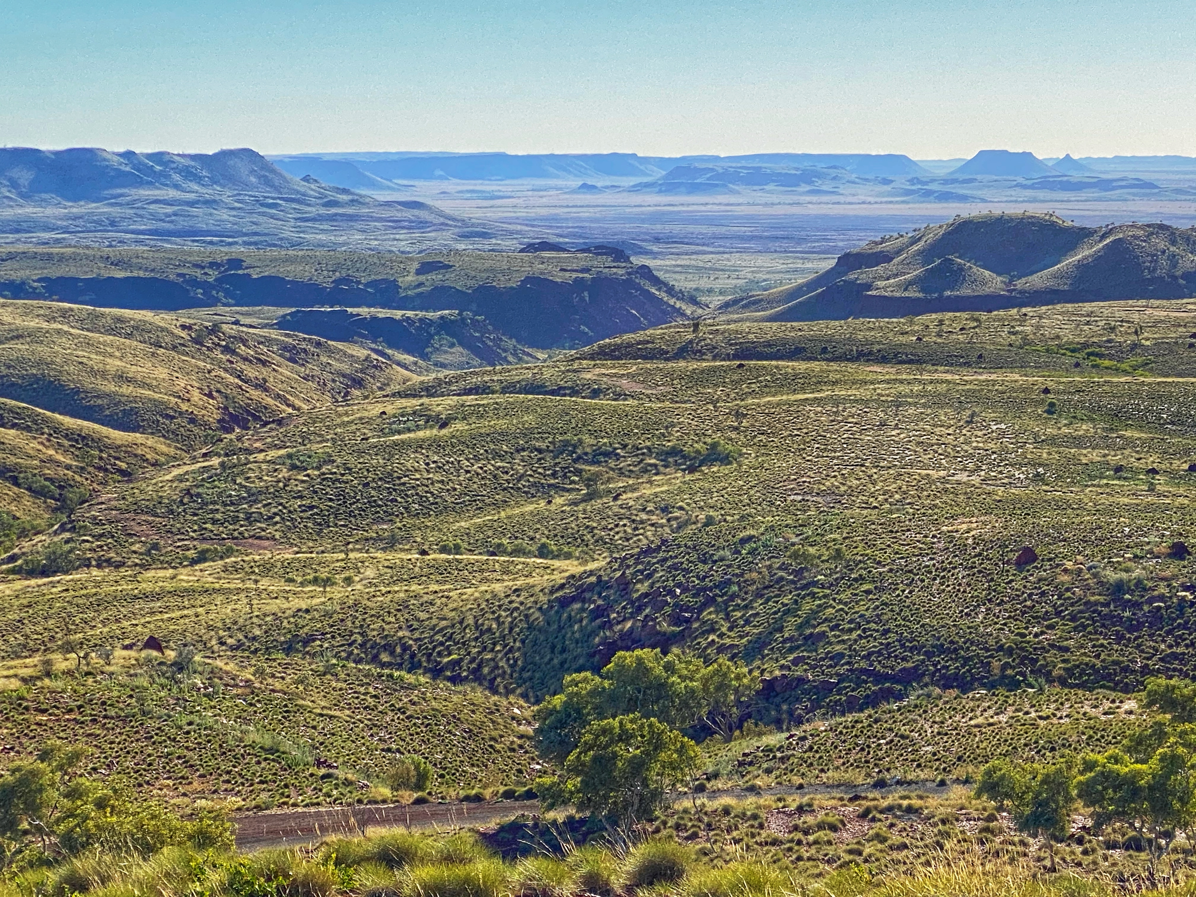
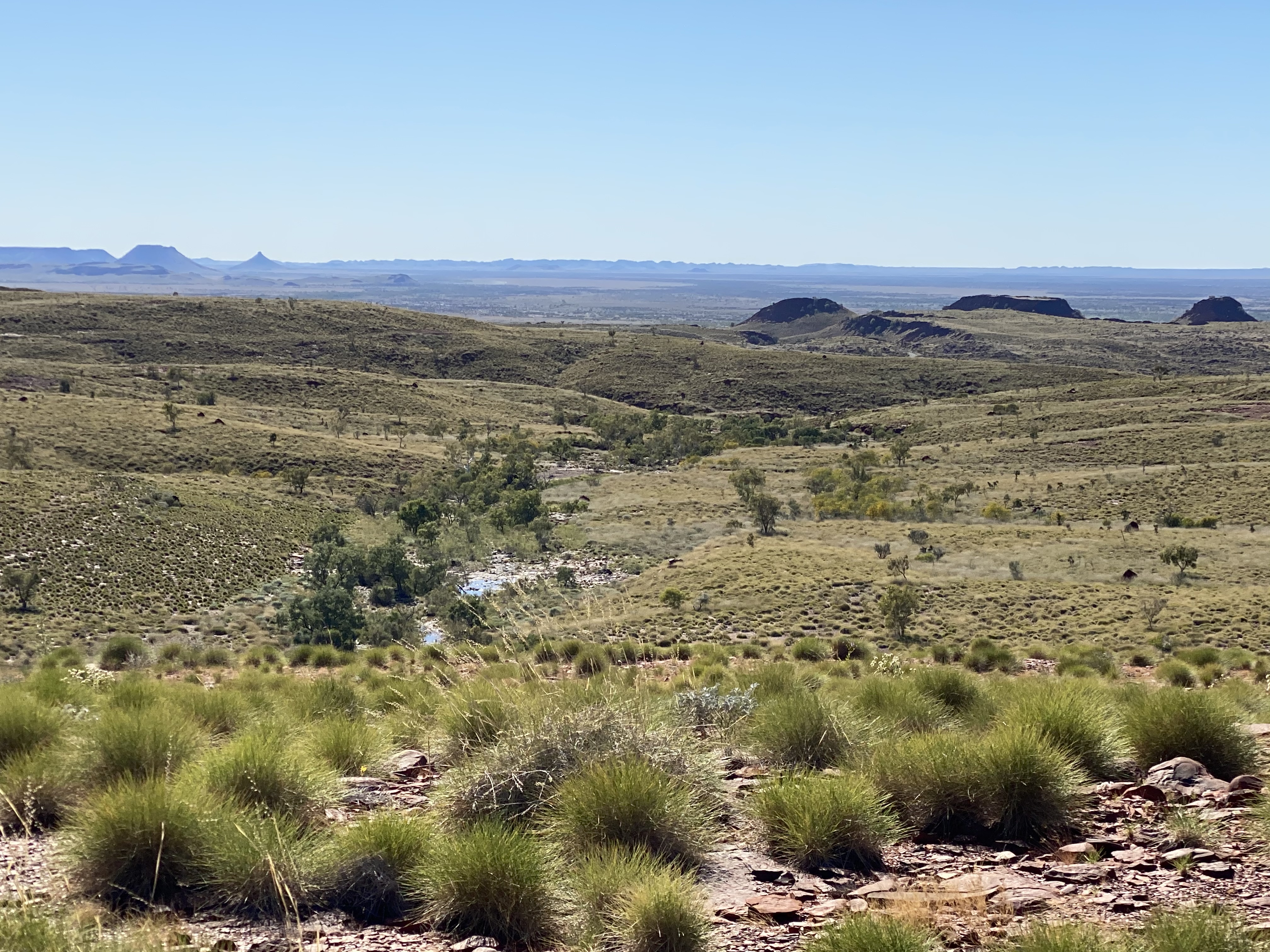
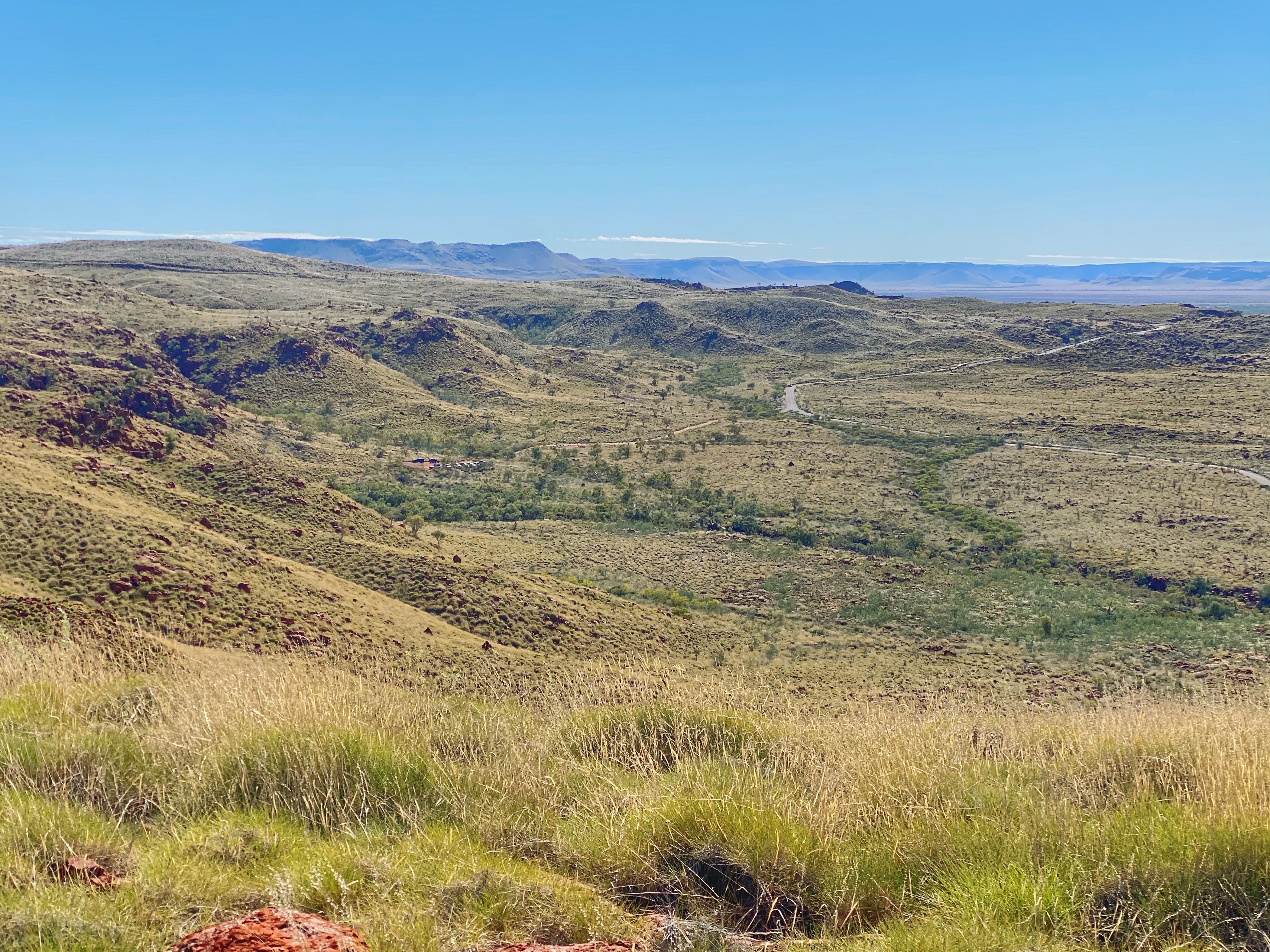
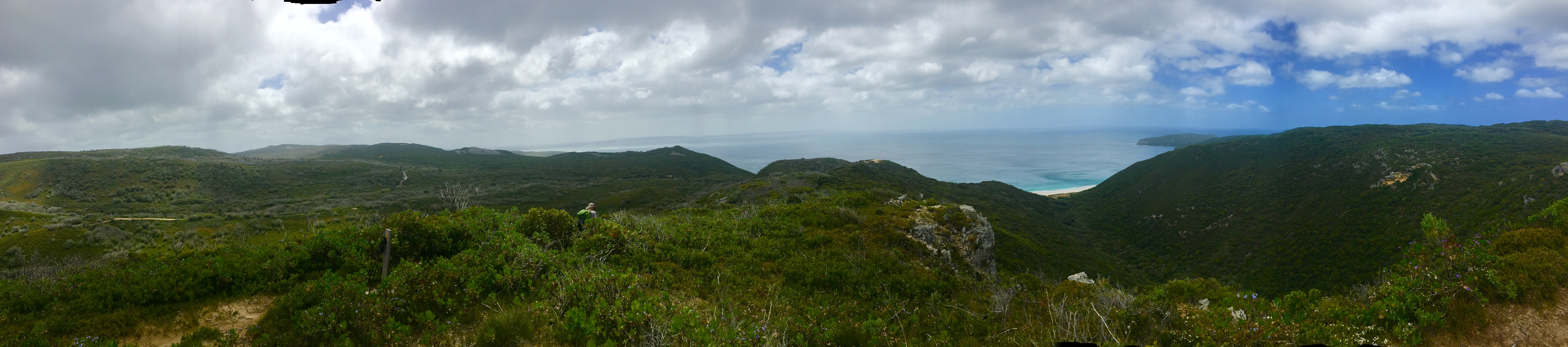
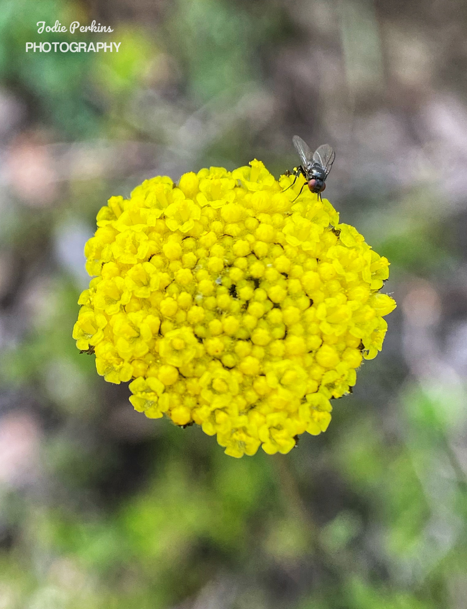
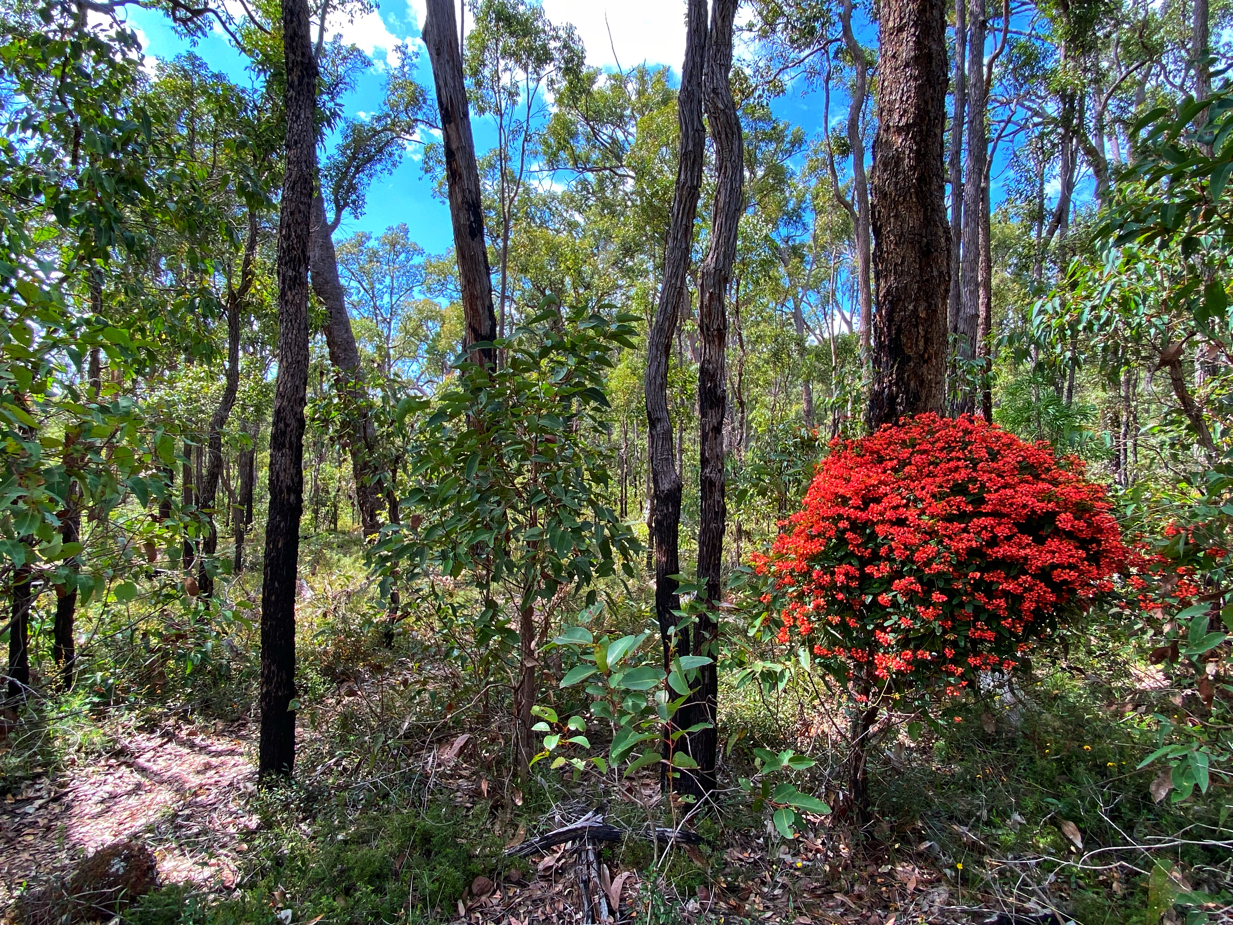
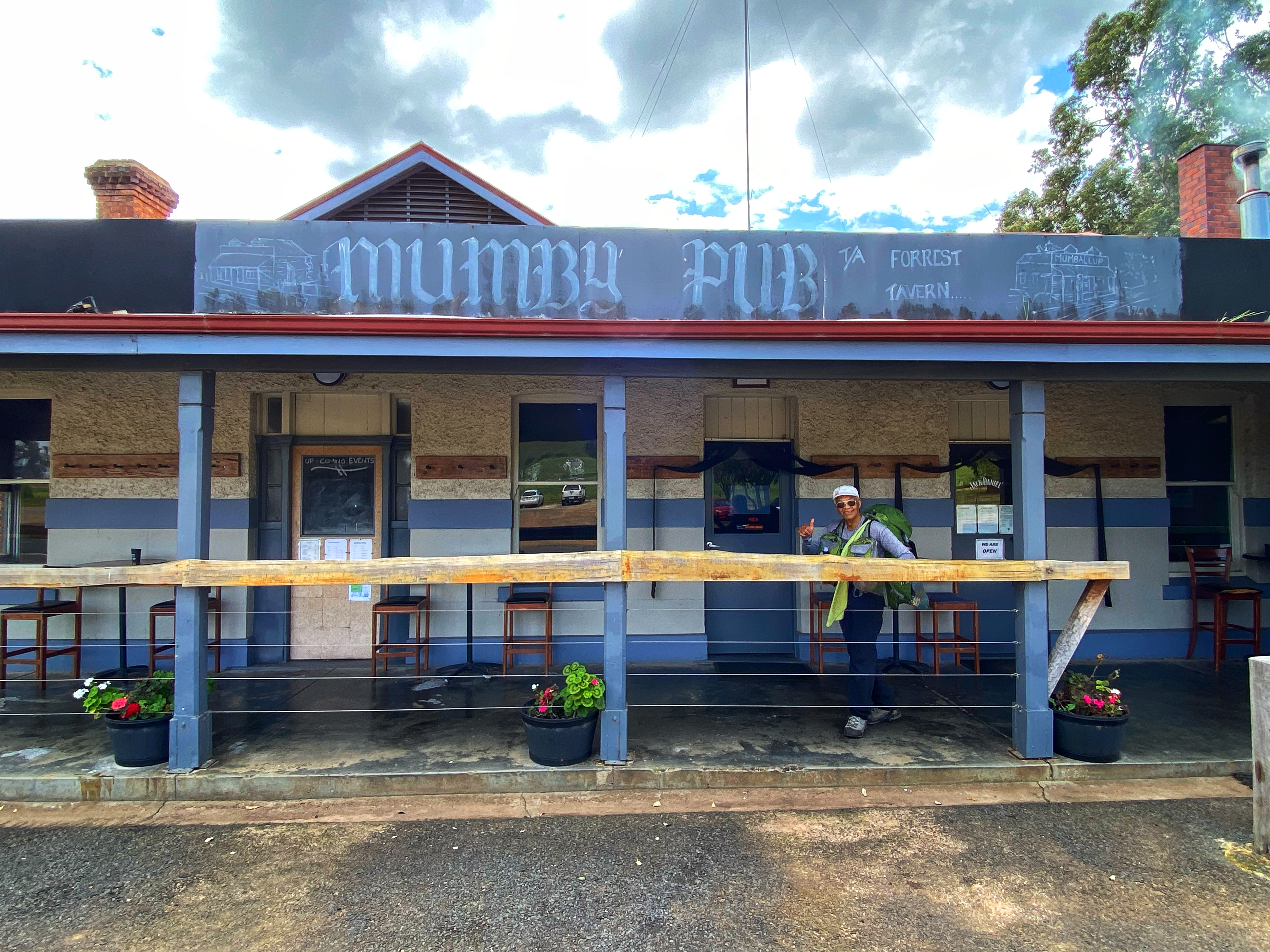
We had a 20 kilometre walk from Yabberup to Noggerup Campsite following our favourite waugal marker. I keenly observed Orchids again and at days end had counted an impressive 15 different orchid species along that 20km patch alone. There was also some rather lovely patches of wildflowers. This section would be one of the best, with forests, a dam, a pub, farming countryside, old railway tracks and some more forest. Not to mention Noggerup campsite is in a rather beautiful spot even if the toilet is up the hill above the campsite! We started well even though Ambles was lagging behind only catching up when I was taking photos. Glen Mervyn Dam was quite noticeable fuller with the water going right up to the banks edge compared to September 2019. It was also packed with many campers staying for the long weekend. Simone and Ben had already overtaken us but we caught up to Olli and Viv at the Dam wall. We leapfrogged each other the rest of the way to the Mumby pub for lunch arriving just after 12pm. 

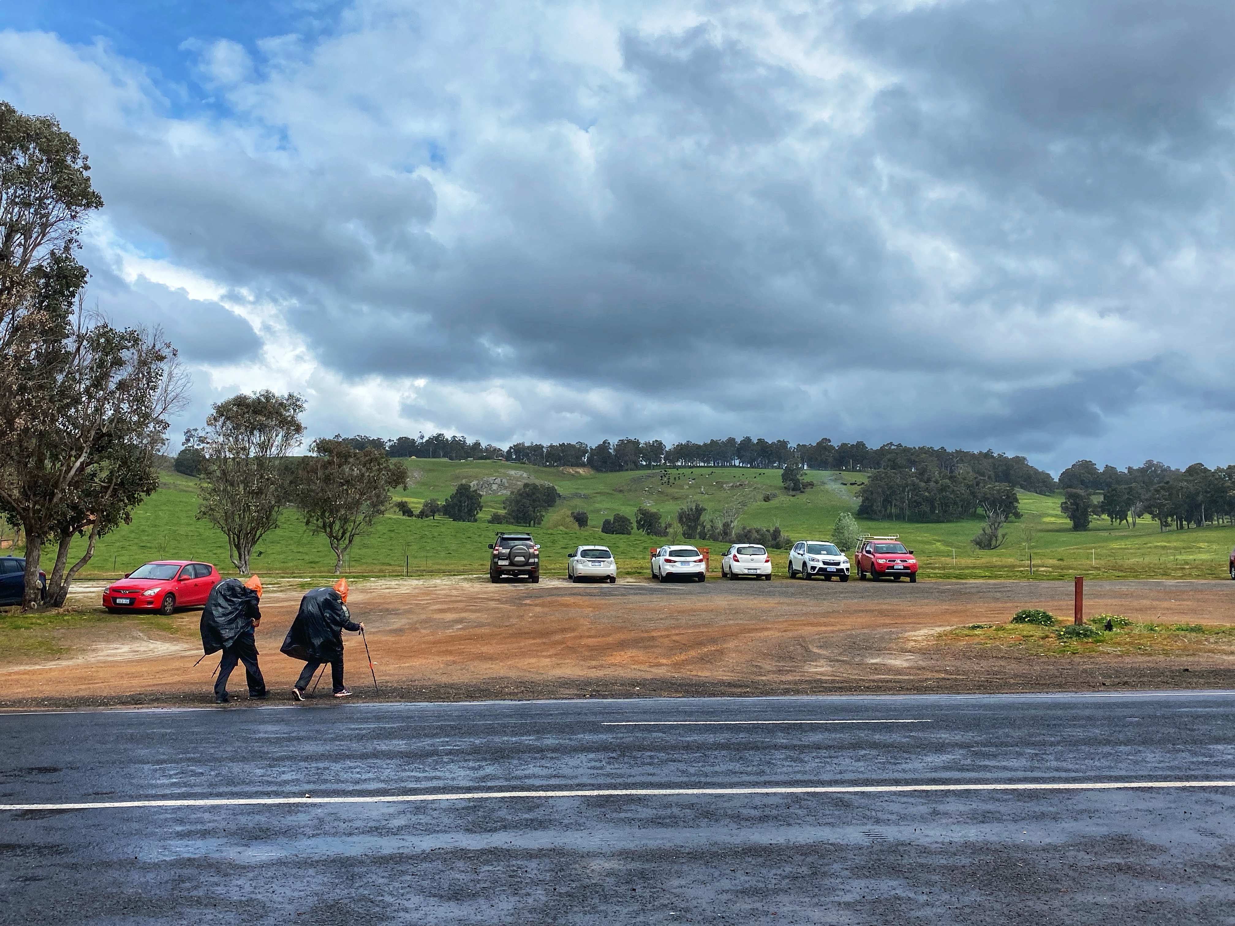
I had again timed it well as the Mumby was open but the next two days they would be closed. All four of us grabbed a table inside, ordered and waited forever it seemed for our lunches while downing our alcoholic beverages. Once again, meals were fabulous and worth the wait and the beer went down well too. I wasn’t looking forward to putting my shoes back on as the back of my heels was hurting inside the shoes. The soles of my feet were sore and tender. Ben and Simone were having a long lunch at another table and didn’t show any signs of moving anytime soon. Just as we were getting ready to go, it started bucketing down with rain. Olli and Viv donned their DIY rain ponchos made of rubbish bags and were the first to leave. 

We started the 8km walk to Noggerup under rain that quickly eased and stopped. The long never ending incline road is still the same and feels every bit long after a pub stop. Ambles quickly fell behind as he struggled, stopping often for a breather. I caught up and leap frogged pass Olli & Viv and into the forest – yahhh! I had made it. It didn’t seem so bad the second time. Ambles had got second wind and suddenly was right behind me. We met this tall young lanky guy moving in the other direction. He goes on to warn us about these ‘4 young guys’ staying at Noggerup campsite. They are getting pissed, eating honey out of a jar, doing all this weird stuff and they are heading to the Mumby Pub carrying an axe to have some drinks before returning to camp. He gleefully said he was happy he wasn’t staying there. He told everyone this same story. He himself was heading to Yabberup campsite at 3.30 in the afternoon! He asked if many people were there last night. I said yes full house. He goes well he might just continue into Collie then! I reckon he was only going to the Mumby pub myself. 10 minutes later, the 4 young guys pass us, not really saying anything, not looking like your typical hikers. I think someone did notice they were carrying an axe.

So we are first again at Noggerup campsite. It’s late after 4pm. The 4 guys have spread themselves out. Two are in hammocks on the right side across the pathway. Two in the shelter taking up a double platform each, one on the top bunk, the other on the bottom. But they have gone to the pub and left their backpacks and stuff there. We claim the top bunk on the other side. I don’t feel comfortable with staying in there. But there is only 3 tent spots to the left and they are crappy, hard ground sites and small. 

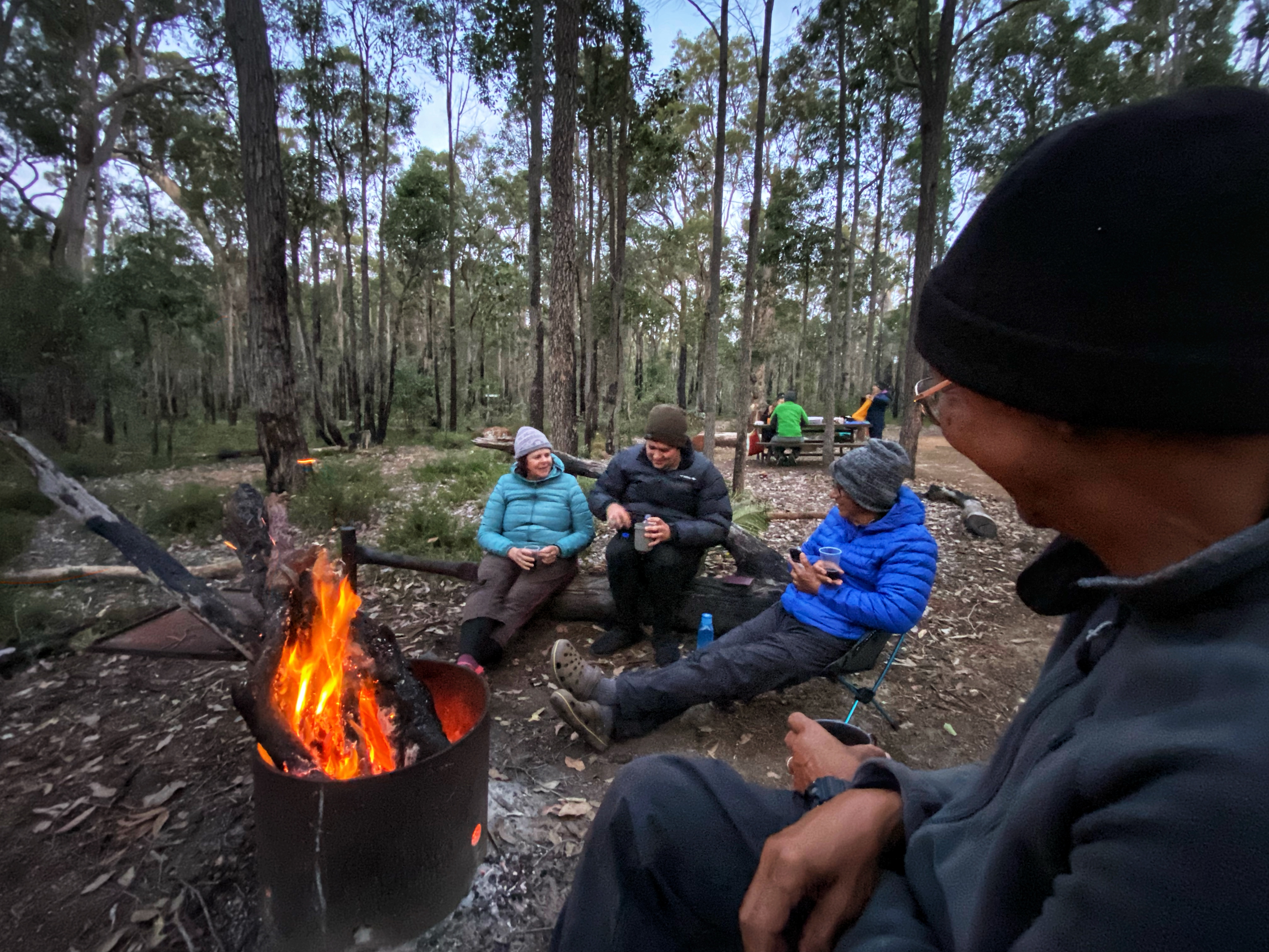
Olli and Viv come in not far behind us. They were informed and decided to tent it. Viv was so tired in fact we never saw her again until the morning. She crashed early without dinner. We didn’t see much of Olli only while he prepared his meal. Simone marches in not happy Jan! She has had a rough day and not in the mood to deal with the 4 guys. She sets up also in the shelter as does Ben. Some other section hikers come in, they tent outside and one called Isis hiking northwards, sets up in the shelter so now it is a full house again in the shelter plus the two guys down at the pub. We are enjoying each other’s company, chatting over the campfire and it’s after 7pm. I notice 4 sets of head torches coming our way and hiss to Ambles ‘They are coming back!’ But they turn out to be 4 women around my age.  We find out the next day they call themselves the ‘Kalgoorlie runners’ and have trail run Collie to Balingup in two days. Well the lead woman demands room is made in the shelter for them. Simone tells them about the 4 guys and is very polite. Simone and the other two move their sleeping bags to make room. The women arriving late with absolutely no hut etiquette pick up the guys stuff on the bottom platform and chuck it above with the other guys stuff then they proceed to set up their sleeping bags and ready to turn in for the night. Simone asked them if they carry tents which they claim to. In that case, arriving late and the shelter being full, they should have set up their supposed tents they had.

Another 4 head torches approach camp and this time it’s the 4 guys returning from the pub. They are actually very nice, polite. One is suffering foot pain and his heel is bleeding so he is struggling to walk. Simone tells them what has happened and they seem cool about it. The two guys staying in the shelter don’t kick up any fuss and one of the Kalgoorlie runners says thanks for being understanding in an off hand way. We all retire to bed and I’m relieved there was no shit storm with the events taking place and that the guys seemed harmless in the end. I think we all fell hook line and sinker from the lanky guy earlier on. He drew these guys in a bad light which was wrong. The guys were going to hike on to Balingup but instead now getting a lift back at Mumby Pub the next day due to the fella with boots too small and causing him immense pain.

These 4 women that arrived late, pushed their way in inconveniencing people. Didn’t make any small talk, just set themselves up and went to sleep. Set their alarm for 2.30am. That’s right! 2.30 AM in the morning! Then proceeded to pack up not trying to be quiet about it. Head torches flashing white light all over the interior of the shelter in our faces as they rolled up their sleeping bags, mattresses, packed their bags and after a seemingly long time of noise and lights they were gone, the last we saw of the 4 rude ladies. I name and shame them as they were downright rude and inconsiderate to the actual Bibbulmun hikers that these facilities were created for. 

Day Four: 

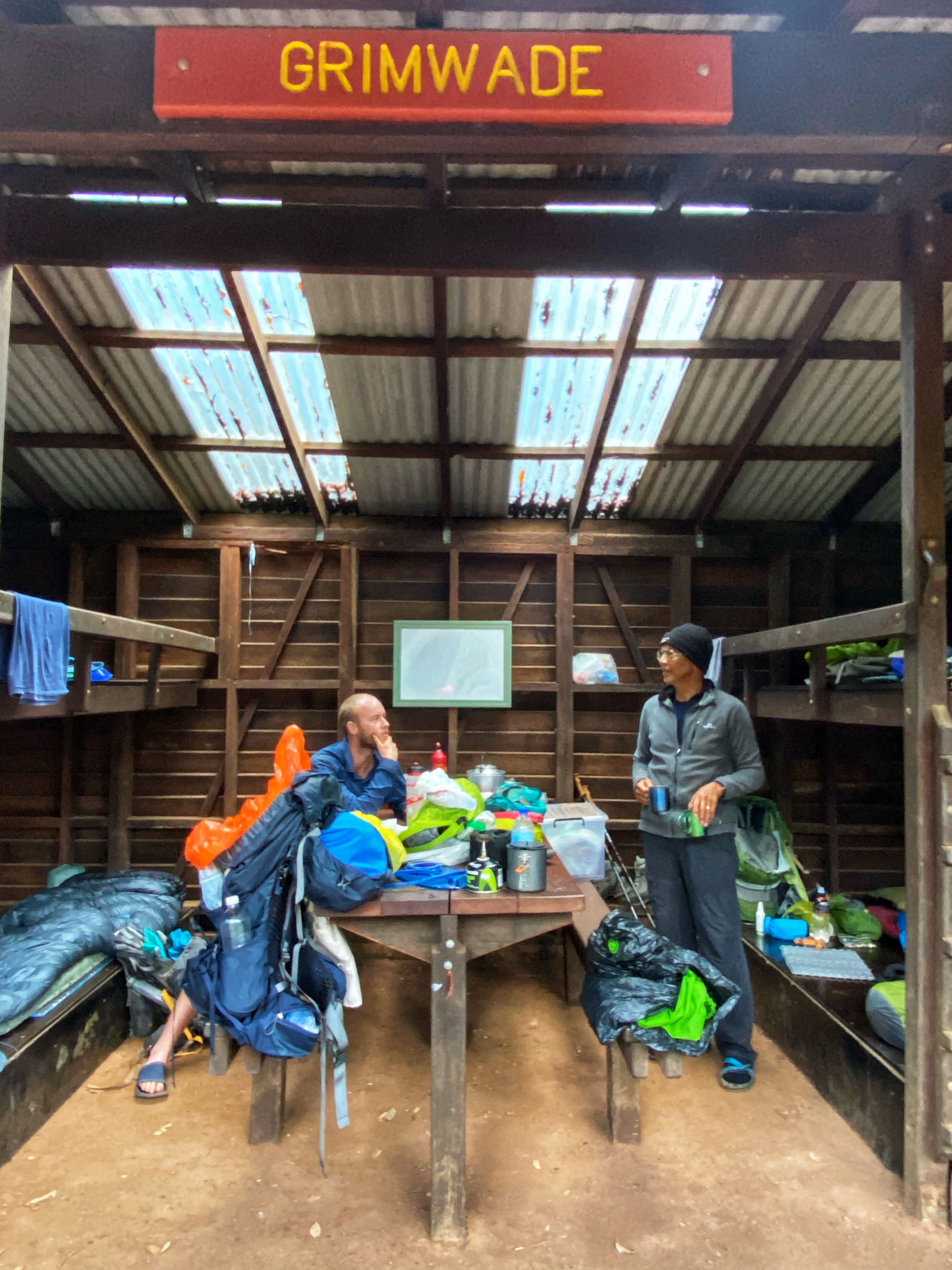
Simone was livid in the morning, in fact we were all totally pissed off being rudely awakened in the small hours of the morning. We were all tired from lack of sleep and grumpy. Luckily for the guys in the tents they had no idea at all and slept all night oblivious to all that had happened. The two young guys pushed to the top bunk were still asleep. Did these 4 women write in the trail log register book? No they didn’t. So our party wrote them in and weren’t very polite about it! We even gave them a far better group name more suitable to them then Kalgoorlie Runners 😂. I felt for Simone and Ben coz they were going to the end, we only to Balingup. Today was a big hike day of 22.5kms to Grimwade campsite and the day had started on the wrong foot.

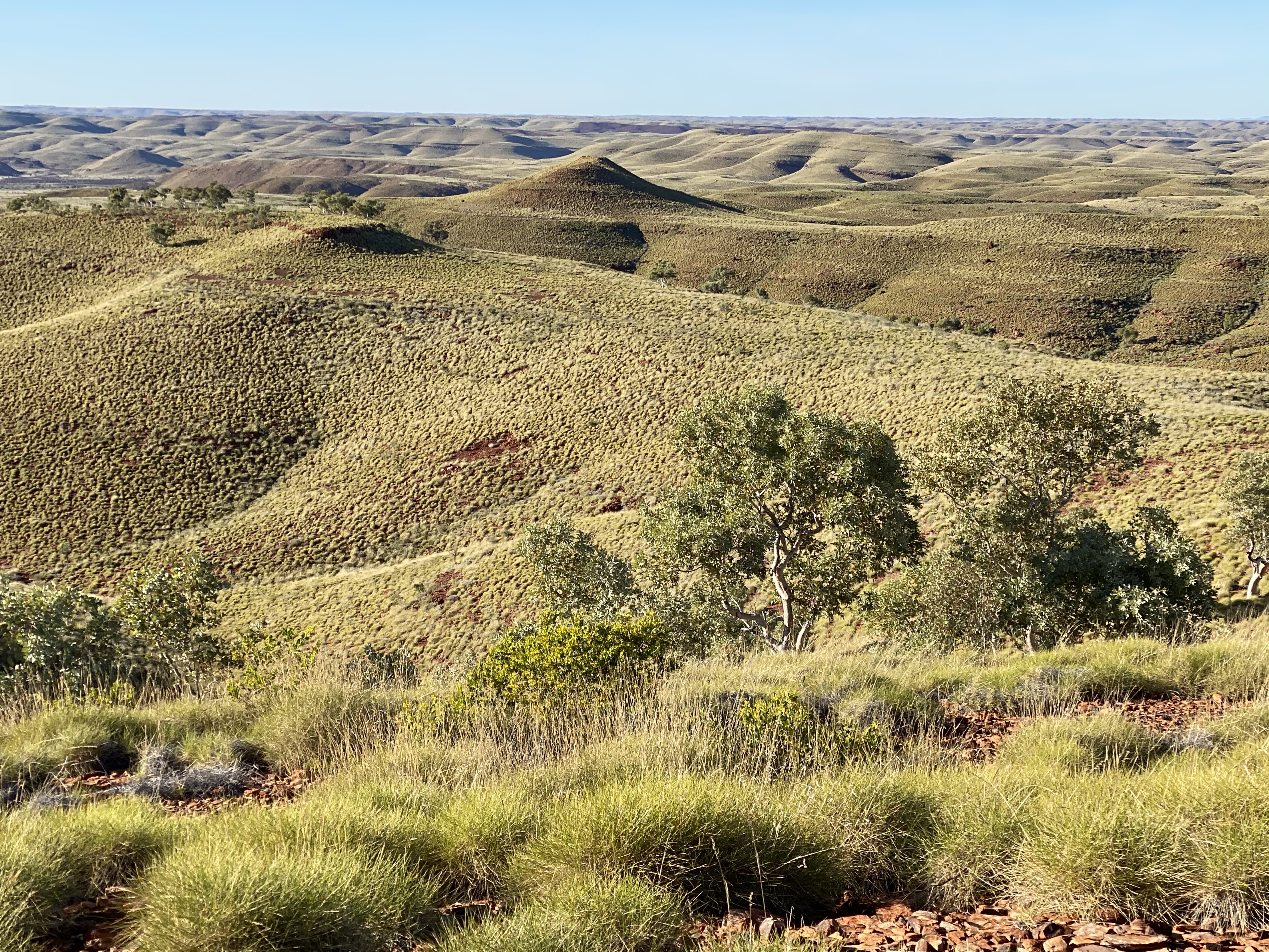
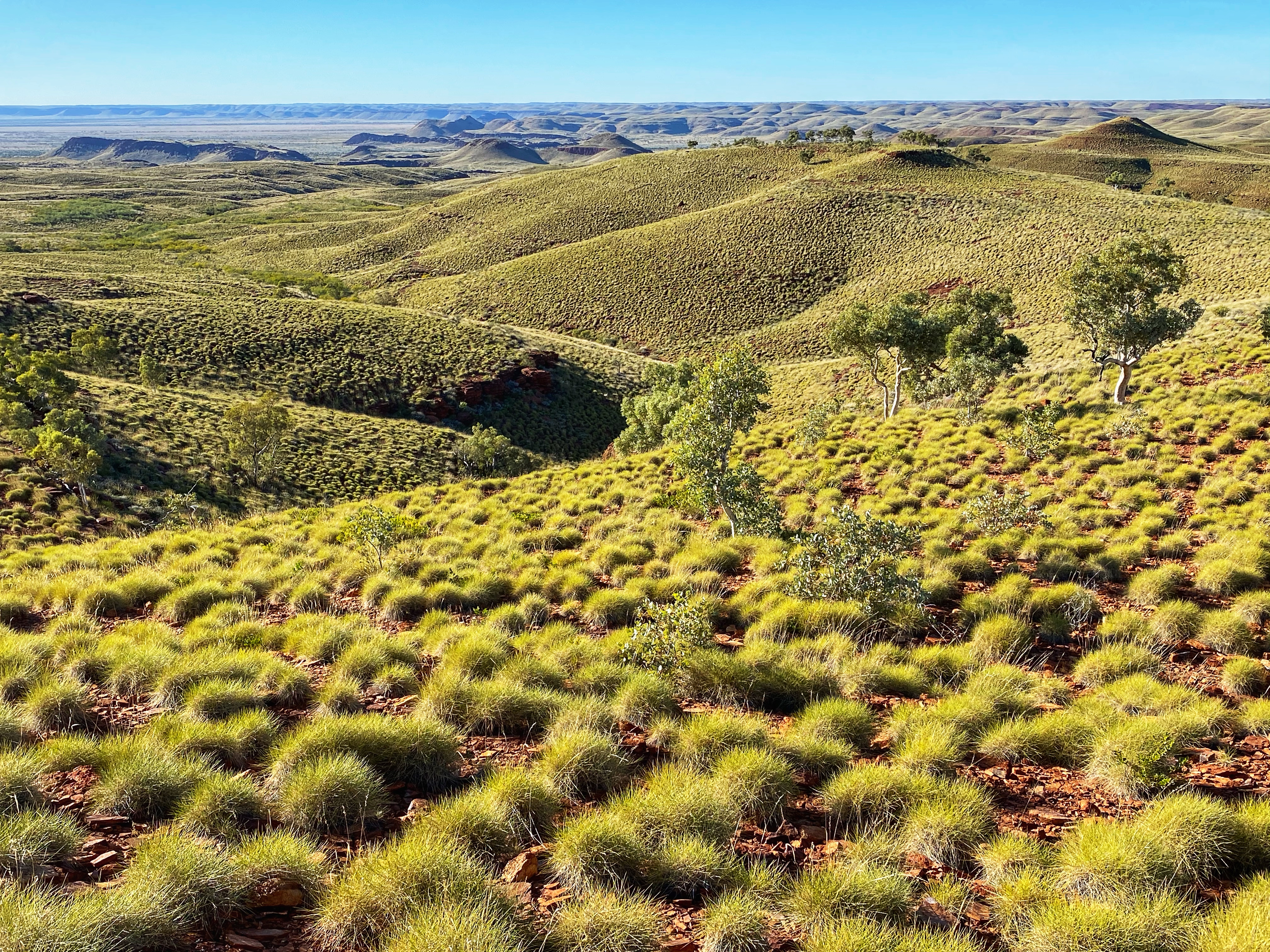
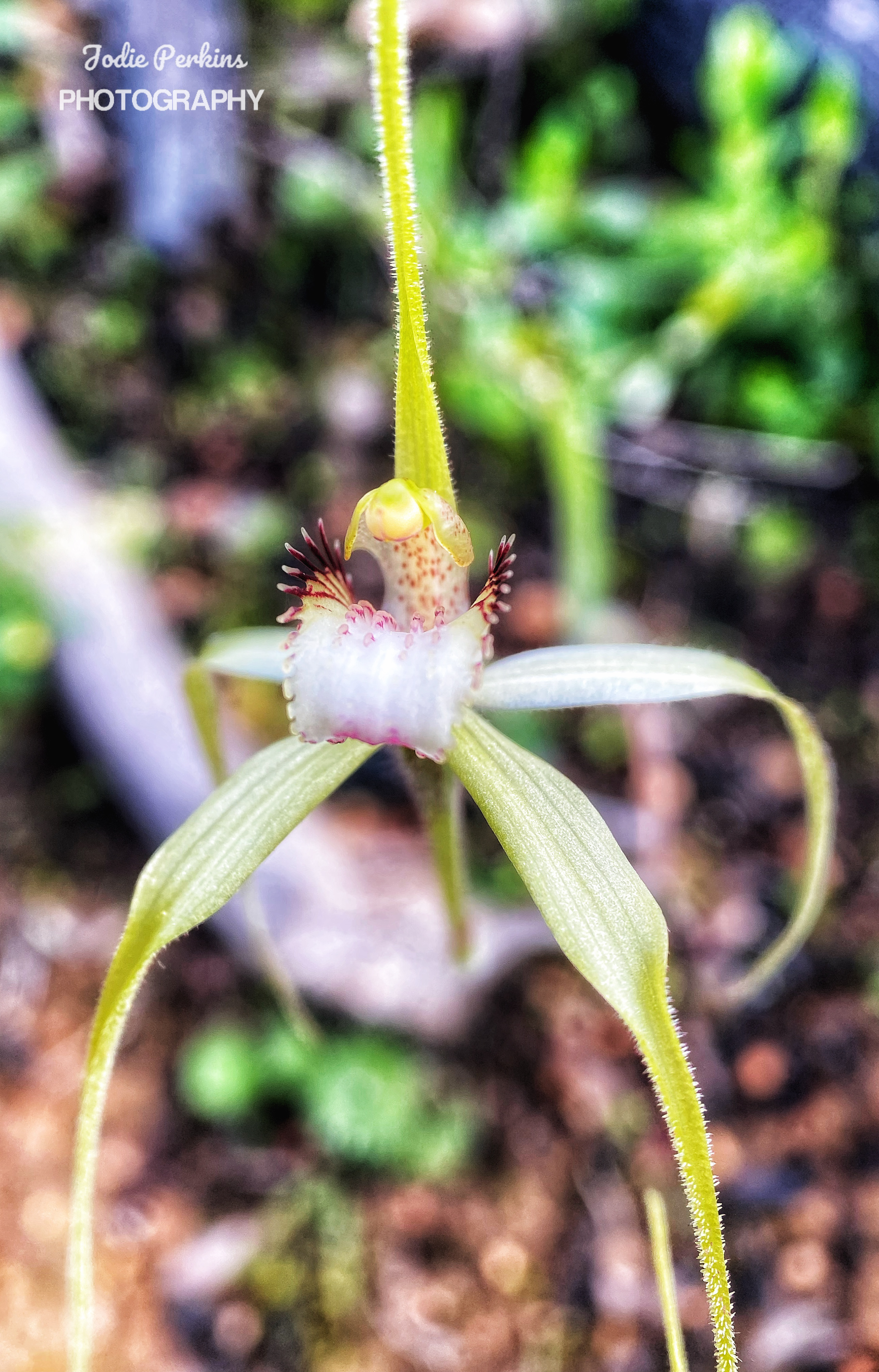
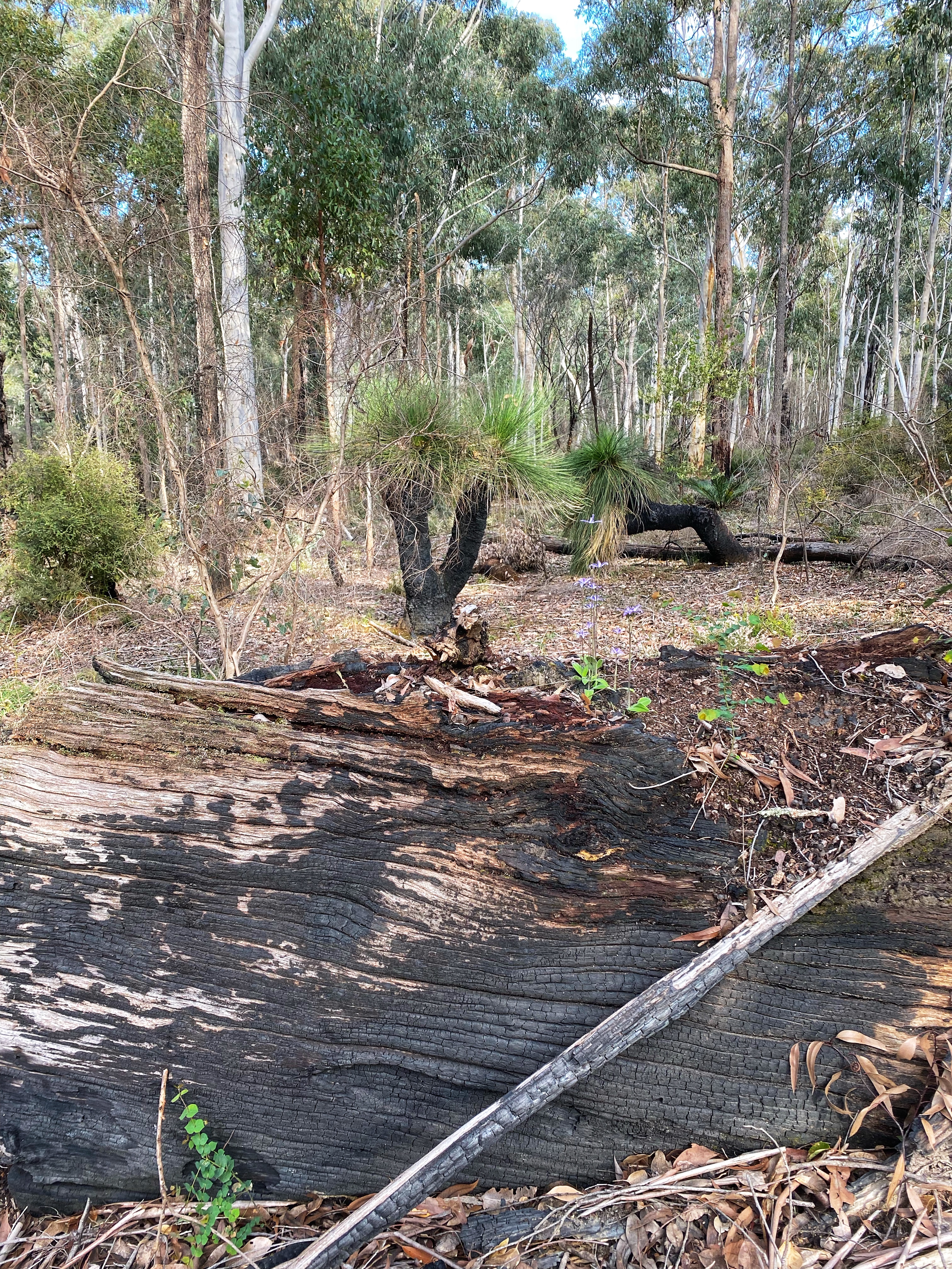
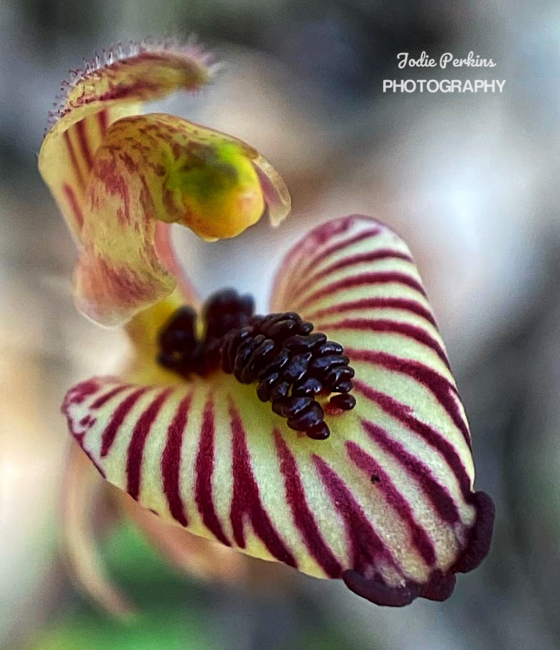
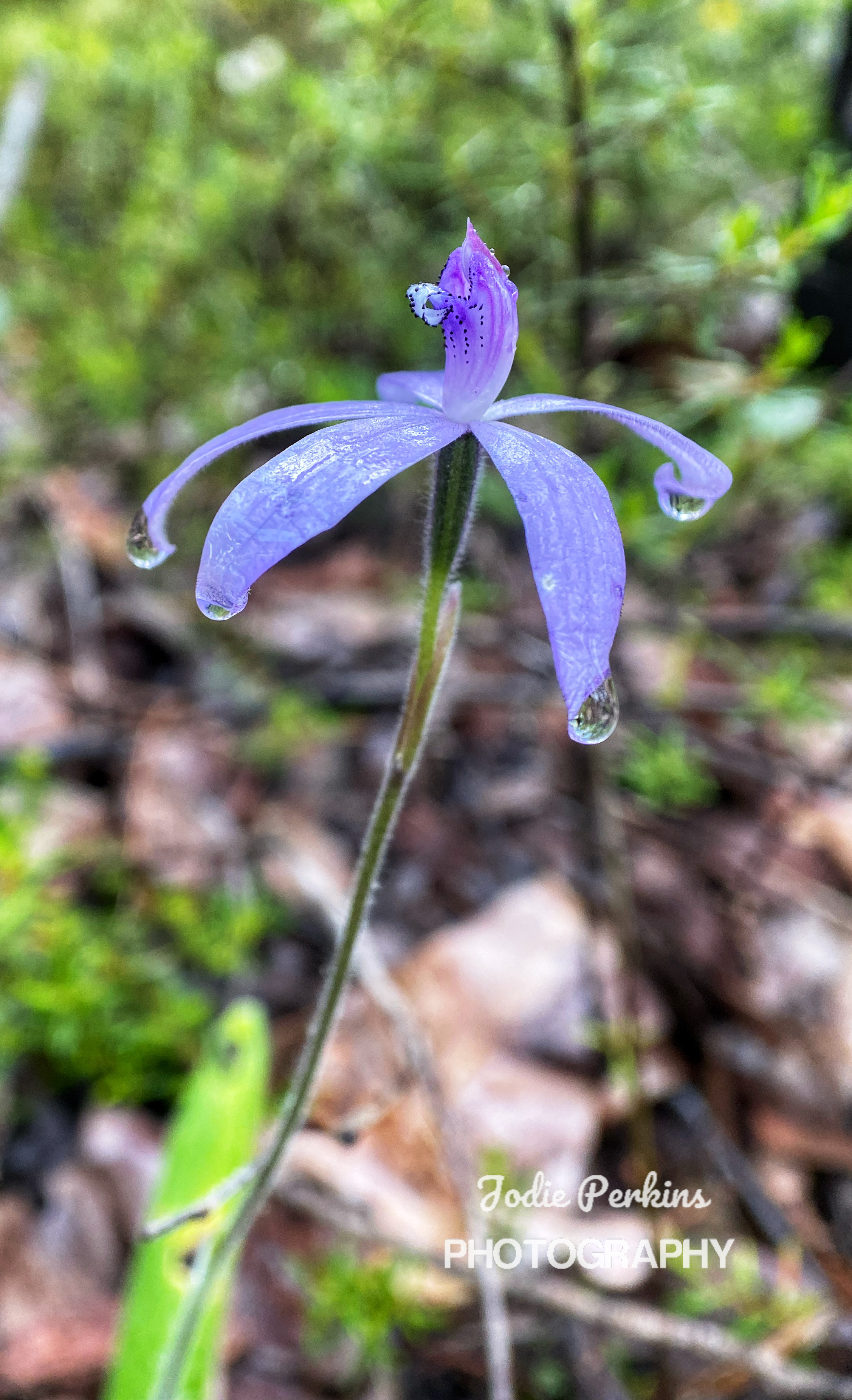
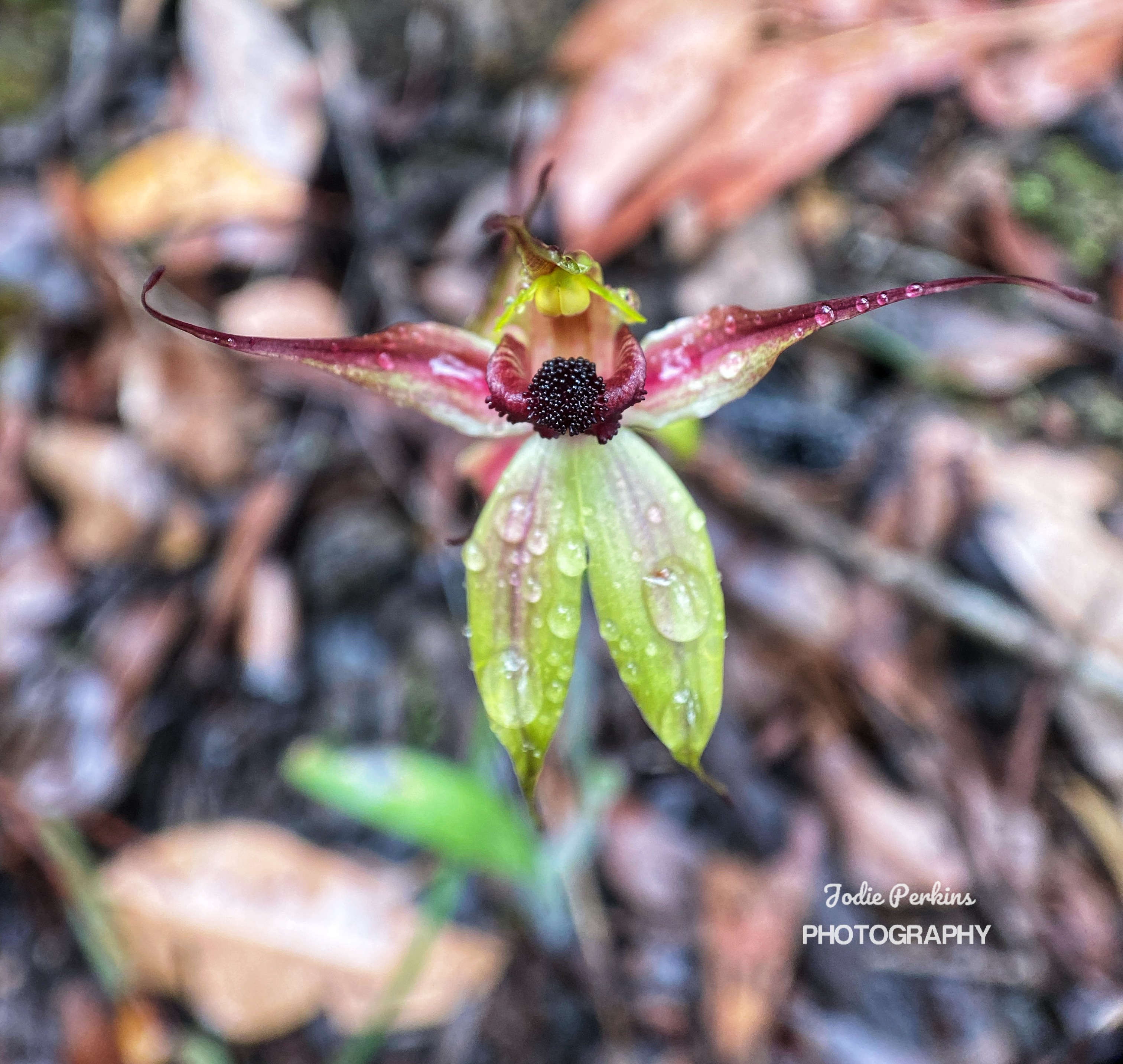
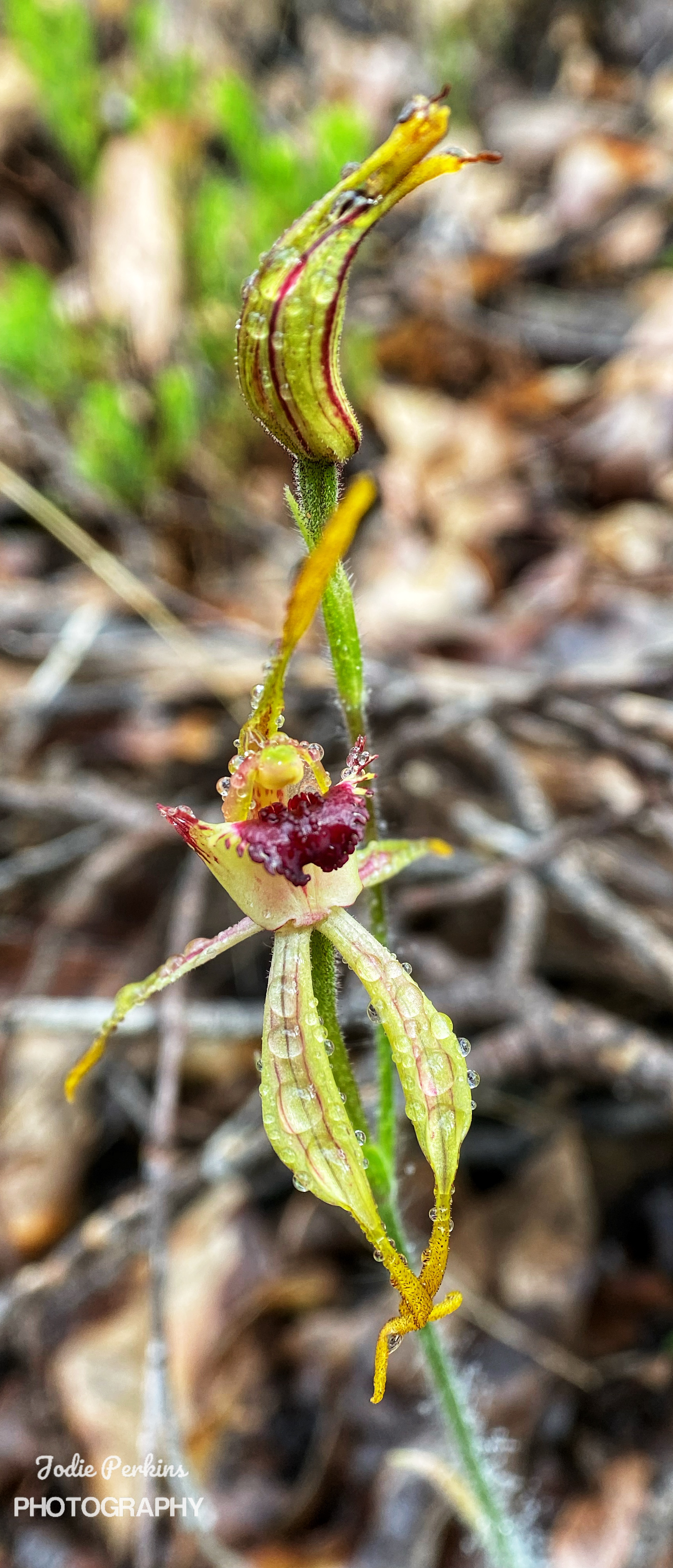
I noticed someone had carelessly thrown some TP in the bush by the track going up to the toilet. It was not there yesterday and as I didn’t know who the culprit was, I cannot speculate names. Ambles and I were the first to leave as everyone else was slow and tired. I figured Simone and Ben would catch up and pass us along the way. We shouted goodbye to Olli still getting breakfast and were off. I had a mindset to do many kilometres as possible while feeling fresh. I always feel good at the start, but it’s hours later it starts taking its toll on me. It had rained a little and the bush was wet, the orchids with rain drops falling off their sepals so lovely that I had to stop and take photos. There is no variation in terrain at all, it is forest and looks the same the whole way. It was getting a bit boring and long in the tooth.

Perry speeds pass me as I’m sitting waiting for Ambles to catch up after a hill climb. Perry I haven’t met yet is another current End to Ender going to Albany. He got in to Noggerup late and put his tent up. He is a very fit, strong young man and must hike at a 6km/hr pace. He asked if I was going to Grimwade and I replied yes. He said “I’ll see you there!” Then Perry was long gone from sight.

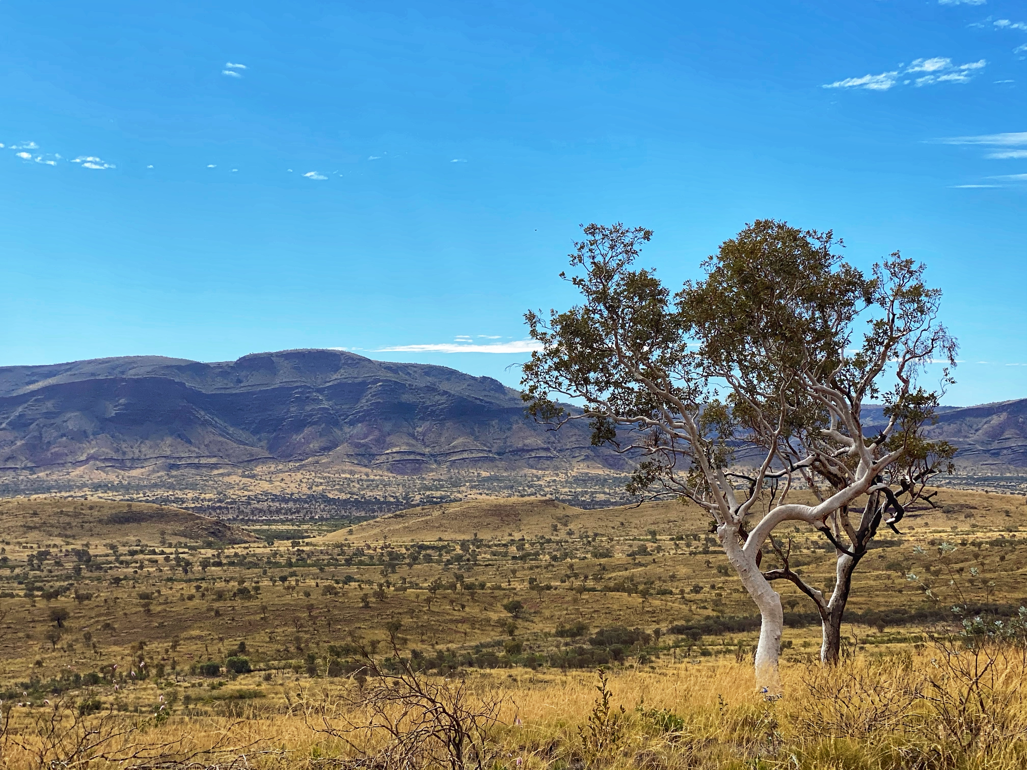
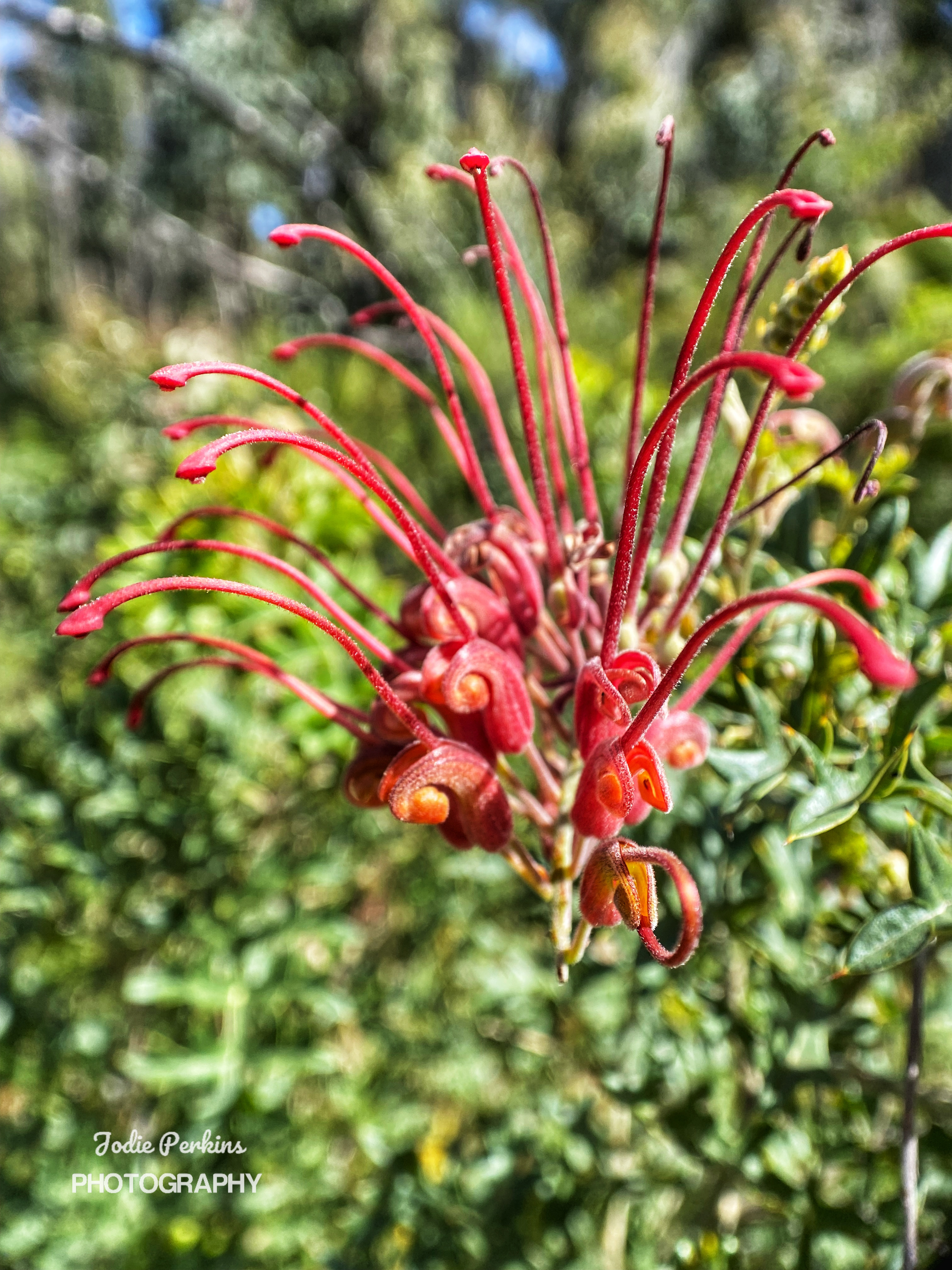
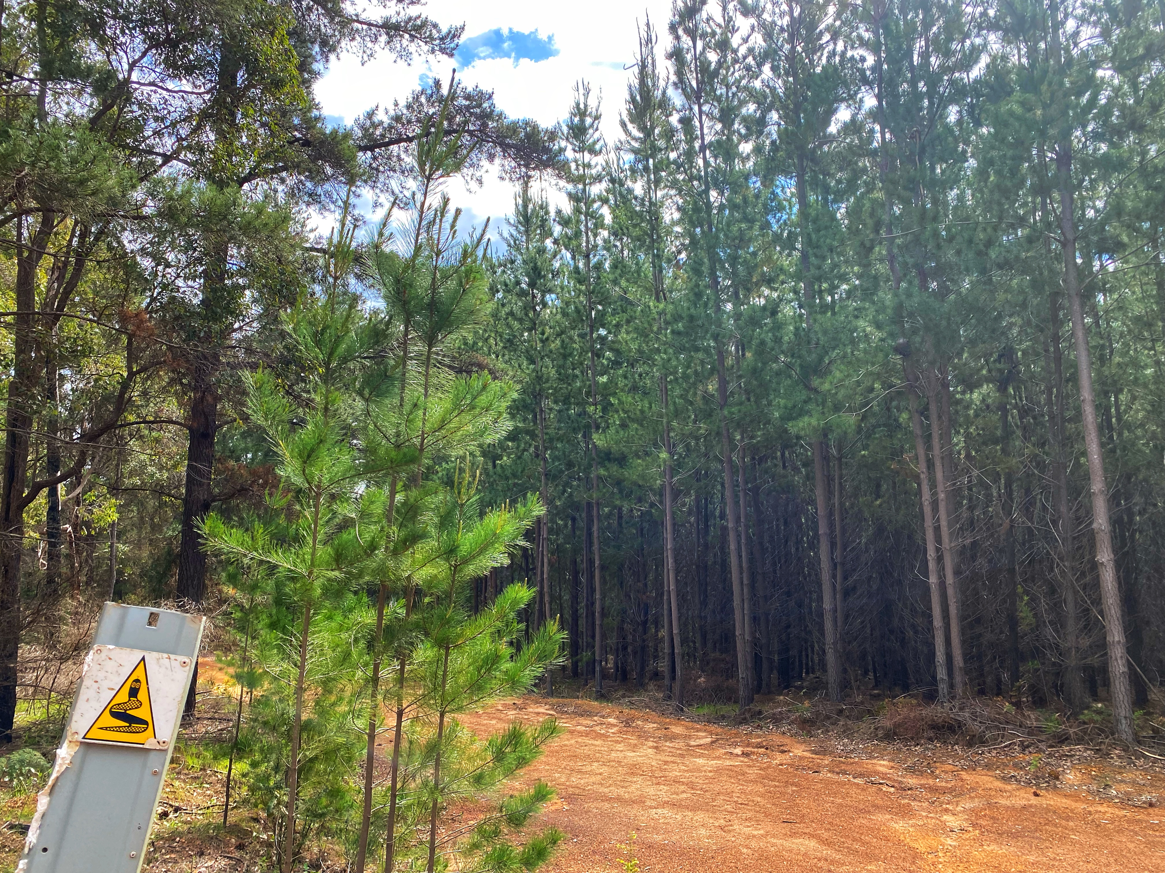
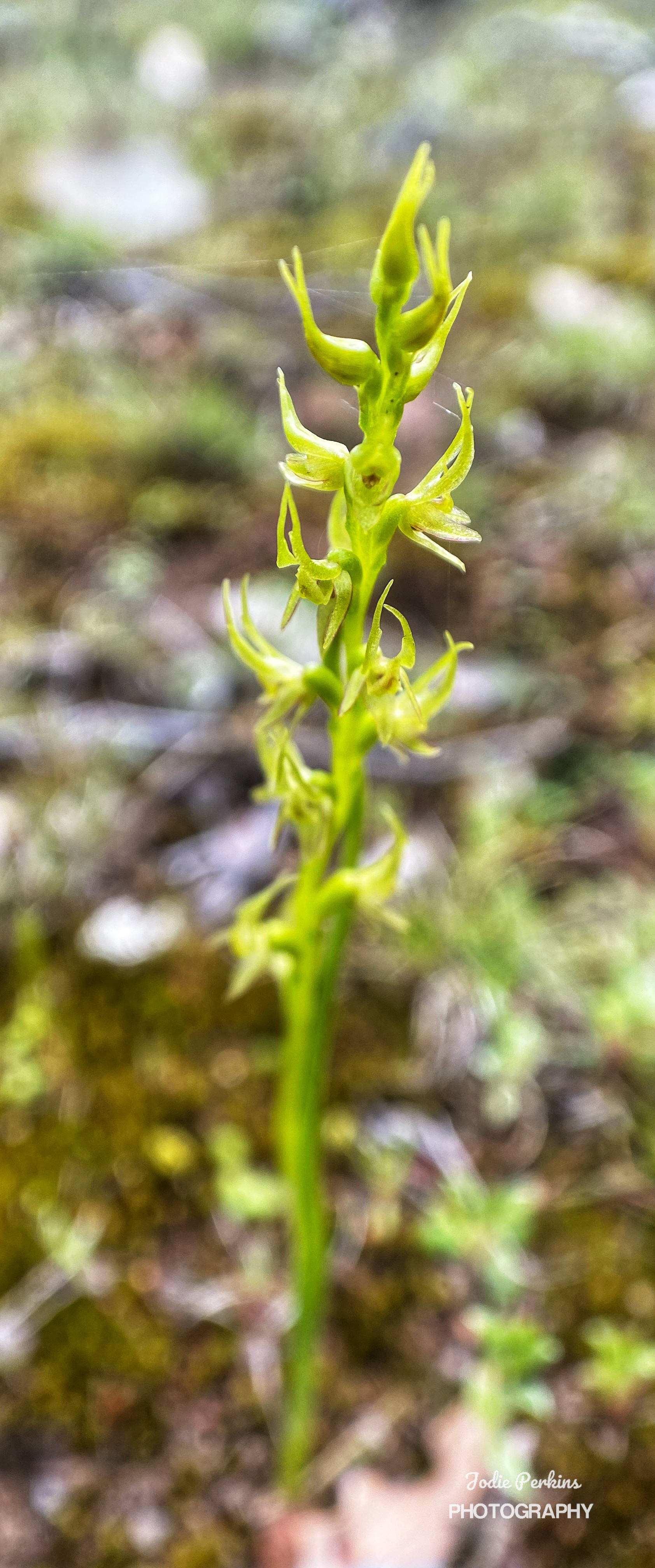
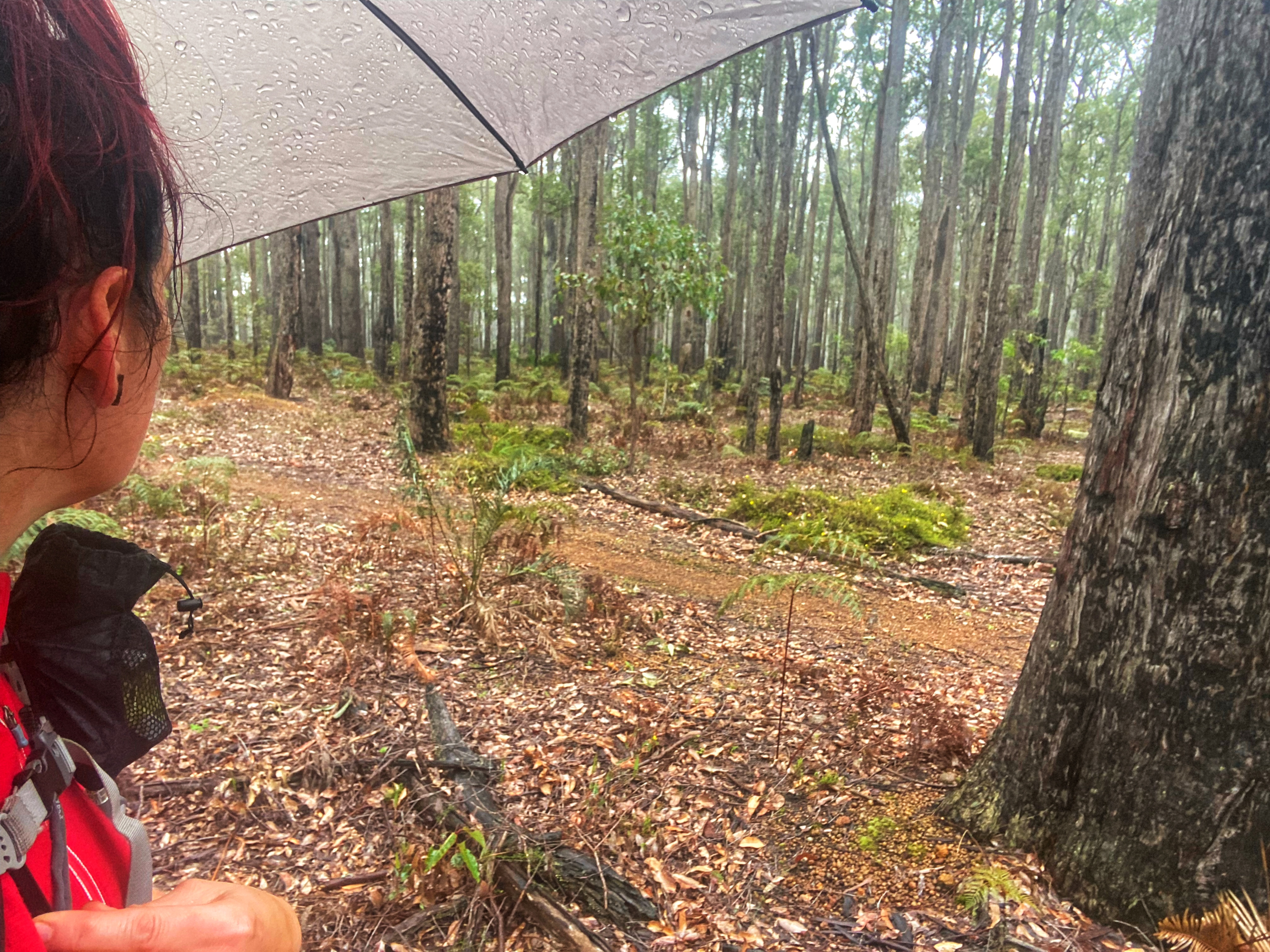
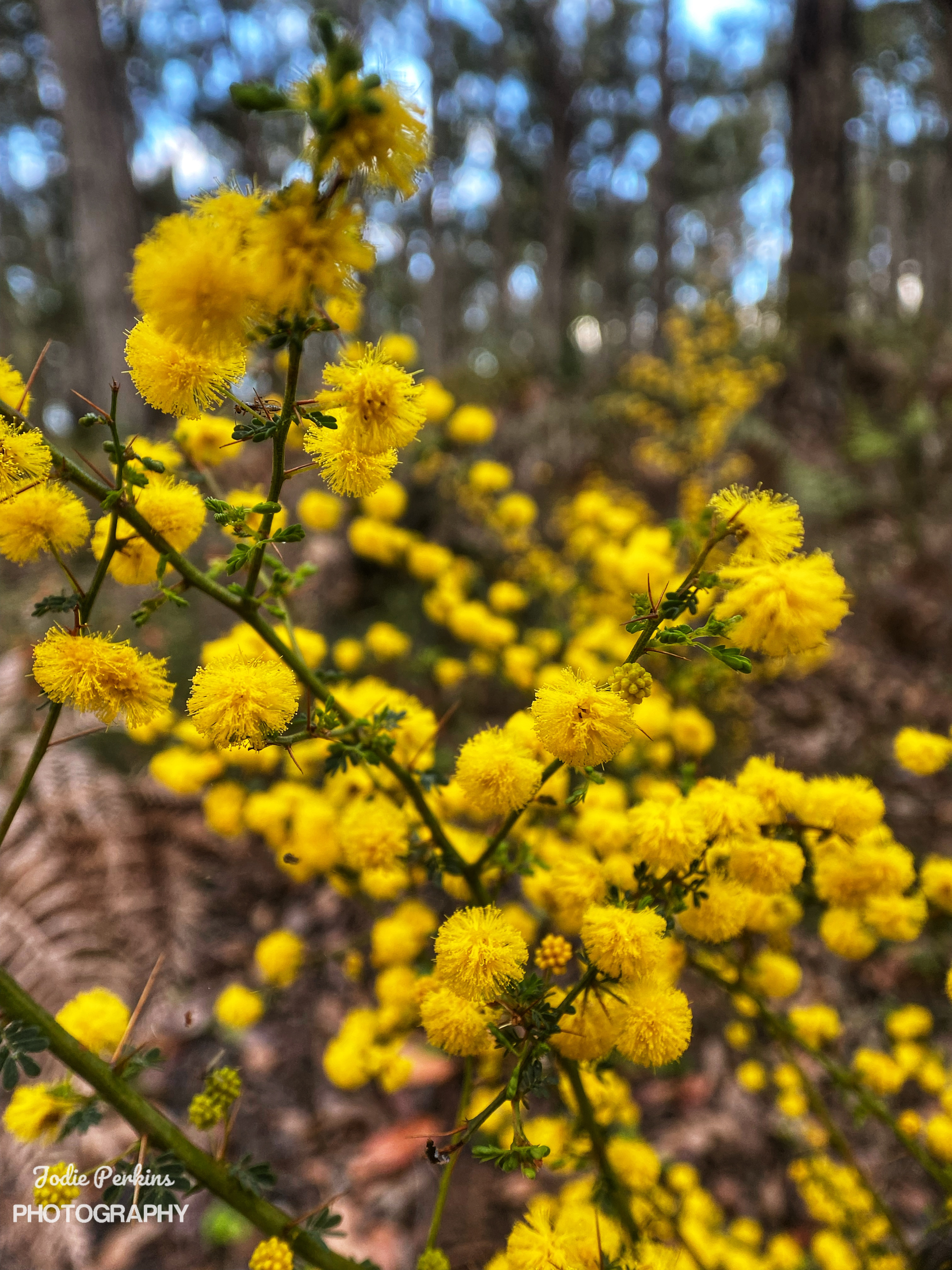
Motorcycle trail riders should not be using the Bibbulmun track, but here they were, ripping it up, a whole family of them speeding pass us, their noisy machines upsetting the peace and tranquillity of the forest. And today it rained on and off, on and off in such an annoying way. No sooner I put my umbrella away, it starts to rain again! I was thinking it will be too hard to stop for lunch on the track. Determined to push all the way to Grimwade but it was meaning a late lunch. I noticed new orchid leaves popping up and wondered what they will be. There wasn’t much besides a sea of yellow wildflowers in places.

My focus was to reach Lowden-Grimwade road where we would have 10 kilometres to go. It was raining again as I reached there and waited for ages for Ambles to catch up. Such was the day, Ambles was struggling and slow, I was starting to slow down, over the walk and my feet were aching, cursing me. But I willed myself to keep going, and willed Ambles to keep going, he could do it! I fished out a cherry-ripe bar for Ambles, his favourite chocolate. He took it face lit up and gave him a boost which unfortunately didn’t last long enough.

12.30pm  went by, 1.30pm went by, I kept going umbrella up, umbrella down. Up hills, down hills. There was a couple of big steep ones in the last 3 kilometres to give me pain. I don’t remember this walk being so bad 2 years ago. I guess it got broken up at the road crossing where my parents met us with trail magic and Ambles new backpack. Today was hell, and it was hell for the others too. I munched on lollies downing them all before I reached Grimwade campsite 5 odd minutes before Ambles just after 2pm. 

Perry was there, well settled in and looking fresh as a daisy. He had sprinted in by midday. Katy another current end to ender, was taking a zero day at the campsite and was quite comfy and relaxed on the top platform with all her gear and cooking stuff spread out around her. A guy with two women walked in, day hikers. The guy was big noting himself to Perry and trying to impress the ladies  talking a lot of crap. Ambles and I got to our late lunch having to cook on the still too small table in the middle of the shelter as it was too wet on the big outside table. Ambles would roll his eyes and whisper, “He is an embarrassment to mankind! Wish he would go away!” We decided to just stay in the shelter again for a quick departure in the morning and set up underneath Katy on the lower platform.

A very tired and weary Simone arrived not saying much but commenting on how fast we both were today and that she hadn’t been able to catch up to us. She set herself up on the other top side, pulled out her cooker and hiking chair and just ate up there, sitting back and watching. She was too buggered to go put up her tent. The day hikers buzzed off then some motorcycle trail riders rode right in to the camp grounds and quickly left again before we could get a photo of them to send in to the Bibbulmun Track Foundation. Weary Ben arrived and decided even though he was so exhausted he was going to set up his tent outside anyway. There was a bit of talk about our rude campsite neighbours last night and Katy said, “Yes, they stopped here for a bit. One of the women was suffering though with her feet and they were discussing about if she could continue. They seemed alright.” They had wrote in the trail log book which gave away whom they were. One of them even mentioned to Katy about not sure what impression they gave at the previous campsite. Obviously they were aware they had upset us. Simone was still livid and had no sympathy for the woman that had been suffering.

Perry spoke to us, yeah his fast pace suits him. He can easily hike 40kms in a day. He proclaimed the Bibbulmun was a pretty easy walk and he would have it done in 30 days or less. Next he would hike in the Stirling ranges, go to do the Cape to Cape. (Probably take him 2 -3 days to complete) then Covid dependant he had his eye on doing the Te Araroa in New Zealand. Then onwards to other big hikes all over the world hiking while he is fit enough and can do it. Katy on the other end was enjoying the Bibbulmun and not wanting it to end, she has unlimited time and is not rushing through it at all. 

By 4pm, Ambles was concerned about Olli and Viv. They arrived 4.30pm and you got to take your hat off to Olli, after a hell of a long day, he decided to set up their tent outside too. Ambles was so impressed. So the day was a killer for all of us besides Perry. Ambles being so tired still got the campfire going and we sat around it chatting but not for too as everyone was too tired. It started to rain again so everyone disappeared into their sleeping bags. We stayed up another half n hour enjoying our last night on the track. I was going to miss these guys, wishing we were going to Albany too. I realised on the last night, everyone was a current end to ender and we were the only section hikers. The long weekend was over.

Day Five:

Ambles said to me, “Did you drop something 1am in the morning on the wooden floor because there was a loud noise that woke me up”. No dear I did not. Katy from above must have knocked something accidentally. The rain had ended and it was going to be a good day. Katy well rested, had packed up and first to leave at 5.30am. Perry was next out and we knew we wouldn’t see him again. Or was it?! 7 days later what were the chances that we would go to the suspension bridge over Deep River along the Bibbulmun Track as Ambles wanted to check out a fishing spot, just as Perry and his latest walking companion would cross over the bridge. He still looked fresh as a daisy not looking wrecked at all and in 7 days had galloped his way from Balingup to almost Walpole! He recognised us straight away and was shocked. He probably thinks we are stalking him! He clearly didn’t want to stop but did momentarily to talk to us. He said he will finish in Albany in 5 days time. Not only his fitness prowess but also the marathon runners currently running Northcliffe to Albany via the Bibbulmun Track left me feeling rather exhausted and very unfit!

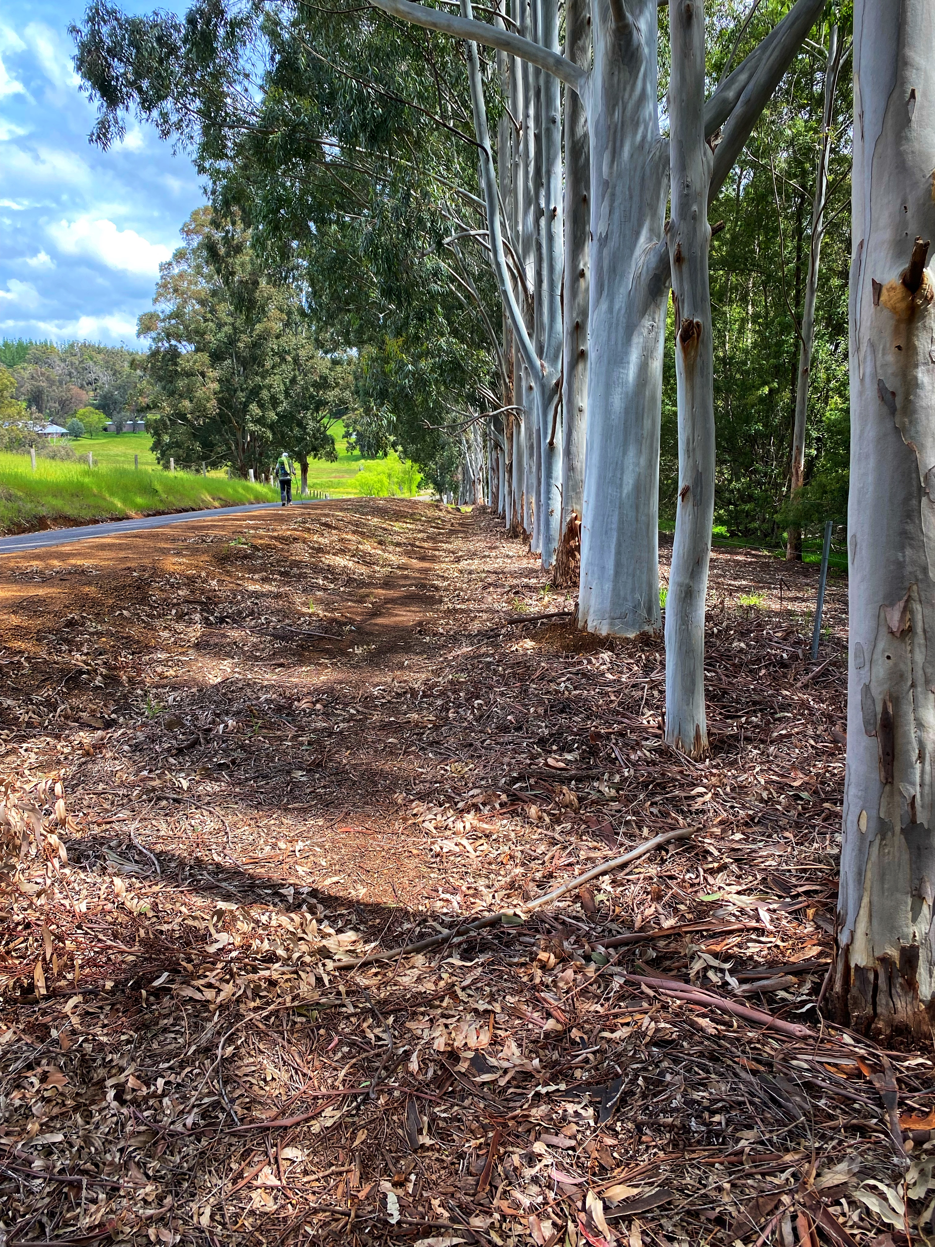
Back to Grimwade campsite and Ambles and I took off third expecting Simone and Ben to leapfrog us so we said see you later and goodbye to Olli and Viv that we knew we wouldn’t see again. Olli goes to Ambles, “Thanks for the laughs!” Those two are amazing and they will complete their end to end, I just know it. Once again, I start briskly and fresh though feet and legs hurt. I have a painful twang in my right shoulder which I always get. I wonder if I pull my shoulders up unconsciously when I hike as I got that problem even with a light daypack on. It was a longer day 23.5kms and 2 years ago this day was bloody hard walking into Balingup. Once again I was way ahead and would find a nice log to sit on periodically and wait for Ambles. More forest walking before we get to farming countryside views and Don’t miss that waugal marker turnoff down to the highway, across it and one big steep hill climb followed by the steep long descent to Balingup Brook bridge. To be honest, the day was much easier and we were smashing it! By midday I had reached the bridge ahead of Ambles and had stretched out resting. There was only 4kms left into town. Ambles said we could grab lunch in town and I was thinking nah it would be too late by the time we get there. Simone from Traaverse was picking us up between 2.30 and 3pm to take us back to Collie.

But maybe lunch we could do! Simone caught up at the bridge going at a clipped fast pace. “Wow! You two are speeding along today! I thought I would catch you both way back!” 

Ambles appeared not long after and we had a short pre-lunch meal of over watered cous cous with beans mix. Then it was the remainder of the walk that this time didn’t seem so bad. Ambles went into 1st gear and I was impatiently waiting for him to catch up. Geez, give it 4 weeks then he would be the one waiting for me to catch up! We arrived at the visitor centre to sign off about 1.30pm, much better than our previous time 2 years ago. Simone was eating lunch outside the visitor centre and asking if we had seen Ben. No, not yet. Ben wasn’t feeling the greatest and said to us yesterday he felt a cold coming on. Simone had no accommodation and being the school holidays, places were booked out and not answering her phone calls. She was waiting for Ben to plan where they would stay. Ambles said we were going across the road for cider drinks and she could join us. There was no cider on offer so we got a bottle of Cherry Port and two Port glasses. Sat down to celebrate with milkshakes as well and our second lunch. So good to get there and off our feet! That Balingup Cherry Port is bloody awesome, delicious stuff! 

We watched Ben walk in and he sat opposite at the cafe across the road having lunch. Then our lift arrived at 2.30pm. As we pulled out of the carpark sitting in car comfort we noticed Simone walking across to where we had been looking for us. Ambles and I waved goodbye to her as our driver Simone, took us back to Collie, undoing all those kilometres we had walked in less than an hour! Simone mentioned the Kalgoorlie Runners, she had picked them up yesterday. One sat in the front wasn’t feeling crash hot great. Must have been the suffering one. So we spoke of our run-in with them. We apologised if we smelt bad but Simone waved off our concerns saying the Kalgoorlie Runners smelt bad and hadn’t noticed an unpleasant stench on us. She is too polite! Back in Collie, back at the Collie Ridge Motel and as it had it, back in the same Spa room where we cleansed ourselves throughly of 5 days in the bush and celebrated with more Cherry Port. 

It was an awesome section full of challenges, beautiful scenery, wonderful wildflowers and orchids. We really enjoyed meeting other hikers on the track. Loved reminiscing the section from our own end to end days. These current hikers believe they are fortunate without the interstate and overseas hikers on the track. The Bibbulmun is as busy as ever right now and most people are local WA’s. There is a SA couple that were a day behind us. The lady being an orchid enthusiast herself and having seen 70 species of orchids on the track so far. Shame I didn’t meet her! The last two days were long and tough but at least we had tried to prepare our bodies to it and started with shorter distances. 
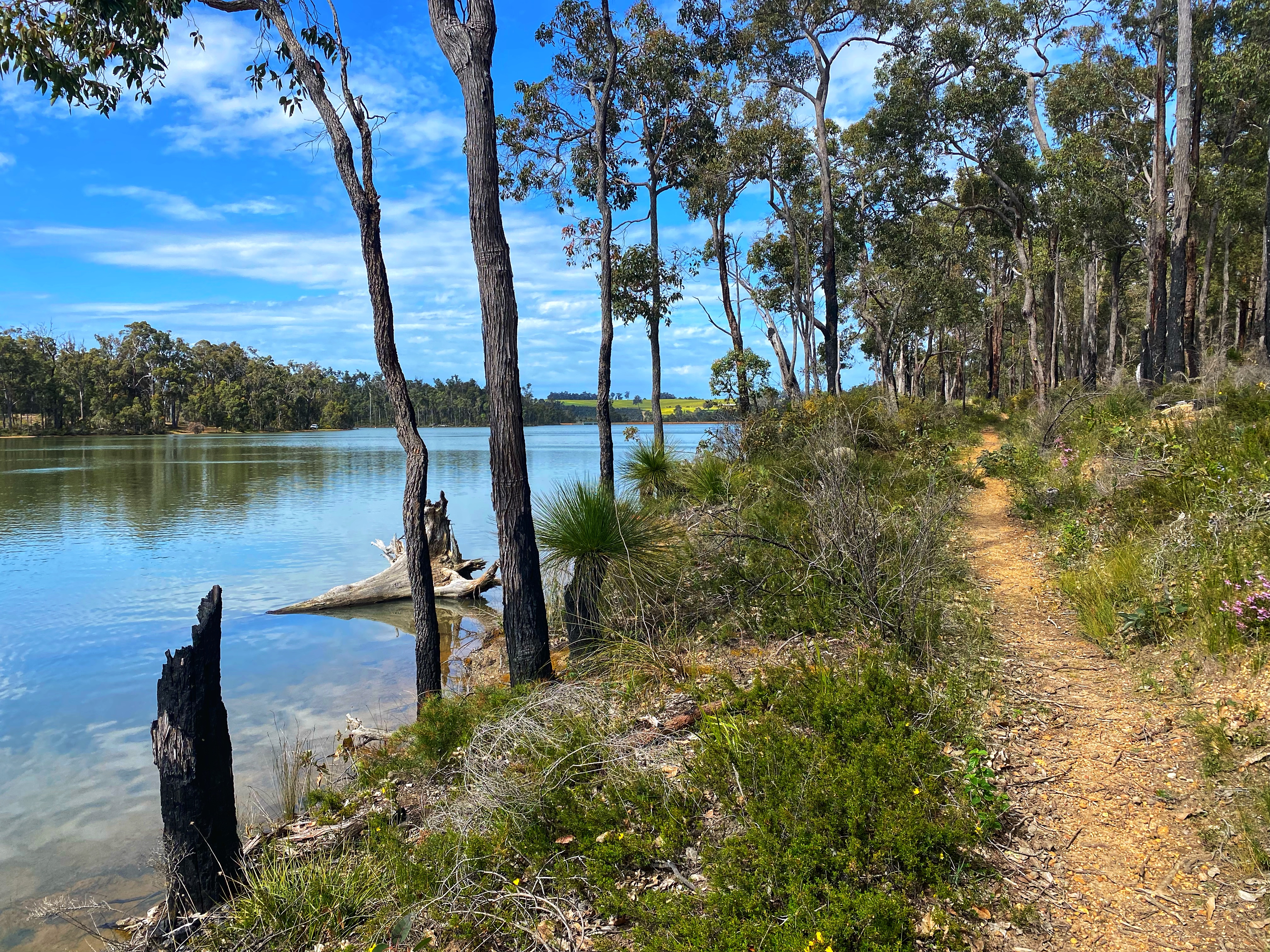
I liked how we started near water and finished near water. like a complete full circle.

Until next time…..😊

Mount Bruce

The impressive Mount Bruce located in Karijini National Park is the second highest peak in Western Australia at 1,234m. We tackled this gruelling 10km return climb on the 18th of July 2021.

Mount Bruce from Karijini Drive

We set off from Tom Price in the darkness planning an early morning hike as we knew the day would quickly warm up. There was already a few cars in the carpark when we set off on the trail at 7am. The first half kilometre is nice and easy, seeing some great views, getting dragged into a false sense of security. The Marandoo trail first part ends at a lookout over to the large mine site below to the right somewhat looking out of place in this beautiful National park. Alongside the mine site is the railway line as we would be seeing and hearing many iron ore trains going about their business.
Continuing along the trail another couple of kilometres is the second part of the trail called the Honey Hakea trail, class 3. The views are getting pretty good. There requires a short scramble over some rocks and then nice walking along the ridge so life is good so far. Once you get to the sign that the trail changes to a hardcore class 5 from then onwards, you can choose to return back to the carpark.

But we continue along the 3rd part of the trail now to the summit. The hardest section right in front of us, a short steep rocky zigzag up the next rocky incline part which is nowhere near the summit. Basically having to use hands to grip rocks and heave oneself upwards. Got the heart racing up to a large gigantic stone with a chain rail to move safely around the narrow ledge overlooking a sheer drop off. Not done with us yet was rock climbing up that narrow stone face with the drop off behind us. Up and over the views are so worth it! We can look back to where we had come from, I love views like this!

We meet the earlier climbers, a group of young people playing loud music that not everyone wants to hear, but hey, they are enjoying themselves. They say to us ‘not much further! Another 20 minutes and you will be there!’ Well maybe 20 minutes if you’re running up and don’t run out of steam, the summit was deceptive and we were nowhere near it yet. Onwards over nicer walking trail not involving rock climbing we went. The views are unbeatable going up as much as at the summit. There was some more rock hopping but not as bad before we entered the final assault, the never ending zigzagging track up, up & up. By this time we were both exhausted with the climb and slowing down. The summit couldn’t be much further! More heaving tired bodies up over large rocks, tripping over loose pebbles and finally! Victory! The summit creeps up suddenly into view. There is the large rock cairn marking the highest point and a metal disc marker showing directions for other mountains and their heights and distances. The summit overlooks out to the other mountain ranges and I had to collapse on the ground, catch my breath and just milk in those views! Yes, we had made it, such an achievement after all that effort. The day was warming up but at the summit it was chilly enough to put the jacket back on.


The summit has two paths going left and right to the ends to take in more views and different angles. I had worked so hard to get there so I spent a bit of time enjoying the side trails exploring what was around. Afterwards I realised what goes up must go down and we had a long way back!

It was a bit quicker returning. More people had set off late and were heading up. It was 23 degrees but felt quite warm. I was ready to get off the mountain, had packed ample water bottles which was very smart. This is a hard walk, it does get warm and people can underestimate how much water they need. The rocky scrambles down were just as tricky as going up. One wrong foot placement could see a disaster unfold. Especially the steep short downhill zigzag back to the ridge line. Very slippery so we took it nice and slowly. It was 12.30pm by the time we reached the carpark, perfect timing for lunch before heading back to town. The estimated time is 6 hours and we had been quicker then that with a long break at the top so was quite pleased with our efforts.

What a climb! I loved being able to see where we had come from and feeling quite impressed with oneself. The Pilbara landscape is truly awe inspiring. Photos don’t capture the raw beauty. There were beautiful wildflowers, birds, blue skies and light wispy clouds, spinifex cloaked hills, tiny lizards darting back into bushes, even watched two butterflies flirt with each other as they flitted from plant to plant. I strongly recommend a visit to Mount Bruce, even those not able to make the summit can still manage the lower trails and the views are still awesome. The mountain climb makes a lovely change from the waterfalls and gorges in the National Park. You want those views?! They won’t come easy but so worth it!

Chichester Range Camel Trail

Mount Herbert Summit


An amazing special little gem trail hidden in the Millstream-Chichester National Park, North-West WA. One of WA’s Trails ‘Top Trails’ but very little information on it. From what little I had read, I was expecting an overgrown hard to follow trail. Which was not the case. It has been beautifully maintained. I hiked this trail 3rd of July 2021 starting at Mount Herbert carpark, going to the summit as you must do, it is a short steep scramble to the top then return down to join the Camel Trail to Python Pool – 8kms one way. Trail moderate level, while the ascents are not too steep or high, the trail ground consists of loose rocks, pebbles and wildflowers growing up in the middle of paths. You do need to be aware of where you place your feet as it is easy to stumble, trip or roll an ankle in places. Signage – very good triangle markers with a camel symbol though I missed one turn off early in the walk, fumbling through overgrowth and big rocks before discovering the trail continued above me.
The raw beauty of the Pilbara landscape is one to stay forever in your memory, the green spinifex hills, the chocolate coloured big Chichester rocks, red dirt trail and large numbers of small wildflowers dotting the landscape with colours of purple, red and yellow, beautiful snappy gum trees and large termite mounds in sporadic places. One huge plant of Sturt Desert Pea covered right across the trail in one spot. It was just spectacular. It is ideal to start early even in Winter ( you should not attempt hiking in summer unless you hike in the dark early morning ), temperatures still go up in Winter and it is vital to carry ample amounts of water, wear protective long clothes from the sun and sharp bushes especially spinifex! Sunscreen and hat. I recommend to start at Mount Herbert if going one way so you can cool off afterwards at Python Pool! It is also more down hill this way.
About just over 2kms along you reach McKenzie Springs, a spot where the cameleers use to take their camels to collect water. At the time of my hike, the springs had quite a bit of water, a small trickle over the side, no raging waterfall, but huge amount of water above where you had to cross over. I would imagine the springs would be fairly dry most of the year and not ideal for swimming in as it is mostly stagnant water.


There is plaques along the way with information on this 1988 bicentennial trail. The views are incredible the whole way through, there was definitely no ‘boring’ part to the trail. I loved every minute spent out there, soaking up the views of the Chichester ranges on little wooden seats placed along the way. From McKenzie Springs to Python Pool, you follow some of the old camel route. There’s a last long rocky descent to Python Pool, where I caught up with Hubby playing with his drone. The hike took me 3.5hrs due to stopping often to take photos and admire everything. The gusty winds kept me cool but the last hour I could feel it getting hotter and uncomfortable. The swim at the amazing Python Pool was just the icing on the cake. The drive out there is also incredible if you don’t want to hike or you can hike part-way return as an option.
stunning, just stunning, and would be up top on my favourite walks list. I was blown away by this trail and have to make mention as it is overshadowed by other great walks but deserves a mention just as much. Definitely a Top Trails and one not to be missed if you are going through the area.

Kattamordo Heritage Trail; Mundaring to Orange Grove.

1F5C7583-AEDF-425F-8637-D58D82ED3EEE

Grade: easy but demanding due to distance length.

Approx 34kms long from Mundaring Weir Road (start in Sculpture Park Mundaring, no trailhead until 50 metres down the path alongside Mundaring Weir Road) to Bickley Reservoir, Hardinge Road Orange Grove. Again easy to start / finish at the Hardinge Road carpark 500 metres pass Trailhead at south end.

The Kattamordo Heritage Trail is one of many government funded Bicentennial projects created 30+ years ago then forgotten about & signage not maintained. A lot of the trail now shares mountain bike trails. The sign markers on trees & trailhead signs read Kattamorda but apparently this was a spelling mistake. I will refer to as Kattamordo not kattamorda. As you will see, the trail is poorly signed, the markers remaining are quite faded & falling off the trees. When I completed this trail only a couple of months ago, I did it in 4 parts, often getting lost, back tracking & guessing a lot which branch of trail to take. When I returned Wednesday 19th August to complete the track in one day, I have been pleasantly surprised to see well overdue track maintenance happening. A group called the friends of Kattamorda heritage trail are re-marking the trail with metal posts & orange ribbons making it much easier now not to get lost! There might even be talk of updating the tree sign markers!

So as close as we can get to the former heritage trail I chose to set off from the south end, starting at the Bickley Brook Reservoir on a very chilly 7.30am start. The first 4 odd kilometres of the Kattamordo Heritage Trail also share the same path as another bicentennial trail called the Bird & Mason Heritage Trail. The track is a wide flat 4WD road for the first kilometre. The Bickley Brook runs parallel to the track and at this time of year, I walk to the sounds of nature & water flowing along Bickley Brook close by. Little tracks spur off to the Brook as I watch the water gushing along. The first bit of history I come across is the oldest wooden tramway bridge left standing in Australia. This bridge is a feature of the Bird & Mason Heritage trail.

The trail then veers uphill over a very rocky ground pathway before smoothing out to a nice flat, firm narrower trail. Before the road there has been a burn in recent months with the area still noticeably burnt out. 1st section to the road crossing that leads to the Victoria Reservoir done & now I’m warmed up! Jacket & gloves are off as I traverse through section 2 to Canning Road. Now I am walking just the Kattamordo Heritage Trail. Another 4 kms along a very nice easy wide 4WD track through pleasant bush land in the Korung National Park. I spot my first Orchids; Hoffman’s Spider-Orchid & Jug Orchids. There are still remaining trail sign markers on some trees. It’s always a delight to find one & be assured you are still on the right track! But a trail head information board located near the Victoria Reservoir end points that you are at the corner of Pickering Brook road & Canning road which clearly you are not! So I believe the signage had been moved from its original location & not placed back.

The trail crosses close to the intersecting roads of Canning & Pickering Brook Road. There are a couple of Cafes & General store nearby, but recently I found them closed. When they do reopen in the future, it would be an awesome spot to dive in for a quick coffee or cake if one is feeling inclined! Maybe more so if heading north to south. I had only been walking just over 90 minutes so kept going into more bushland, part of the George Spriggs Reserve. It can get confusing at this point as new markers haven’t been placed & there is many bike trails going every which way. I look for the older faded orange ribbon I followed last time, doubted myself 200 metres along & turned back only to realise I was on the right track. That turn around was worth it as I happened to spot the only 2 Bird Orchids by the side of the path. More excitement at finding a new Orchid & lots of photos later, I continued along. Previous times out here I have passed mountain bikers but it was very quiet this day, it was just me, myself & I.

The trail shares another Kalamunda walk trail (Carmel trail) for a short ways down a long hill, along winding narrow goat tracks through some mud puddles & over big rocks. Not on the trail but to the left on a higher bike trail is an interesting disused wooden bike ladder circuit ramp that is no longer safe to use that has been nailed into a large fallen tree. Once at the bottom of the hill, the trail enters another variable landscape of vineyards, orchards, farms & large dam. This also signals the first real tough steep ascent. Once pass the farms, I turn right & straight up and up passing a house with a barking maremma looking dog to the left. Kangaroos enjoying the peace & solitude, upset by my arrival, hop across the wide 4WD track in front of me disappearing into the bushland.

I grab a protein ball snack at the top, catching my breath, before continuing to Gunjin Road through more narrow winding trails. I pass more clusters of Jug Orchids & Blue Fairy Orchids. Not to mention the various wildflowers also blooming! More cycle tracks but no one around. The sun has emerged & it is feeling quite warm. I cross onto now the Mundi Biddi cycle trail that shares a lot of the north half of the Kattamordo Heritage trail. Onto Gunjin Road, a wide & frequented road for 4WDrivers & especially mountain bikers where I finally see other people! A 4WD car approaches me & stops while I near it hoping the driver isn’t some weirdo. Well he wasn’t, just waiting for his dog to catch up whom is running behind on the road as he drives. He lets me know the dog is friendly & drives on. Another form of ‘walking your dog’! Gunjin Road may be considered the least favourite part of the trail, it’s long, & basically you walk along the dirt road that steadily climbs up to the top known as Mount Gunjin, second big ascent & almost the halfway point. Mount Gunjin use to be a fire lookout tower site back in 1921. Now base to a web of mountain bike trails. I take a second break & snack some more. Being a Wednesday, it is quiet up the top here. But weekends it is a busy hive of cyclists congregating before deciding which trail to tackle next. This day saw a small hub of cyclists taking a break. One van came up with a trailer of bikes. Out jumped a group of people, grabbing their bikes off the trailer & heading off down a trail. Yes, it can be tricky to share with cyclists, having to watch out for them & move out the way before they bowl you down. But I enjoy being part of the exciting atmosphere. Also the bike trails have such cool & funny names like dead cats tail, mo fo & muffin top.  The temperature drops, I start feeling chilled so put my jacket back on.


Heading downwards for section 3 now, watch for that orange ribbon to the left side of the road or you will continue down the road to somewhere else! Now the Kattamordo Heritage trail follows a bike trail called Little Oven Circuit, cutting through other bike tracks heading to The Dell on Mundaring Weir Road. Short, sweet & downhill. I pass an upside down, flattened red car that must have happened recently as was not there on my earlier hike in the area. This is where I noticed the signs stuck to trees at the intersection of bike trails that read out the friends of kattamorda heritage trail. Huh! They were not there before! The trail continues to the left of the popular Dell carpark where more cyclists congregate & take off on other bike trails. It’s after 12pm but I just recently stopped so decide to go further along before having my lunch. The trail continues along what use to be the route of a wooden railed tramway taking timber from the Dell to Mundaring Weir back in 1908. The line was discontinued eventually due to many accidents. The old Kattamordo sign markers on trees re emerge not seen since Gunjin road. The track is wide that descends gradually where it crosses another interesting old trail called the Winjan Track that I struggle to find information on, then the Bibbulmun Track. After this, it is a steep long descent down towards Helena River where the track almost reaches the river, goes right & follows the river from slightly above towards Mundaring Weir which is fairly close now. The traffic on Mundaring Weir Road is loud & noisy after being in the bush.  I stop for a well earned lunch on a large slab of rock overlooking the Helena River.

The pole markers & extra ribbons have not gone unnoticed, now more than ever I realised a fairy has been out working their magic re-marking the trail. There wasn’t this much signage 2 months ago! I continue across to the Mundaring Weir wall crossing the bridge. I believe the older bridge further down use to be the crossing point of the trail but now it is in ruins & sealed off. Unless this was the remains of the old Mundaring train line that use to bring city folk out to the Weir wall to see it after it was built. This train line was shut down in 1952. The whole area here is enriched with history. About the Weir Wall, the pipelines, to the Mundaring Weir Hotel where I stopped in for a hot drink before the last section to Sculpture Park! The friends of kattamorda heritage trail decided in the last two months that the trail goes up the stairs after crossing the bridge, all the way to the top, and crosses through the little fenced gated rose garden! Then across the lawn pass a mob of gangster kangaroos, then down to the Weir hotel. Well! 2 months ago those markers weren’t there & I like everyone else, guessed the trail follows the Bibbulmun track below the lookout & pass the Weir Hotel along the side. Well, we won’t know for sure as no original tree markers remain between the last marker near Helena river before you cross the bridge & then pass Jacoby park. I passed a hiker pair finally! I did expect to see more hikers on such a beautiful day. The clouds had come over, it was cool & just right hiking temperature yet no one was out hiking except me!

Section 4 & legs holding up well! I chatted to a friendly twenty eight parrot perched just outside the Mundaring Weir Hotel & enjoyed my chai latte before setting off towards Jacoby Park. This park has the oldest English Oak tree indeed planted in 1870 standing tall & majestic. Though I had a chuckle when I saw how bare it was, not one leaf on the gigantic stick tree! This tree is best viewed fully dressed, such as it was in May. I include a photo from May as the tree looked far more appealing than its current status. Onwards I marched, the Kattamordo Heritage trail now largely follows the two bike paths; Mundi Biddi & Kep Tracks, crossing Mundaring Weir Road 4 times heading north to Sculpture Park where the Mundi Biddi Northern Terminus lies.


The afternoon stays overcast, the sun peeking out of the clouds every so often very briefly. Still the trail continues to the right of the big water pipes, but the friends of kattamorda heritage trail have been busy here placing many pole markers & orange ribbon tied to them. The trail now goes above the old water pump number 2 station instead of through it where I had traversed earlier in the year. And I remember seeing the old trail head post & single tree marker off to the side of the trail and thinking well – the trail used to go in there but there was no tracks, just leaf litter covering the ground & bushes. I did a double take, a triple take, as I was caught out again! A path had been re-formed to go through the trees, pass the old markers & down to the Kep track path below. Scratching my head & thinking I was losing my marbles I was like but! This wasn’t here before! I swear! So I backtracked now on the new pathway just so I didn’t miss any part of the trail out. The tracks are wide, sometimes narrow single bike track, with slight elevation but relatively easy walking. I noticed interesting stuff in the bushes – an abandoned concrete staircase that had no trail running from it, sitting lost in the middle of vegetation with nature slowly reclaiming it, plants growing through all the gaps. Old concrete looking pillars on the ground that looked like they once held massive water pipes? My imagination runs away with me thinking what use to be there a long time ago. If I go walking in there exploring, who knows what I would find!


I pass a farm & someone’s house smack bang in the middle of all that bush. The pretty yellow & orange Donkey Orchids spring up everywhere along this section. Old sign markers appear sporadically along this final leg of the journey on the occasional tree. Just before reaching the road crossing into Sculpture Park, I pass another & final big trail head board for the Kattamordo Heritage Trail. Is this the northern terminus end? After this there is no further trail markings, nothing on the information boards in Sculpture Park to say that is the start / end point. But makes a nice finish anyway. Sculpture Park is homebase to the historic Railway Heritage Trail, another awesome trail following the old railway line out to Helena & beyond that no longer exists. From the park with nice grassy picnic spots, toilets & interesting Sculptures, the Mundaring Hotel is right across the road. So with somewhat tired legs & feet, I headed over for a well deserved beer before heading home. My personal best yet, the longest hike I have done in a day to date. The longest being 26kms until now. I can chalk up a 34km hike successfully completed with limbs still attached ☺️.


I used AllTrails app to record distance. App paused in recording one point pass the Dell. Wasn’t going to back track once discovered it hadn’t been recording. I started at Hardinge Road Carpark but didn’t start recording there. All trails app can be very helpful to not getting lost, however, for the Kattamordo Heritage Trail, they need to update their map as over half the time, it kept sending me alerts I was off route. Well, I was passing old sign markers so clearly wasn’t off route! You can walk either direction. I just liked going north & finishing at the pub! So what are you waiting for? Get out there & enjoy this marvellous trail right on our doorstep!
FA2886DC-D968-4345-BB09-A216A958B348

Wungong Gorge Walk

A gruelling 14km walk graded ‘hard’ in the Wungong Regional Park off South West Hwy. There are many options to shorten or lengthen the walk with many goat trails running off here, there & everywhere. Most popular is the Wungong short gorge walk alongside the Wungong creek. Popular with families & dog walkers. This first kilometre starts nice, easy on wide 4WD, leads you into a false sense of ease thinking this aren’t bad, rather pleasant in fact (!) before you venture off to the right crossing the creek on logs & rocks onto the first of two loops – straight up! I would recommend going this way getting the hard part of this loop out the way first rather then at the end part of your walk.

It is important to note this walk is not sign marked at all except for some sporadic pink ribbon tied to trees I only saw on the first loop for the first 5kms then they disappeared. The only way to do this walk is to have something like the All Trails app, enables you to record your walk or just to keep track where you are on the map, it would alert me to when I had ventured off course which happened easily due to the many intersecting tracks.


The right side of loop one takes you up a long steep climb. Just when you think you are at the top on flat ground, the wide gravelly rocky path turns the corner – and oh! More climbing! Sweat running down my face I finally get to the top & begin the walk eastwards looking to the gorge, valley’s  & cityscape views. The wildflowers are poking their heads out & already there is lots of yellows, whites, pinks & reds. Then comes the steep long descent back down to the creek. Already it has taken me over an hour & a half to go 3 odd kms. The terrain is tricky & one benefits from taking walking poles to help with the ascents & descents. I decide to take a break down the bottom sitting on a rock watching the small creek with its running water. Not big at all, narrow but very tranquil & lovely.

As I continued onwards towards the second loop, I am distracted by two ducks drifting by on a makeshift trickle of a stream running across a 4WD track. A stream not existent during most of the year I’m sure. Those ducks made me chuckle as I hopped over the stream & found green hills with tracks running up them in all directions. Which one to take? Looking back at All Trails I noticed the trail continues back to my left so off I go retracing my steps to the walk & continue along.

Up a short uphill I turn right & start on the second loop, a nice meander along with the creek below to my right now. I emerge at a beautiful look out spot overlooking the valleys & hills it is so beautiful out here. Then I turn following the app taking me up my second bastard of a steep hill, on a narrow goat track winding through grass trees. Another option is to take the wide path around & up, may be a better option,  but I was following the map this time. Once at the top, red faced & sweaty Betty, relieved also, I continue along the goat trail now flat walking & pleasant through the bush.


The map is incorrect at the top of this loop saying it goes straight across. Yes you can bush bash through the parrot bush trees & such with no marked trail to follow. I couldn’t care for that so followed the now wide track down around and back to meet the trail. Here you reach the border with Bungendore Park with more trails in here.


Then what goes up must go down! The second loop finishes with a long steep downhill walk, a jumbled stack of rocks more than a path in places. Once down the bottom it joins the pleasant short gorge walk & the majority of hikers you will bump into. Not many people were seen up in the hills. Trail bikes could be heard, seen sometimes tearing up the dirt roads as they fly along with their noisy machines, breaking up the peace & tranquility. Sometimes a bike rider, I only saw one. What was a disappointment was the amount of rubbish discarded into the bush by people. Being pleased with the tough parts over with, I took my second break for a small lunch now above the creek looking up at the hills I had traversed through earlier.

The second half of the first loop meanders along a wide easy dirt road above the creek before descending gently down to cross the creek twice, passing the small dam wall & some old structure just off a short side trail. Couldn’t figure out what this was used for once upon a time. A perfect combo of hill climbs, views, varied terrain & the creek always a highlight. Certainly a winter / spring walk but not summer. I would be happy to return & explore different trails that run off the main track. There is so much to see & explore. In another few odd weeks, the wildflowers will be most abundant. You will see vibrant orange butterfly’s, birds, ducks, ants & fungi. Lots of everything! If you are up for a challenging walk, this one is it!

Wungong Regional Park, Roleystone

Not many people will know of this secret hidden little gem. Tucked away in a corner of Roleystone, Perth. You can google trails in the area, it won’t pop up. It won’t be seen listed on the trails websites or apps. Like it doesn’t exist which makes exploring this area more exciting. It doesn’t have a name actually, only that it is made up of 4 small walk trails called the Echidna, Kangaroo, Emu & Botanical walk trails located in the Churchman’s Bushland Reserve. A perfect day hike awaits!

Driving along Brookton Hwy you come to Stocker road. Nothing in it. Just a quiet no through road with farm houses coming off it. No sign saying “awesome walk trail this way”. Drive to the end across the small bridge over Canning River & you arrive at the cul de sac. A short dirt road leads up to locked gates but an open pedestrian gateway & your journey begins at Wungong Regional park. An old interesting shed still stands disused & slowly falling apart. Interesting contents inside from a bygone era. There is no trail signage, only 3 wide tracks leading off left, right & in the middle. Right goes to private property. I go left instead & it ends at the Canning River. So backtrack & take the middle Path pass the shed head straight up hill. Might as well get the heart rate up at the start! The track unmarked but well maintained, follows the Canning River from above, the sound of water rushing along below. Lots of kangaroos everywhere. They are not impressed by my presence. So much green from the rains. This area is so beautiful passing small creeks, moss growing on trees & that green cover over the ground with rocks poking up so photogenic this landscape!

After going 2 kms or so the track turns sharply to the right & the first trail markers indicating this is the Echidna trail marked with an orange triangle or orange ribbon. Steep climb commences. The trail turns into a goats trail, bushes overgrown I end up drenched wet from brushing pass wet foliage. I also can’t walk upright due to the branches in my face. I have to walk hunched over head butting my way through what a crazy trail it has become! I eventually come out face to face with an impressive 30m high huge granite rock face. Rock climbers come here for a party as is obvious by the metal hooks in the face wall. Awesome spot, must see to be admired as photos don’t do it justice. I go right, climb some man made stone steps up the side but they stop abruptly & I end up carefully picking my way up on hands & feet. More climbs! I play along the top, daring to peer over the edge to the long drop below. Scary. Not wanting to break my neck today I scrambled & climb back down to the bottom via the steps on the other side. After looking at every nook & cranny, feeling puffed & weary from the climbs already, I went back up the left side straight to the highest point of the walk where I reach the small dirt car part where the rock climbers access the rock face.


To the right the Echidna trail looks to continue on its loop. Ahead going west is a sign stating the other 3 trails going in the one forward direction. The path up here is wide again, pleasant, flat & different landscape altogether. The old hand drawing picture of this area made by a bloke called Bill,  shows an abandoned airstrip. Now covered in green lush grass I wouldn’t know it was an airstrip – used for something in a bygone era. Old white information markers are scattered along here but the words have faded away with very few readable at all. I encounter one other hiker that has also discovered this place. There are many skinny goat trails running here & there off the main path, sometimes I come across a marker with a kangaroo or emu picture so know I am still on the trail. This part of the walk reminds me of a part on the Bibbulmun track heading to Beraking from Waalegh campsite, as I stomp along enjoying the occasional wildflowers starting to bloom.

I reach the far end here again now changed to some skinny trees woodlands & out into a vast oval of lush open greenness. Farms skirt the edges as the track unmarked here can only go forward in a north direction completing its big loop back to the start. The track again is pleasant, flat, high above with views out to the surrounding farmlands & hills. I even took a right turn on purpose instead of left back to the start so I could do some more steep uphill climbing. The track rejoins the higher kangaroo track loop portion I had passed by earlier. Now with a visual map of the area in my head, I trotted back down the pea gravel track back to the start where I enjoyed a lunch break in the old shed. You can walk as far as you want on this one. So many options but is very hilly, so my total 12.5km hike felt double that. A very nice 3.5hr loop hike. The scenery is amazing here. I can only imagine how nice it will be in spring with the landscape  bursting with colours. But still right now is best time to go. The greens are amazing. Kangaroo central here, I must have seen at least 50 of them hopping across the trails in front of me.

Remember this place is our little secret!


Day Sixty Three: Sandpatch to Albany!

Our final leg of this incredible journey. 12.5kms into Albany to the Southern Terminus sign. My mind was too active for sleep & spent the night rolling from left side to right side on my noisy sleeping pad. It was warm, the outside seem quiet besides a gentle breeze making the outer tent flap on my side blow inwards & outwards. Ambles at one point said he could hear something outside. But it was only the tent flap. Certainly by 4.30am the breeze was getting stronger, Ambles said, “uh-oh, there’s dark clouds coming!” But he had nothing to fear, besides a strong breeze, we had a perfect morning weather wise. Truly blessed. There were clouds rolling through & that was all. The winds had a chill to them. We had a quick breakfast & went up to the lookout top to brush our teeth & watch the sun rise. So lucky it wasn’t overcast & drizzling rain like yesterday morning! We had to fight the winds to pack up the tent being the only drama. By the time 6.30am rolled by, we had backpacks on for the final time. Mine felt super light, we had eaten most of the food. So as we started this journey together just the two of us, it was fitting we finish together, just the two of us. Everyone we had met had already finished in Albany or not on the track anymore. It was just us two still walking. Ambles quickly forgot about doing his daily push-ups to build his upper body. Not good enough! I think he was just too excited to get this other with!


We left the barren campsite behind & made our way onwards through some more sand hills, one last lookout to the ocean before we turn inwards & towards the outskirts of Albany. I spot one more snake just at the last minute it slithers away from my pole & boot & into the bush. Jolly early, I didn’t realise snakes would be active so early but now I do! Ambles pulls in front at times & I keep reminding him we must walk together the whole way today! Once we turn into Frenchman’s Bay, it’s bitumen footpath for awhile. Our feet don’t like this. Rubbish goes into the first bin we see.😆 Soon enough we turn onto more pleasant dirt track still skirting the waters edge before doing those silly Bibbulmun track round the mulberry bush, go left go right go around but oh – you could have just gone straight ahead!😏 It is feeling warm, the sun is out for the first time in awhile. It’s a Sunday so not many people are around. As we near the end back on street sidewalks, one cycling couple go pass us & say, “You are almost there!” So does a lady outside a cottage. The track goes pass a museum & a beautiful boat on display called the Amity.  For the track to end there would be perfect. But we must continue along, cross the railway line & the main street where I pick out my parents & Kerry waiting for us! My mum plays my favourite ‘Giant’ song on her mobile phone as we finish our final steps to the southern terminus sign. It’s 9.30am. Job done! Almost! Mandatory photos at the sign then walk back & up the main street to the Visitor Centre. Along the way up we spot the familiar figures of Deb & Mel walking towards us. We greet, congratulate & hug each other. We will catch up later for a drink with them as we continue our way to the centre. Here I fill in the trail logs book as arrived & we ring the finishing bell together, I make sure my faithful little Galicia bell has its final ring too! Ambles next important port of call is to the pub across the road where we all have a drink even though it’s only after 10am!


We have eaten & drank well, showered ourselves clean & back in normal non hiking clothes. I’ve been so use to wearing the same clothes for 9 weeks. We have our congratulatory drinks with Deb & Mel late in the afternoon with a promise to catch up in Perth before they fly home. We only stay the night in Albany & pig out one last time – Razzlers steakhouse is highly recommended! Home with our funky smell-o backpacks early Monday morning. It will take some readjusting from living a simple life, out of a backpack for so long. I already miss the trail & can’t wait to go back & hike my favourite parts. Guess it will have to wait until Autumn next year. Without our trail angels, we would have survived yes but would not have been the same. Without my parents providing food drops in between sections means I would have had to carry up to 7 days of food for us both. And we wouldn’t have had the pleasure of catching up with them. They also were our back bone of support for all Ambles malfunctioning equipment, emergency aid. Thank you so much to my parents as they were amazing, a support we were so appreciative of. A huge thank you to amazing Kerry for helping with our food drops as well! It was always great, I was always excited to meet up with Kerry in our next trail town with our resupply box. And the surprise visit further down! To John & Kate that surprised us with their company in our first trail town of Dwellingup! For helping Ambles ‘stash’ some of his gear further up the track!😆 And Tim & Jules the joy of seeing you two walk into our camp unexpectedly especially after our long hard day slogging in the dunes! Those beers & your company truly a god send. And your hospitality feeding & transporting us to Parry’s & back to trail. Was a memorable night camping with you both at Parry’s. And the drinks & meal shared in Denmark. All our trail angels gave up their own time to meet & help us, it was awesome sharing our journey with you all!😁🤩 My biggest thank you to my partner in crime Ambles, you have been my rock & supportive all the way! 🥰


To everyone we met on the track, we will always remember meeting you all, if just one or two nights, or a week or more. Meeting other hikers is what makes the journey even more special. Daisyfish, Kirsty & Gijs, Veronique, Emu, Jeremy, Dave & Jayn, Wayne, Tristan (H), Simone, Deb & Mel, Lisa & Geoff, John & Lindsay, Sarah the author, Drew & Ray. The Essendon Bushwalking Club of Four, Birdman!


My list of good & not so good: Best Shelter for views: It’s a tie with Rame Head & Blackwood. Worst shelter: Yabberup (too dark & gloomy) Uneasy night Shelter: Yourdamung, Shelter on track with best swimming hole: Dog Pool! Best design Shelter: Frankland River, The only ‘hut’: Mt Wells, Worst rodent shelter: Tom Road, Shelter with the worst inside table: Grimwade, Shelter with the worst toilet: Woolbales, Shelter with the worst water tank tap: West Cape Howe, The most tidy & immaculate shelter: Long Point, best toilet amenities: all the new rammed earth king sized toilet rooms! Best single day walk: Woolbales to Long Point hands down for wildflowers, orchids & landscape varieties from granite rocks to forests to sand dunes & beaches! Worst single day walk: William Bay Road to Denmark, was the longest day walking, body tired feet really hurting especially on Mount Hallowell. Best section: Hmmmmmmm. Walpole to Peaceful Bay. Worst section: Peaceful Bay to Denmark. Three really hard days in soft sand horrid up n down dunes… Favourite town: Balingup hands down, so friendly & welcoming to hikers.😊Raelean Bailey I loved meeting you finally! Worst encounters on track: huge swamp puddles to wade through!!!


What’s more we had NO diversions the whole way! The best of the weather. We chose the right year & best time to go! Ambles made sure we had at least one cup of red wine each night on the track, sometimes 2 or whiskey as well! The track tested us physically, mentally & tested our relationship. We planned, organised & executed this dream! My dehydrated meals & food planning were on par, we ate very well on the track! I couldn’t be prouder of us both!🥰 Final Snake sightings: Ambles 5, Rose 6.5 Ambles insists to be called Mr D again & not Ambles! We thank the Bibbulmun Track Foundation & all the volunteers that maintain this track, they do an amazing job! We are forever grateful to have this track on our doorstep & free! So lucky are we! Next year we have lined up the Camino Portuguese coastal route & Overland Track in Tasmania. Stay tuned for future blogs😆😁.


Day Sixty Two: Mutton Bird to Sandpatch

26/10: Sleep eluded me for awhile. Ambles had an eventful trip to the toilet sometime in the early morning. Could not be a simple trip to the loo. It had started to drizzle when he went & while he was sitting in the toilet doing a big job, a gang of mozzies started biting him on any exposed piece of skin they found. Then his head torch battery indicated it was about to go completely flat with several warning flashes. He is slapping at the mozzies & as his light flashes he catches a glimpse of a big black spider coming out of nowhere catching a mozzie & eating it. Ambles was like, ‘I’m out of here!’ With his head torch flat now, he stumbles back in the dark & now the rain which was more than a drizzle, back to the shelter. I didn’t get up at all until after 5am. The sky is overcast but as morning wakes up, some blue skies start peeking through. Very briefly, then an annoying constant drizzle of rain starts & seems to have set in for the morning. Ambles fetches water from the tank & gets a spider come out of the tap into his bowl! He must be having an insect kind of day.😊


I lay cosy in my sleeping bag with my first cuppa until 6am. Then I get up with my second cuppa & start packing my stuff up. Before porridge, Deb & Ambles do their push up challenge. Ambles goes first & does 24 push-ups, not full ones the cheat! Deb does 25 – take that! But she pulls skin off her knuckles this time & decides she better not do any more. Ambles returns for another 24 push-ups, knees dropping, struggling with the effort. The trees close by the shelter become full of white tailed cockatoos, chattering away to each other, flying back & forth, the branches sagging under their weight. White tailed Cockatoos have a pleasant melodic call, unlike the screeching raucous that the red tailed cockatoos make.


We had all packed up & watching the rain, where did this weather come from?! Our weather apps mention no rain, cloudy with top of 20 degrees. We hang back procrastinating to go. The next campsite has no shelter as Sandpatch shelter was burnt down in May last year from a controlled burn that got out of control. Deb & Mel were even considering staying two nights here & walking 24kms to Albany tomorrow. We watched the cheeky magpie lark return & scavenge for any food scraps. By 8.30am, the rain was slowing down & a hint of blue sky could be seen. The rain stopped so we quickly packed & left camp leaving our northbound hiker whom his name is Tony we found out, behind. A lazy 12 kilometres to the next & last camp. It was humid to start with & flies buzzing about my face. We hadn’t gone a kilometre when we could see rain over the ocean coming in again. Before long our umbrellas come out as we walk along in the rain some good kilometres before it stops for the last time. Views are limited through the rain haze. It is what it is. We pass alongside the Albany wind farm, lots of wind turbines turning & turning. If they make a noise it must be a low hum as I hear the waves crashing louder in my ears than the turbines. The first wind turbine is broken & doesn’t move as if to say to the others, ‘Stuff Y’all I aren’t gonna work no way! Can’t make me!’ Another wind turbine further along has a missing head. The rain lifts & the views return as we walk into Sandpatch. Two men are getting ready for some hang gliding & Ambles stops to talk to them & explain what we are doing out there. Then we join tourists on the boardwalk around to Sandpatch beach, one tourist couple are brave to ask the stinky funky smelling hikers that is us to take their photo. I’m all obliging. Another hiker comes up behind us. A man whom carries a big pack & maybe he is a thur hiker as well. He must be triple hutting into Albany & came from Torbay I guess. He grunts a hello but doesn’t stop to chat. A man on a mission! We spot Mel sitting on a bench, she is waiting for Deb to return whom has gone down to check out the beach. They both set off to check out Sandpatch campsite & decide what they want to do. It’s midday as I go check out a lookout first, the guide book highly recommends it. So Ambles hangs around on the bench Mel was sitting at & I go check it out. It’s well worth it, with views over the whole wind farm & at the higher lookout, views over to Albany! The end goal is in sight! Now only 14kms away😁. I’m ecstatic as I head back down passing toilets & bins. Hence I head back up a second time to empty my rubbish bag!

836FF2FF-58FD-456A-818E-8A81594DEEAB


It’s an easy 2.6kms now to camp, entering the area that is rejuvenating after the May 2018 bushfire. And there’s so much flowers, a rainbow of colours & green bushes amongst the blackened trees. So we arrive a little after 1pm to a construction site where the foundation of a new shelter is being started. There’s a water tank & drop toilet. No trail log book to write in. No red book to read peoples comments & stories. The tent sites haven’t been maintained & have bushes growing all over them, unlevel ground & chunks of rock stuck in the ground. How they were ever tent sites I don’t know!😕We find the best one under the shade of a tree. It’s the only shelter we can find. Bit of a slope but it will do. There’s a lookout at top to watch the sunrise & sunset over the ocean. Unfortunately the ground up there is not good for a tent either. Mel hates the site, the whole place & Deb has called their accommodation place in Albany & booked tonight as well. They will continue on into Albany today.☹️We all sit on the ground & have lunch. Deb had a speech prepared as her farewell to us, she read out her speech which was lovely & touching. They really enjoyed sharing their journey with us. So Ambles did an impromptu speech. Just after 2pm, Deb & Mel walked back out to the track. And now for the second time on this trip, we will have the campsite to ourselves! I can see no one stays here. I’m sad to see Deb & Mel go, but will enjoy my last night on the track. We have some hard work preparing the ground & putting up our tent. It is harder without a picnic table, sitting on rocks on the ground preparing meals & cuppa teas. Almost like roughing it but we still have a water tank & toilet close by! The afternoon has warmed up, hopefully the rain now stays away!


We prepare dinner early so we can eat, clean up & be ready for bed. Then we can watch the last sunset before crawling into bed. Take our remaining vino up here & admire the glorious views. ☺️ Can hear the wind turbines now whirling loudly, sound right behind us but they are to the west of us so their sounds must be echoing through the valleys. I can hardly believe this is the final night! What a whirlwind of an adventure it has been!🤪

DE64DDD0-44E3-4424-A961-52143A71C868


This slideshow requires JavaScript.

Day Sixty One: Torbay to Mutton Bird

25/10: Ahhhhh…..tick tock, tick tock, it sounded like a loud ticking clock next to my head. After awhile I realised it was just the sound of dripping water on the outside of the shelter wall dripping from the roof to the ground. Went on all night. Rained a small amount too a couple of times. The winds had finally died down. Had to get up to relieve myself & looked up at the night sky on the way back from the toilet. It was a clear night & the sky was covered with impressive stars. Woke up after 5am stretching out leisurely in bed. No need to rush, an easy 12.4kms today. We originally were going to do 24kms but changed our plan as the sands were tougher to walk in & take us much longer. But they are easy this side of Denmark than the other side, much easier! Anyway, nice to enjoy our final last days on track instead of rushing it. Ambles had another wacky idea – instead of camping at Sandpatch tomorrow, walk into the outskirts of Albany & stay at a hotel on the track – this idea got quickly shot down in a ball of flames. Ambles is out numbered by three women to one man😂. I wonder if we will get any more End to Enders that started later than us, catching up at this end? Many people double hut through to Albany from Denmark. Ambles & Deb did their early morning push ups again while preparing breakfast cuppa. We did a real lazy pack up leaving camp after 7.45am, I was ready by 7.15am so sat & passed time watching the male & female wren birds chase each other through the foliage while waiting for Ambles to be ready.


Most of the walk today is on beach & the sand is firm enough making it easy to walk along. We had a short 2.7km walk out to Cosy Corner Beach where we start, finishing at Mutton Bird Beach. There is used / unused toilet paper heaps of it just dumped into the bushes on the side of the track. Reminds us of the Camino, 😆😆but very bad to leave that there when there is bins only a kilometre away! Somewhere in between there is Perkins Beach but there is no sign on the beach so unfortunately can not know when we were walking on a beach named after us!😂 Deb & Mel left earlier than us & scored a free car ride to the Cosy Corner Cafe which was up Cosy Corner Road some couple of kilometres. Shame it wasn’t closer at the beach, we didn’t feel like some 1.5 hours return walk for coffee. The only other person on the beach was a man & his dog. The weather was good, somewhat cloudy & cool, making good walking weather. Halfway along we have to scramble over rocks to the other side while the waves pound into the rocks, sea water spraying in the air. I really enjoyed this bit. Ambles was feeling tired & lacklustre of energy for beach walking. This is our last beach walk so I really enjoyed it, watching the birds, the waves, not much else to watch, no strange objects washed up on the beach, no dolphins, no bluebottle that Guthook says there is. This is where I guess Perkins Beach is – east or west side of Torbay Inlet.

45D0B6F5-6D4D-4EFA-B3A5-E4C097B73799


Torbay Inlet is closed again after being manually opened recently in the last week. Lucky we didn’t arrive earlier October, we would have to wade across ankle to knee deep water or take a 15 kilometre diversion around. Phew! Wading required only through 1cm of water sloshing across the sandbar from the ocean! A man with 5 dogs walked pass. Then it was less than 2 kilometres to the Mutton Bird Beach, back up some steps passing another guy & his dog. Seems to be man & his dog/s day today.😊The last few kilometres are easy back along the inside dune vegetation passing the rifle shooting range where Ambles thought about going in to have a shoot….then decided not to.😁It was very convenient today to have toilets to use & bins to chuck my rubbish into! We arrived at Mutton Bird Campsite shy of midday. Nestled in out of the wind but not having ocean views to look at. Some lazy person had dumped all their rubbish in the bucket beside the toilet. Poor form😡. The platforms in this shelter are narrower so our tent has to sit a different way inside. Deb & Mel came in at 12.30pm & told us about their awesome second breakfast they had at the cafe & had bought us a slice of cake to share between us which was very nice of them!


The sun has come out this afternoon & so have the trillions of annoying flies. There is a cheeky magpie lark that was wandering about outside camp looking for food, thought Mel’s Luci light might have been edible & knocked it off the post Mel had it on. Must be careful not to leave food out! A young man came through at 1pm having walked in from Albany this morning! Young & fast, he finished his end to end a month ago & was walking on this afternoon to Torbay or West Cape Howe. Just doing a section as he enjoys it so much.


The best thing way to pass the afternoon is hide in our tents from the flies & mozzies. Ambles has a Nana nap & all is quiet but for the buzzing of flies, the unseen ocean waves, crickets, the winds through the trees & the periodic crunching of sleeping mats as someone moves position. Very civilised!😊 perhaps we were all deep in thought about each of our own journey to this point. What it all meant & memories made. What will happen when we return to our homes?


Late afternoon sees another hiker join us. He has left Albany also today & section hiking to Denmark. Feeling not part of our group, the man sets up his tent outside. But joins us later while we have dinner. Ambles & Deb challenge each other with push ups again. Deb beating Ambles again 25 to Ambles 24 – close! Might be set match tomorrow! Our second last night on the track – exciting & sad at the same time!😊 Our last night in a shelter. I went searching for a good sunset, went back out on the track & found an old slightly overgrown goat track leading me out to the cliff edge about 200 metres where I soaked in my second last sunset out here watching the waves crashing far below, the sun setting on the horizon to the west & the wind farm to the east. Well worth the effort, I felt on top of the world. All this for free so to speak. Yes! It’s good to be me!😁

AB192284-C99D-47F0-A8D4-5ACEFDC3B5AD


Day Sixty: West Cape Howe to Torbay

24/10: It got wild & stormy last night. Lightening came close by the shelter then a huge CRACK, BOOM! Of thunder almost upon us it was so loud, woke us all. Deb said she jumped at the sound, straight off her sleeping pad! Then it poured heavily onto the shelter roof for a good hour or so. So lucky we didn’t walk in that! We had a lazy 16.4kms today, each day short & easy now to Albany. No hard long days any more. The best thing is we don’t have to pack super early, enjoy a more relaxed wake up, meander about getting breakfast & packing up. Ambles & Deb have way too much energy for early in the morning, challenging each other to how many full push ups each can do. Yes they have done this before! Deb is super strong doing push-ups on her knuckles while Ambles does normal hand ones. Then he throws out a challenge to how many sit ups can Deb do. The wooden platform is not ideal for this excerise & hurts the back. So Ambles thinks he is smart & does sit ups with his legs & knees straight out on the ground. But that’s pretty hard & not good for the back. Geez, he will be broken before he gets to Albany!😂We want to leave later like around 8am but as always are packed up ready by 7am. And we weren’t rushing!


It looks like more rain but luckily it’s not. Just very cold, cloudy & windy especially near the coast cliffs, a gusty southerly. We walk through some pretty recent controlled burns, at least not too much of the track goes through it. There was a diversion for some time & just recently got lifted. Have we managed to hike the whole  Bibbulmun track without getting a diversion? Amazing! It smelt strongly of burnt still with a few sporadic flowers emerging & small amounts of green grass. The predominant colours being brown & black.😕Ambles actually did a better job of walking with me today, speeding away once for a few kilometres then waiting for me to catch up while watching 3 kangaroos that stood watching him. The kangaroos must be used to hikers & not too afraid. As I approached they also watched me not moving away as most do.


I caught up to Deb & Mel having a break & this day hiker lady was chatting to them. She walked off northwards & came across Ambles bringing up the rear. She goes to him, “Geez! There’s lots of you out here! There’s 3 more up ahead!” She sounded vastly disappointed that others were also out on the track not just her! In fact her first response to Mel saying they were thur hiking the Bibbulmun was, “So have you lost weight?!” We can see the wind turbines of the Albany wind farm in the hazy distance. Even further ahead is more day hikers as we climb up & along some steep cliff drop off point, the winds threatening to blow us off. There is another hike trail that follows the Bibb a short ways, a carpark far down below. So we found out where these people were coming from! At the Albany / Walpole signage, Ambles had to drop his pack. It wasn’t sitting right. He felt all the weight was on one side. So he emptied it out & re-packed. Then discovered his bottom pack rod do-dah thing had slipped out of its loop. He sighs & goes, “One of these days, I will get a decent backpack that doesn’t break & cost so much!”


The nice thing about today’s walk is that it is more varied. We move under paperbark trees then out onto granite slabs, along the coast ridge with gorgeous coastal views of Dingo Beach, the colour of the water & beach sand so postcard perfect. Back into more peppermint & small Jarrah trees. Ambles goes ahead & spots a huge brown & black snake on the track. It goes into the bush & scaredy-cat Ambles tells me to go ahead first pass the spot where the snake had been. The snake has gone the coast is clear as we finalise our walk into Torbay campsite re joining with Deb & Mel. Lucky they had been ahead of us & cleared most of the snakes off the path. Mel came across 4 big snakes in the last kilometre! Oooooh – horrible!😳


We had arrived just after midday so settled down for lunch & usual camp chores. Mel is going great, her foot problem is actually improving, great news! Ambles puts up the tent without all the drama this time. He didn’t need water filtered as he didn’t drink much at all – naughty naughty! The sky cleared up & the sun felt so warm & lovely, unfortunately the strong gusts of wind are downright chilly cold! This campsite is above again on top of the cliffs away from the water but still with lovely views out, especially from the outside picnic table which is further away up a short hill with views out to the ocean. Well, beautiful & warm when the winds aren’t blowing otherwise it’s freezing cold up there! Ambles tried to save the unused fuel by putting it back in the bottle but half of it spilled down the sides. So he will just burn off the remainder of fuel in the cap, wasting it. He reckons there’s enough fuel & there better be! Won’t be happy eating cold soak porridge!

5EFD1DF5-9F30-4A4A-B1FC-58A8F4197CD3


So I’ll explain the picture on yesterday’s blog post of the hut sign with Waugal markers. So we didn’t know this & Jacko told us: most Waugal markers the tail tip points left, but a whole batch were made with the tail tip pointing right! So in that photo you see one of each Waugal. Now I know this, every time I come across a Waugal, I note which way the tail tip is! And today’s walk had lots more Waugal markers where yesterday there were hardly any along the track.


Lots of birds today, especially those cute blue wrens fluttering about, two male ones chasing after a female. Almost stepped on a lazy blue tongue lizard hiding amongst the bushes. Ambles thought I was talking to the flowers but no I was talking to the lizard! I do also talk to the flowers.😂 Oh dear it will be hard to re-adjust into society! We all speak some mad talk now, Ambles entertains us singing out corny songs & talking crazy like he reckoned that we could walk into Albany today – yeah just pump out a 50+ kilometre day! Sounds awesome but……NO! Deb came up with an hilarious tune to 99 bottles on the wall song as Ambles discusses how the lightening last night could have zapped us. I tweaked it slightly & goes like this, “There is four fried hikers laying in a hut, if one fried hiker should accidentally roll out, then there will be three fried hikers laying in a hut….”🎼


We spend the afternoon hiding in our tents but the cold winds blow straight in, I reckon those winds are coming from Antarctica! On goes every item of clothing we have. Ambles complains of a sore back…..from those sit-ups!😏 Nevertheless the challenge of push-ups still continued this late afternoon with Ambles smashing out 16 while Deb did 15. Ambles is not competitive – oh no!!😆


Hmmmmmm…. what for dinner tonight?! I have been feeling hungry all day today! Must be ‘hiker hunger’. We were enjoying our meals when a random lady jogged pass with her dog. Yep, don’t feel so isolated in the wilderness now, too close to civilisation! Nooooo!😧 Definitely going into bed early to read my book, too bloody cold outside the sleeping bag! At least that wind has died down somewhat. We have less than 40 kilometres left, the 26th of August seems a lifetime ago!

Snake sightings: Ambles 5, Rose 5.5